![]()
Selected Elements of Korea's Non-Motorized (Bicycle, Pedestrian & Inline Skate) Infrastructure and Facilities Engineering

![]() IBF is 100%
IBF is 100%
solar powered
|
|
|
| Content: | |
| Overview | |
 Click on any thumbnail picture in this article to see an enlargement of the picture. The enlargements are generally much clearer than the thumbnails. |
This is a brief look at bicycle, pedestrian and inline skate facilities in South
Korea. It is by no means comprehensive. Historically, Korea has
been a walking country and still is. Compared to late 20th century
levels of participation, bicycling has been booming since the millennium,
but it is still dwarfed by walking.
The town with the oldest active bicycle program is Sangju (the self-proclaimed bicycle capital of South Korea). The province with the most active program is Jeju Island, which is discussed near the bottom of the article. There are also more detailed descriptions of bicycle infrastructure in Daegu, Gyeongju, Sangju and the Nationwide Network.
Your comments, suggestions and questions on this page are welcome at ibike @ibike.org |
Accommodation for Pedestrians |
|
|
|
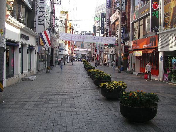
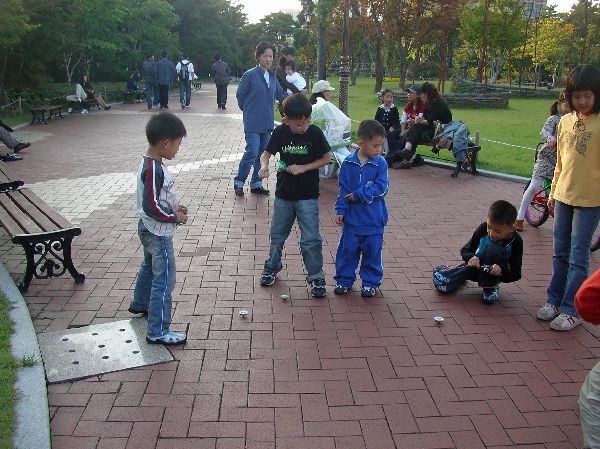
 The most lively, vigorous, and social sections of many Korean towns are their pedestrian only streets and central markets. Because of land use, density and scale, most business districts in Korea lend themselves to being pedestrian and bicycle friendly, especially when they take steps to restrict motor vehicles. These districts are the jewel of many cities. They invite you to slow down and spend time in the area -- which, of course, is what the businessmen hope for. The three photos above are samples for (left to right) Jeju, Daegu, and Jinju. [Note: the central markets are being undermined by urban-edge, car-oriented, big box stores. These would be comparable to giant Targets and Sears.] |
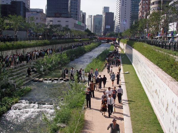 |
A major pedestrian, quality-of-life
and environmental quality
project in the heart of Seoul is the restoration of Cheonggye-cheon (stream).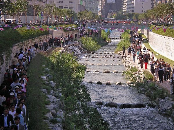 Prior to the restoration
this heavily polluted urban stream was completely
encased and the corridor used for a highway. The day lighting of the stream
and installation of riverside walks, vegetation, waterfalls and public art was completed in October 2005.
The water is now crystal clear and attracts large crowds on sunny weekends. Prior to the restoration
this heavily polluted urban stream was completely
encased and the corridor used for a highway. The day lighting of the stream
and installation of riverside walks, vegetation, waterfalls and public art was completed in October 2005.
The water is now crystal clear and attracts large crowds on sunny weekends. |
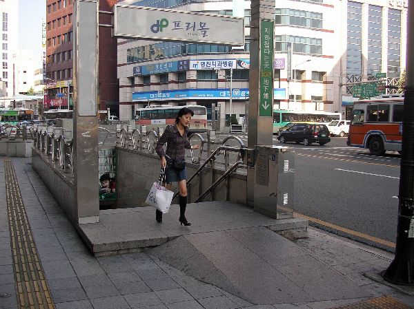 |
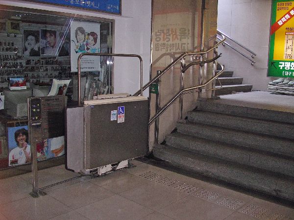 The raised entrance to the
underground (left) is to keep torrential rains from flooding the system. The ramp
has been installed to help the disabled and there is a lift (right) that will take
them to between the street and underground level. The vast majority of
entrances to the system are not this accommodating to people with disabilities
-- escalators and elevators providing access to the stations are rare as well. The raised entrance to the
underground (left) is to keep torrential rains from flooding the system. The ramp
has been installed to help the disabled and there is a lift (right) that will take
them to between the street and underground level. The vast majority of
entrances to the system are not this accommodating to people with disabilities
-- escalators and elevators providing access to the stations are rare as well. |
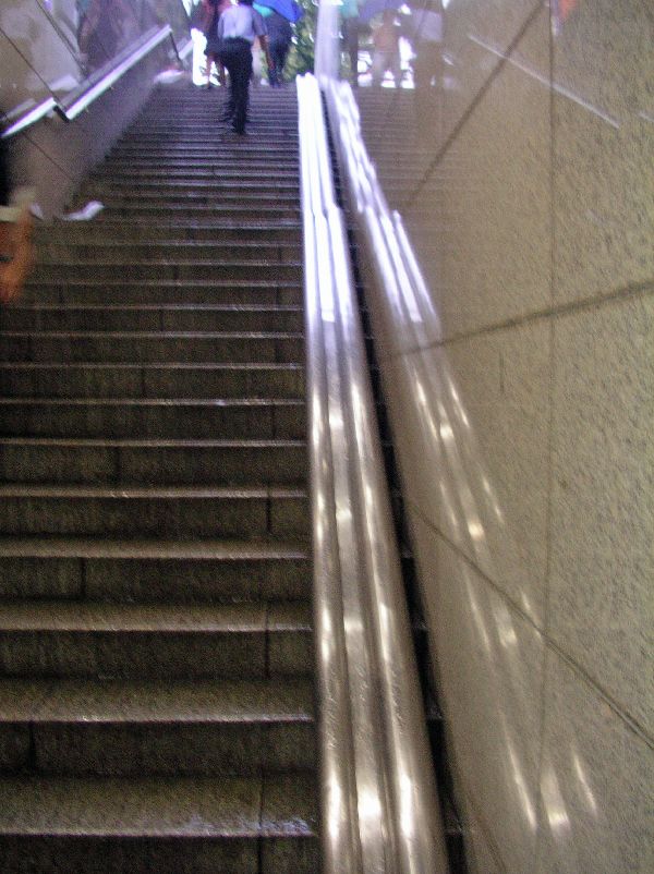 |
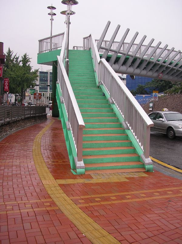
These stairs (left) lead up from
one of the pedestrian underpasses that are common under and along the major
arterials in Seoul and other large cities with heavy traffic. A particular
feature of this set of stairs is the bicycle rail or gutter along the side to make it
easier to use the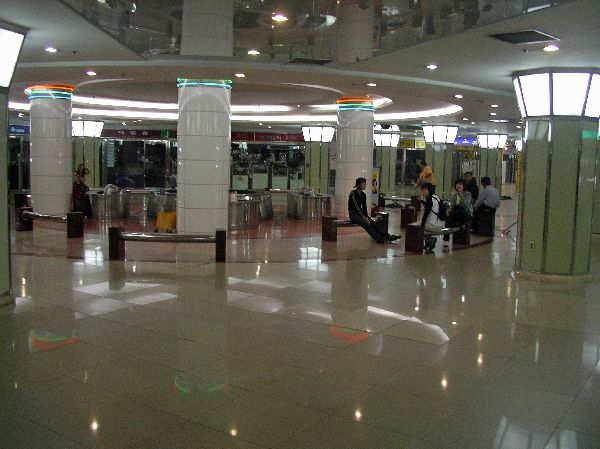 system with a bicycle. system with a bicycle. The extensive system of subterranean tunnels around the stations often incorporate linear retail malls of small boutiques, gathering points and could server as bomb shelters if the country was attacked. |
|
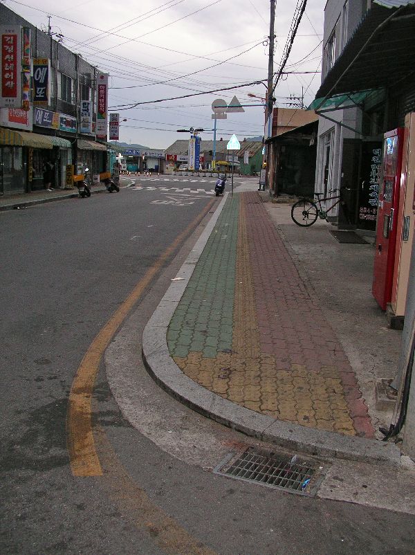
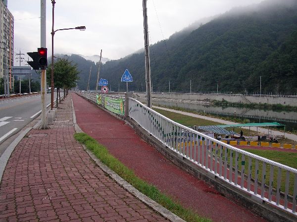
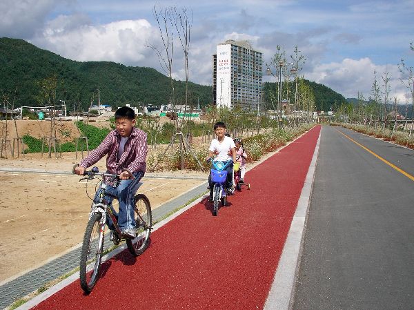
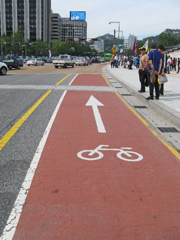
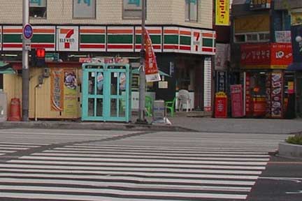
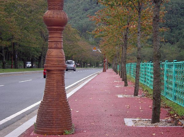
Increasingly, on pedestrian routes, yellow pavers are incorporated to aid the sight-impaired. The yellow bricks feature several different texture to indicate various items and have surfaces that are different from the general walkway. In this picture, there is a continuous yellow path along the sidewalk, which "T's" at the stairs. There is a different texture of pavers at the junction and at the foot of the stairs. While great for the sight-impaired, these textured surfaces play havoc with inline skates. In this picture the red pavers are for pedestrians and in the next pictures the red pavers are intended to indicate the lane for bicyclists. |
|
Throughout the country, even in small towns, sidewalks are built with colored and texture pavers. This picture was taken in Hadong in an area that is mostly used by pedestrians. There are raised yellow bricks in the middle of the sidewalk for the sight impaired. These "T" into a different texture of pavement at the intersection. This illustrates another design standard that we don't understand as well; where green pavement is for walking and red pavement is for bicycling. Besides being very narrow, the red "bikeway" is adjacent to the buildings and opening doors. Presumably there will be sight impaired users on the sidewalk as well, going down the center following the yellow bricks. |
|
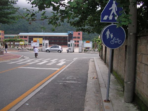
On this street (left), which
approaches a school in Hwacheon, on the right side of the street,
pedestrians and bicyclists are expected to share a painted lane that is at grade with
motor-vehicles. (What there is of a sidewalk is very
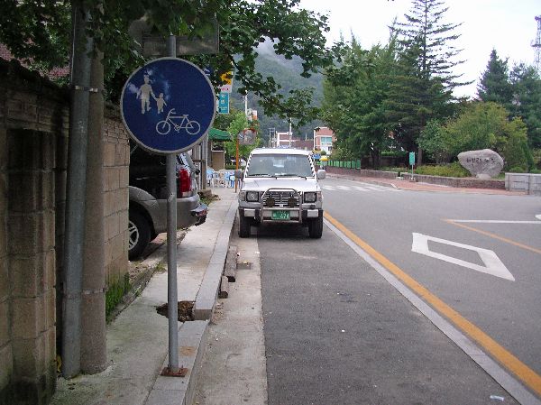 narrow
and obstructed. On the left side of the street, pedestrians have a
sidewalk, as well.) narrow
and obstructed. On the left side of the street, pedestrians have a
sidewalk, as well.)Looking the other direction (right) at he same location, a car is parked in the pedestrian / bicycle "lane". |
|
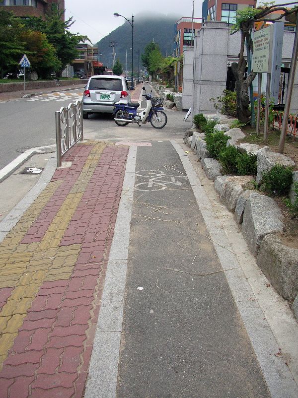
Here is more detail of the pedestrian facilities, in Hwacheon, as they approach the school. Pedestrian movements are controlled by fencing. There is a speed-bump to slow motor vehicles. Yellow textured pavers are available to assist the sight-impaired. |
|
(Left) Still at the same location in Hwacheon,
as in the three preceding pictures, this pictures reinforces that even the best
infrastructure isn't going to work as well if it is encroached upon. The
bicycle facility is also narrower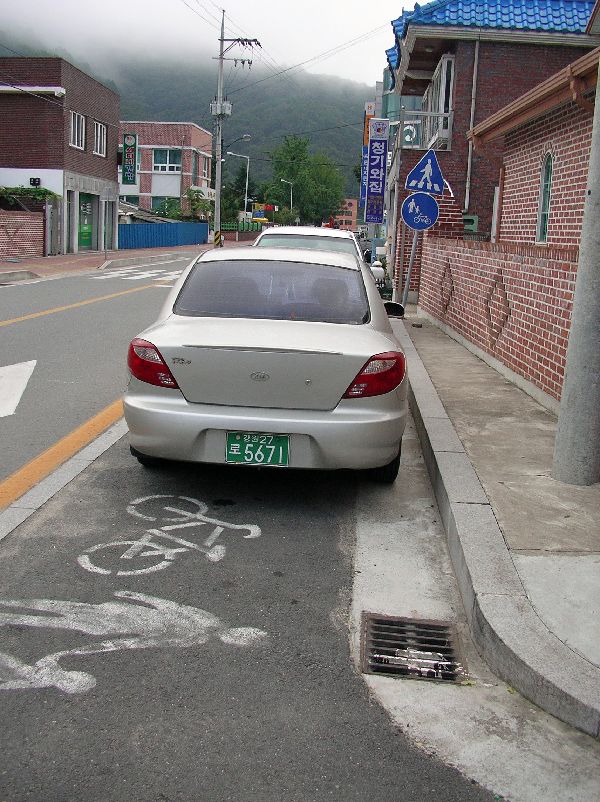 than would be recommended by most design
standards and block by a motor cycle.. than would be recommended by most design
standards and block by a motor cycle..Also in the vicinity of the school (right), several cars are parked in the bicycle / pedestrian lane. The graphics behind the car show both pedestrians and a bicycle. Parking in pedestrian and bicycle facilities seems to be a fairly common behavior. |
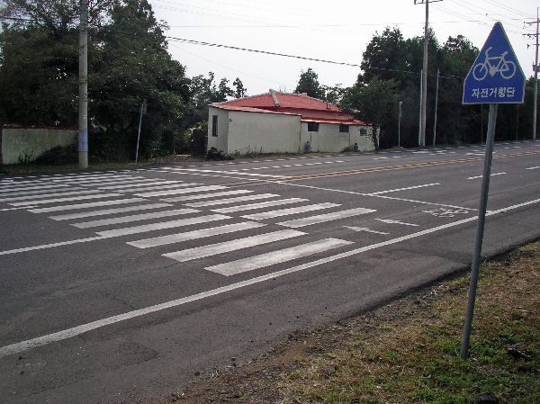 |
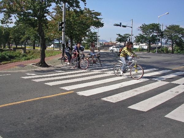
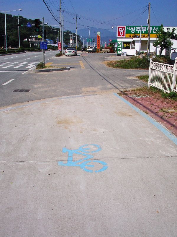
The typical marked street crossing in Korea usually consists of essentially three lanes: a set of bars for pedestrians crossing left to right, a set of bars for pedestrians crossing right to left, and a narrower unmarked lane for bicyclists (at the top of the picture) - presumably for bicyclists crossing in both directions. |
 |
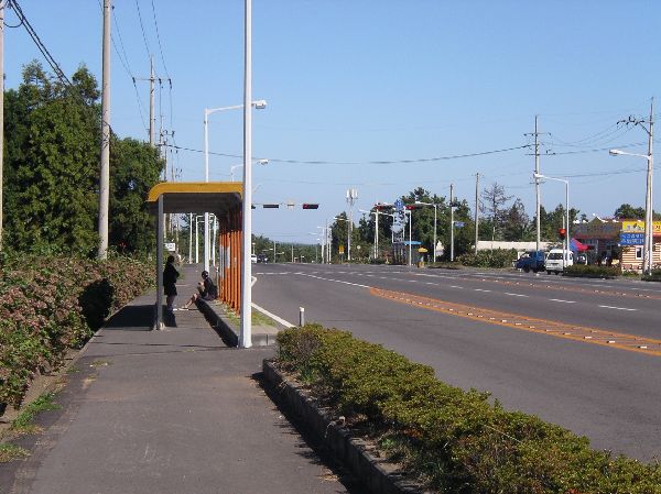
Another aspect of South Koreas complete transportation infrastructure is its far-reaching mass transit system that make is fairly easy to get by without a car throughout Korea: The big city like Seoul and Busan, have subway systems. There are commuter, intercity, express and high speed trains to all regions of the country. There is even more coverage by the bus system which has city buses, district buses, regional buses and cross-country buses. On the coast there is an extensive system of ferries serving hundreds of islands. With a combination of these systems you can get to almost every village in the country. That bus shelters display extensive route and system information is indicative of a transportation infrastructure -- unfortunately there doesn't seem to be much hesitation when locating a bus shelter in what is other wise marked as a bikeway. Which leads us to more about bicycle facilities... |
Bicycle Facilities |
|
|
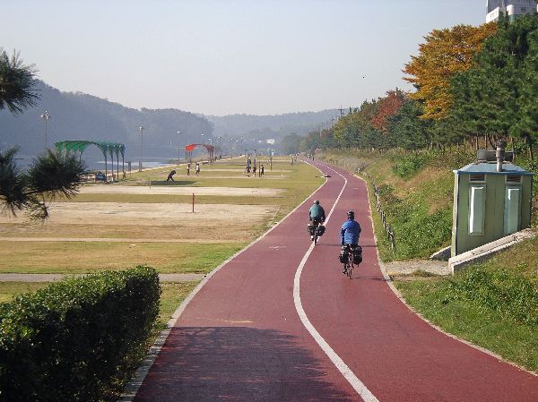
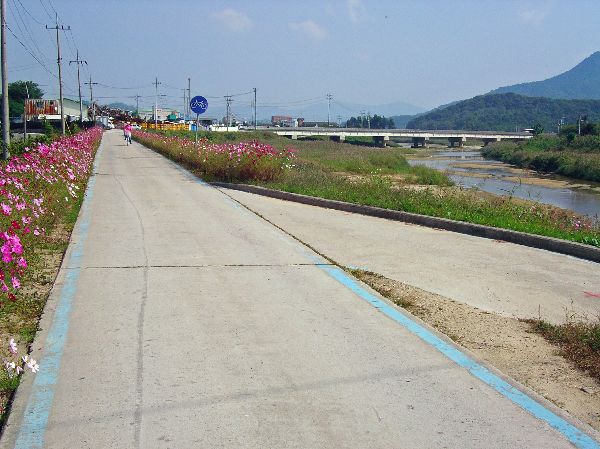
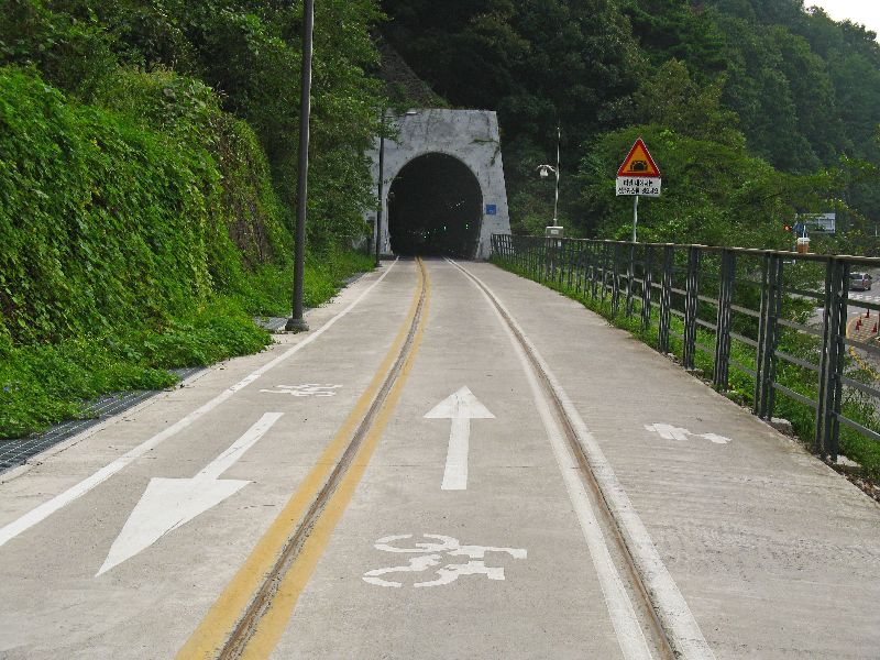
 One of the nicest features
of Korea's bicycle infrastructure are paths along rivers. The highest
concentration of these is around Seoul, but projects are underway to link routes
along the major rivers to create a nationwide network
of bike paths. One of the nicest features
of Korea's bicycle infrastructure are paths along rivers. The highest
concentration of these is around Seoul, but projects are underway to link routes
along the major rivers to create a nationwide network
of bike paths.
|
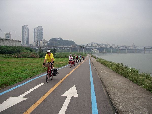
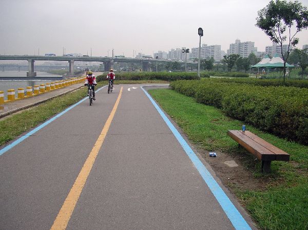
 In Seoul, along the Han
River and several of its tributaries there are wide, flat, car-free
non-motorized facilities. You certainly don't realize that you are in a metropolitan area of more than
eleven million people. There is a
Seoul bike trail map (PDF)
(check the boxes at the top to add features - the first box on the left is for
bike trails),
but it is only in Korean and it has been hard to find a hard copy. In Seoul, along the Han
River and several of its tributaries there are wide, flat, car-free
non-motorized facilities. You certainly don't realize that you are in a metropolitan area of more than
eleven million people. There is a
Seoul bike trail map (PDF)
(check the boxes at the top to add features - the first box on the left is for
bike trails),
but it is only in Korean and it has been hard to find a hard copy. |
|
|
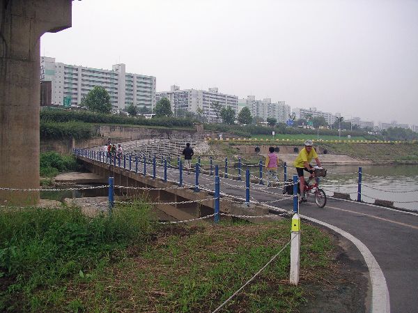
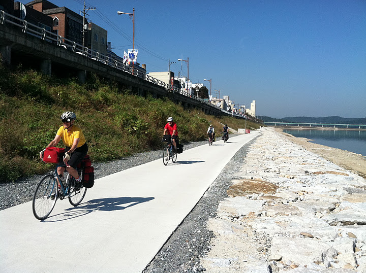
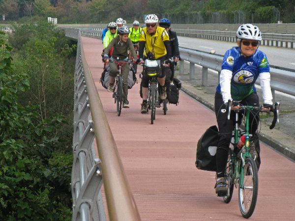
To the left, is a section
of the path along the south bank of the
Han River, Seoul, where it bridges a tributary. Around the country, there are hundreds of miles of non-motorized facilities along rivers, including in Gyeongju, Jinju, Sangju, Busan, Hwacheon, Mungyeong and Deagu. |
 |
In Jinju there is a non-motorized river side facility, but some of the facilities are on the left bank and some of the facilities are on the right bank. Unfortunately they are not well connected to each other, but each facility is very nice by itself. |
|
Besides many of the riverside trails, the area in the flood plain and the area inside the dikes is sometimes used for other kinds of recreation facilities like basketball and volleyball courts, inline skating ovals and soccer fields. |

|
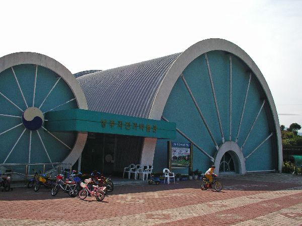
Part of the riverside
trail facility in Jinju is this bicycle safety awareness course for kids.
It incorporates a variety of intersections,
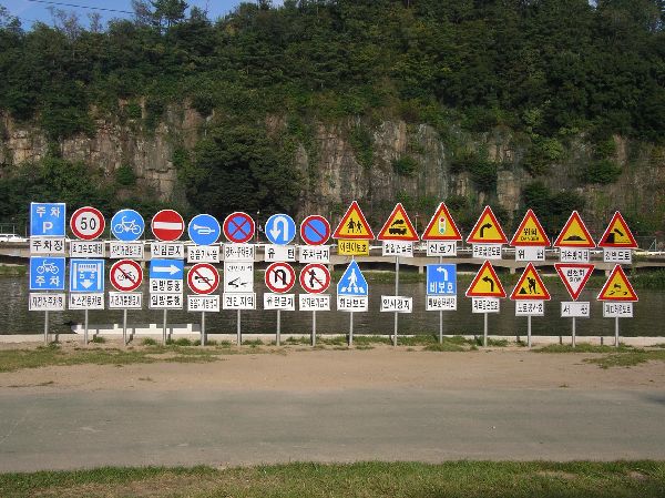 signs, signals, stripping, curb
penetrations and traffic situations. signs, signals, stripping, curb
penetrations and traffic situations.As part of the bicycle safety awareness course for kids in Jinju is a display of international traffic signs and their explanations. |
|
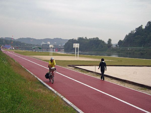
Where riverside trails have been built, it is not unusual for there to be non-motorized facilities both at street level and near the river side, as seen in this photo. The facilities near the river are generally in the flood plain so might not be accessible at all times. |
|
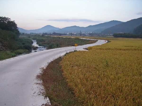
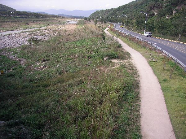
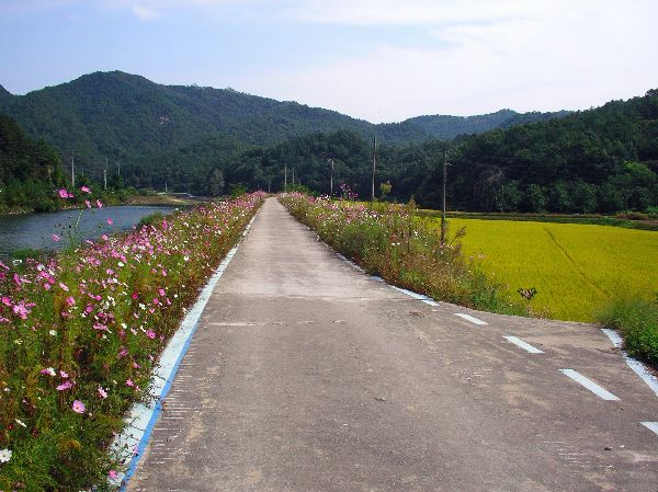
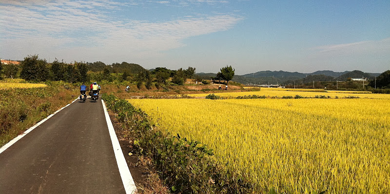
In the flat lands and agricultural areas dike / levy roads and "tractor roads" are other great features of rural South Korea. Because the roads are mainly for local access and not design for high speeds they have very low traffic volumes. These sections can be strung together to map out long distances rides that are idyllic and virtually care-free. They aren't always smooth enough to comfortably accommodate inline skaters. |

|
Dirt tracks are very much the exception. Except in the national parks most primary, secondary and tertiary roads are paved. We had to go out of our way and ignore a beautiful paved, almost car-free road, to find this track. |
|
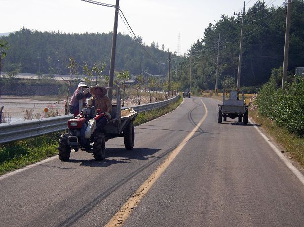
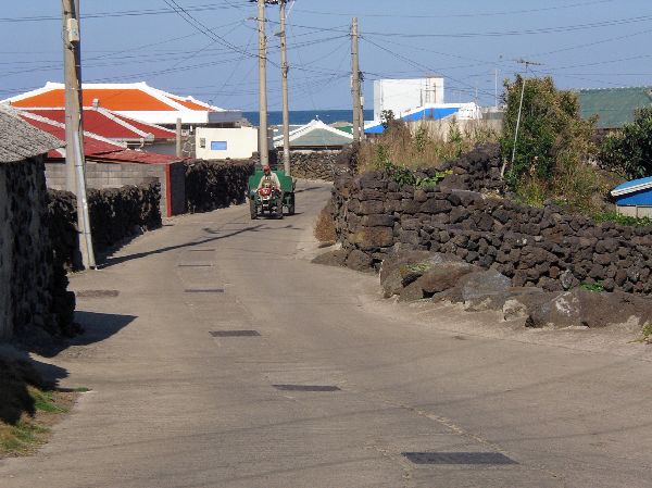
This is a unique moment of heavy traffic on a rural road. The convergence of three "iron-horses" (two-wheeled tractors towing trailers) at once is very rare. These machines, with different accessories, can be used to haul goods, till fields, pump water and take the family to town to do the marketing. There are rural roads like this all over the country that make for very scenic, relaxing and enjoyable bicycle touring. |
 |
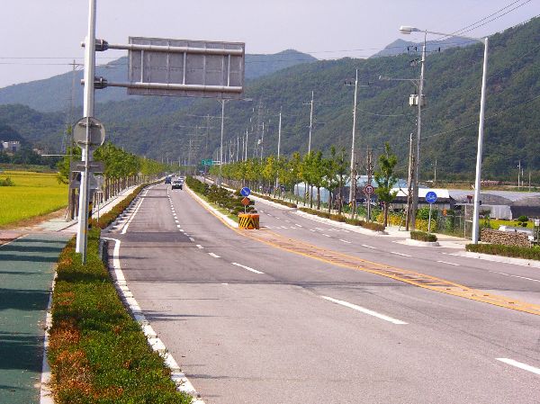
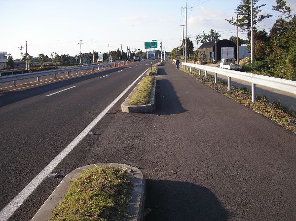
The system of rural highway cross section was largely filled out and paved in the 1960's and 70's. As they have been repaved and upgraded in subsequent decades paved shoulders have been added to many. The scened to the left has the added feature of wildlife overpass. Newer, late twentieth century era, intercity highways, in more densely populated areas, typically have at four lanes with paved shoulders. Bicycle are often allowed on these but it is generally not a very pleasant traveling experience. The latest generation of highways full limited access expressways, which prohibit bicycles. |

|
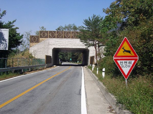
This is a typical rural highway. It doesn't give a sense of how wide the lane is, but they are usually plenty wide (three meters). Even with the wide lane, there is also a paved space outside the edge-line. In this section the paved shoulder is narrower than most. The picture is mostly about the sign, which is not at all uncommon in a country with hundreds of rivers and streams that are often paralleled by roads. |
|
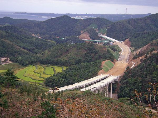
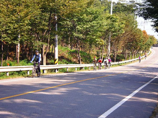
Cycling may get even better on rural roads: Throughout the country there is a huge amount of construction on express ways. These roads tunnel in onside of a hill and pop out the other and then float above the valleys in between the mountains. As they get completed they pull long distance traffic off the old highways leaving more spaces for cyclists. |
|
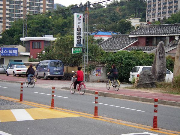
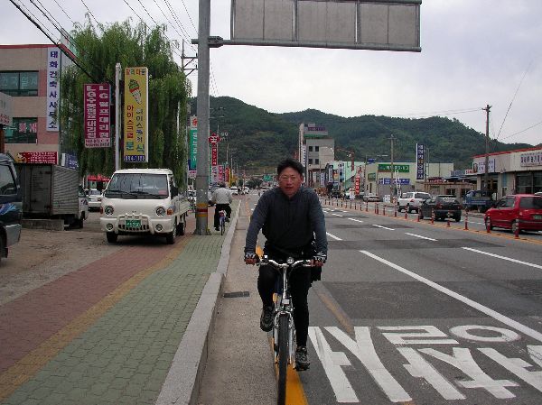
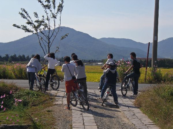
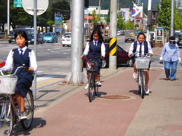
A group of women cyclists in Hadong -- some use the roadway and others use the sidewalk. Per-capita, bicycling seems to be more common in small towns and villages. |
|
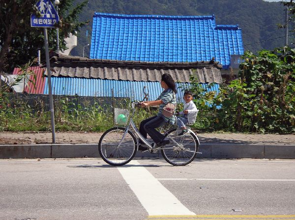
 Woman and child
(left), and woman (right) doing
errands by bicycle, Gapyeong. They are using the main road surface of a
main arterial. Woman and child
(left), and woman (right) doing
errands by bicycle, Gapyeong. They are using the main road surface of a
main arterial. |
|
These kids, in Jinbu, seem to be out for a recreation ride. They were very disciplined at getting off there bikes to cross roads as they road across town. Kids took advantage of the various forms of grade separated bicycle facilities a lot. |
|
 On
the other hand, to often, bicycle
facilities along major urban arterials, if they exist, can be a bit of a
mish-mash without standardized design treatments, or dimensions. More often than not the
intent seems to be for bicyclists and pedestrians to use the sidewalks together.
While the sidewalk shown on the left is wide and clear, it is not uncommon to
find them full of bi-directional bicyclists, pedestrian users, vendors, street
furniture and parked cars. Some facilities use different surface colors
and different surface textures to indicated the intended user group. On
the other hand, to often, bicycle
facilities along major urban arterials, if they exist, can be a bit of a
mish-mash without standardized design treatments, or dimensions. More often than not the
intent seems to be for bicyclists and pedestrians to use the sidewalks together.
While the sidewalk shown on the left is wide and clear, it is not uncommon to
find them full of bi-directional bicyclists, pedestrian users, vendors, street
furniture and parked cars. Some facilities use different surface colors
and different surface textures to indicated the intended user group. |
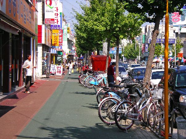
|
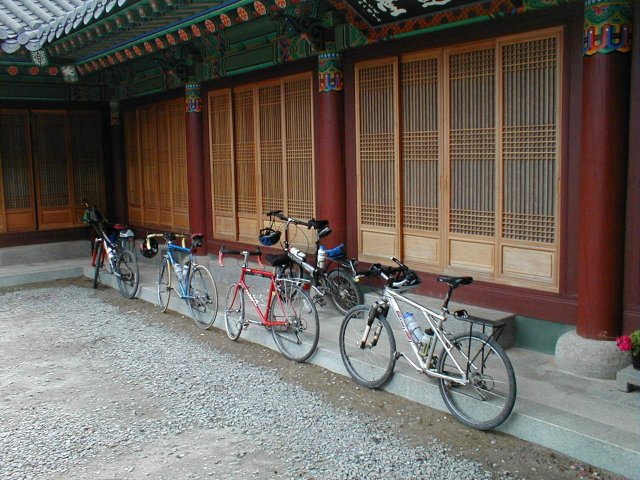
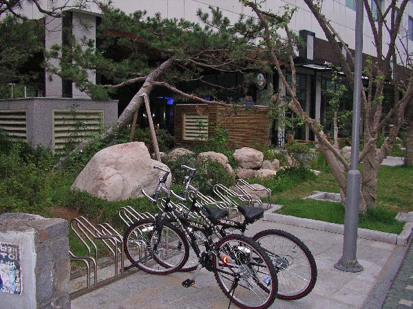
The standard bike
rack for Korea (left) is an upgrade of the classic "wheel bender." In this case, it is nicely set back from the traffic flow
of the sidewalk. You see them around Seoul and other large and small cities, and at museums, and
historic and cultural sites in the country.
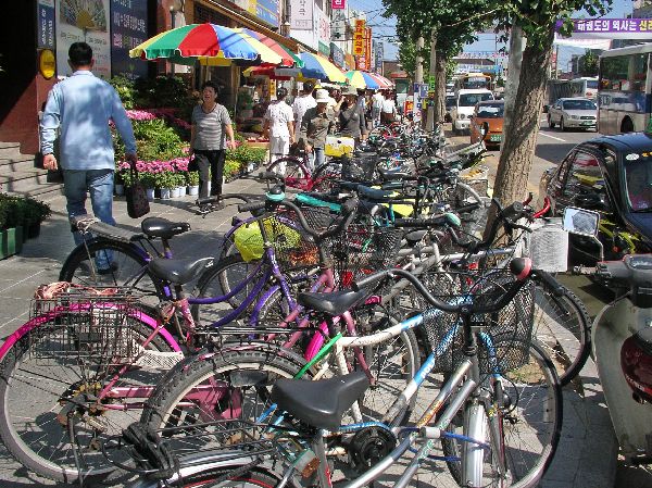
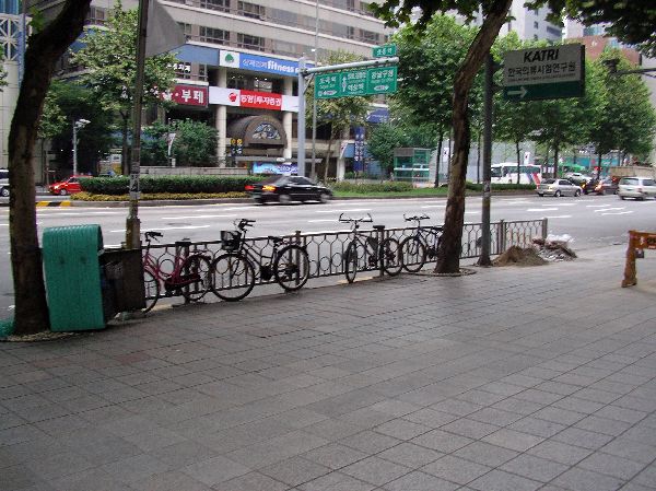 Because bike parking stations are few and far between there is also plenty of informal bicycle parking, especially near an entrance to the subway in Seoul. |
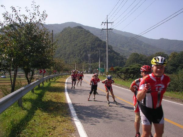 |
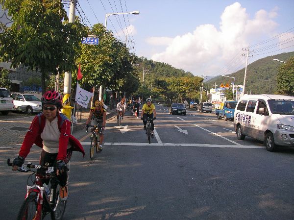
Flanked by warning vehicles ahead and in the rear, inline skating clubs take day-tours along the country roads in the flat river valleys. This group, passed between Hadong and Gurye, had a couple dozen members in it. |
|
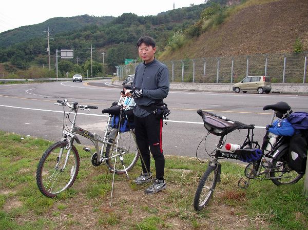
 Touring cyclist seem to be
very rare in Korea outside of Jeju Island, but this is one fellow traveler that I met. He had
cycled from Seoul to the southeast part of the country in less that a week.
Using a more serpentine route it had taken me three times as long. Touring cyclist seem to be
very rare in Korea outside of Jeju Island, but this is one fellow traveler that I met. He had
cycled from Seoul to the southeast part of the country in less that a week.
Using a more serpentine route it had taken me three times as long. |
|
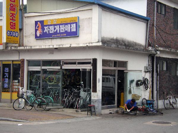
If such a thing exists, this is a pretty typical bike shop; small, doors wide open, some of the stock spilling out on to the street and repairs being done right inside the front door. Sometimes repairs are done out on the sidewalk as well. |
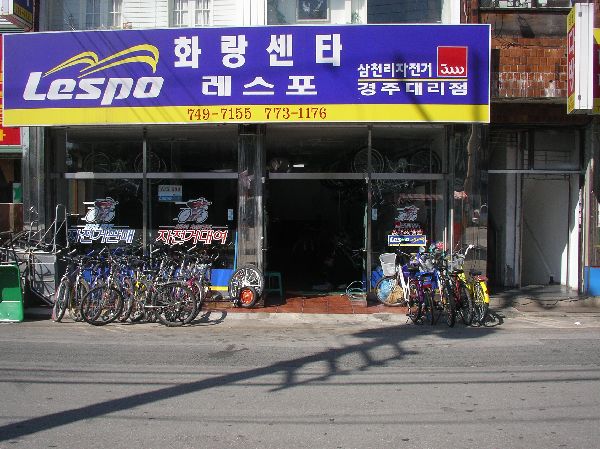 |
Because of protective tariffs most bikes in Korea are domestically manufactures. Import cycling equipment is relatively expensive. The domestic bicycle industry produces a little over a half million units a year. (By comparison, the domestic automobile industry produces over three million units a year.) |
|
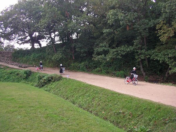
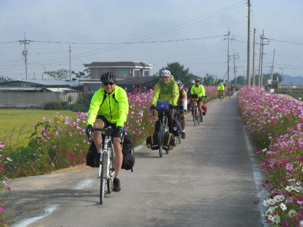
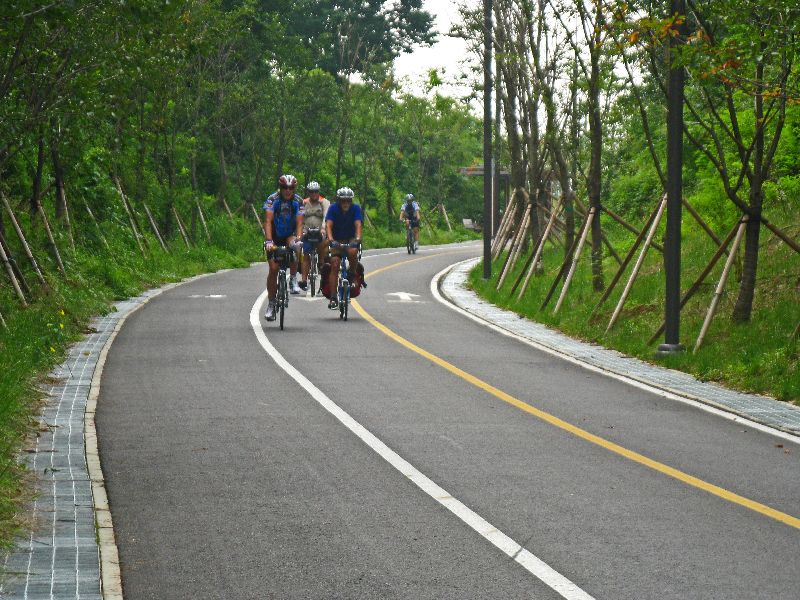
 Korean cyclists are often
well equipped and well dressed. Many cyclist on the trail system use
racing bikes. All of the cyclist in these to pictures have nice mountain bikes,
many with suspension.
There is much greater use of helmets by the recreational users (on and off road) than
utilitarian users (on road). This
facility (left) is also smooth enough for use by inline skaters. Korean cyclists are often
well equipped and well dressed. Many cyclist on the trail system use
racing bikes. All of the cyclist in these to pictures have nice mountain bikes,
many with suspension.
There is much greater use of helmets by the recreational users (on and off road) than
utilitarian users (on road). This
facility (left) is also smooth enough for use by inline skaters. |
Daegu |
|
 |
 Another nice quality of
Korea's third largest city, Daegu, at least in the center of town, is parks and
open space. They have a program to plant trees, create parks, and remove
street walls. The effort has already created a positive impact on the
local climate -- cooler summers. Another nice quality of
Korea's third largest city, Daegu, at least in the center of town, is parks and
open space. They have a program to plant trees, create parks, and remove
street walls. The effort has already created a positive impact on the
local climate -- cooler summers. |
|
Daegu, while mostly flat,
with a moderate climate, doesn't serve wheeled non-motorized travel as well.
The small neighborhood streets are generally discontinuous and indirect. The
through
roads are huge, multi-lane, high speed and offer no accommodation to
non-motorized vehicle, or the intended facilities are the sidewalks that have
irregular surfaces, are used for parking, or have other impediments.
Daegu has both established bicycle and inline skater groups
advocating for transportation alternatives (www.dgcn.org
and Daegu Green Consumer
Network Meeting).
While out bicycling in a group it is possible to commander a lane and feel pretty comfortable. Commuting solo on the arterials there is no comfort zone and the traffic is pretty aggressive and intimidating. |
 |
The situation on this street in Daegu, which at times is packed with pedestrians, is a narrow street, where, very appropriately, authorities don't want any parking -- particularly on the sidewalks. But, instead of solving the problems by educational initiatives and intensive enforcement directed at motorists, they have placed a lot of low lying cement obstacles on the sidewalk. So the treatment itself is directed at motorists, but the greatest negative impact of the treatment falls on pedestrians, who already must negotiate utility poles and a variety of other obstacles. |
 |
 These pictures,
also in Daegu, show a wide crosswalk, crossing a wide
road, but on closer examination (right) half of the crosswalk is blocked by
telephone booths, poles and other objects. These pictures,
also in Daegu, show a wide crosswalk, crossing a wide
road, but on closer examination (right) half of the crosswalk is blocked by
telephone booths, poles and other objects. |
Gyeongju / Lake Bokum Resort / Bulguksa (Temple) |
|
| While bicycling is relatively rare in most medium and large size cities in South Korea, Gyeongju is a notable exception. | |
 |
Gyeongju is the center of
cultural and recreational tourism activity. This has prompted the
development of a network of
miles of non-motorized facility but they don't always ace the implementation --
they aren't as homogeneous as the lines on the map would indicate.
|
|
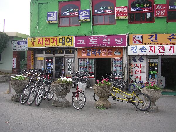 A common weekend activity
is for families or groups of friends to head for Gyeongju and rent bike to tour the city, or go for a
longer
rural bike tour. There are several bike rental shops, including one at the
train station. Bicycle rental business
often have tandems (bicycles-built-for-two) available for rent as well. A common weekend activity
is for families or groups of friends to head for Gyeongju and rent bike to tour the city, or go for a
longer
rural bike tour. There are several bike rental shops, including one at the
train station. Bicycle rental business
often have tandems (bicycles-built-for-two) available for rent as well. |
|
 A group of young
women (left) are taking a bike tour of the cultural sites in Gyeongju and a
group of nuns (right) are doing the same. A group of young
women (left) are taking a bike tour of the cultural sites in Gyeongju and a
group of nuns (right) are doing the same. |
|
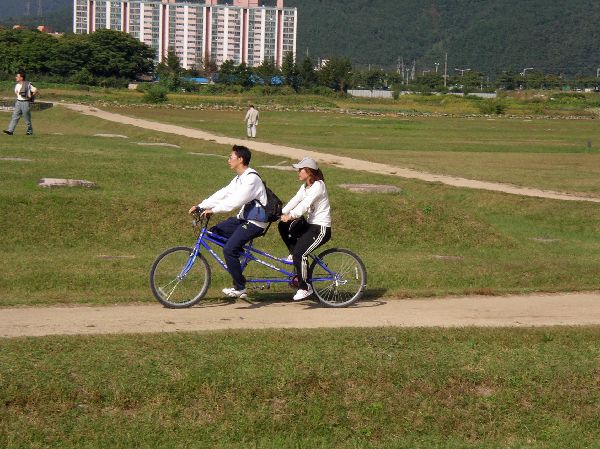
Here, a couple enjoys their excursion on a tandem. As seen in this picture and the preceding frames, an excessively lower seat height is the norm among most of the cyclists in this area. This suggests that they aren't regular bicyclists. Their technique would support this hypothesis -- all the more reason to make sure that facilities are designed to the highest standards. |
|
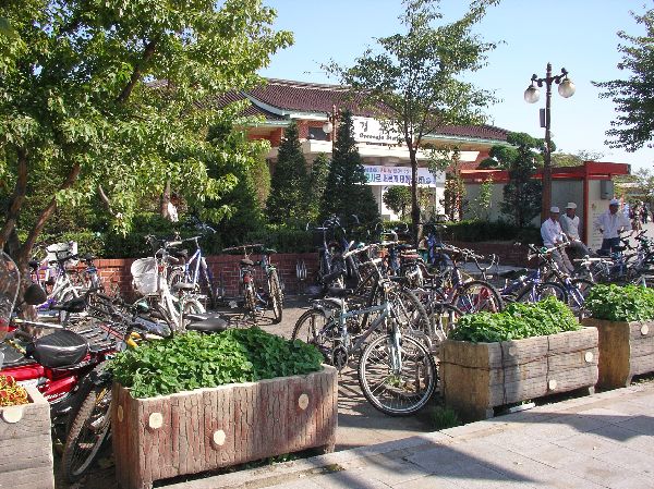
 With
the general encouragement of bicycling there is demand for bicycle parking.
Identifiable bike parking areas like those at Gyeongju railroad station (left) seem to be rare in the
downtown area. It is more common to see bicycles parked opportunistically
on the street (right). With
the general encouragement of bicycling there is demand for bicycle parking.
Identifiable bike parking areas like those at Gyeongju railroad station (left) seem to be rare in the
downtown area. It is more common to see bicycles parked opportunistically
on the street (right). |
|
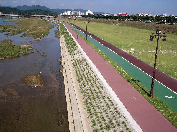
Three parallel facilities have been built in the flood plain at Gyeongju. The one near the river is designated for walkers (pink), the path to the right of it (green) is for inline skaters and the third (dark red) is a bicycle path. There are also bike / pedestrian facilities at street level. |
|
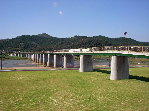
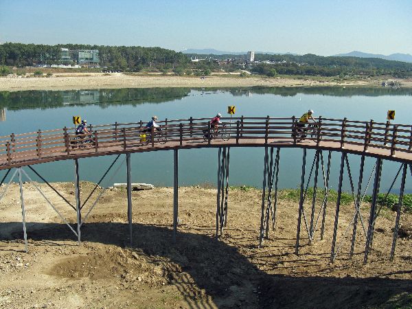
This pedestrian and bicycle bridge crosses the flood plain, and over the river side non-motorized trails. It connects the central business district of Gyeongju with a university area. Atypically, the route for motor vehicle is several kilometers longer. |
 |
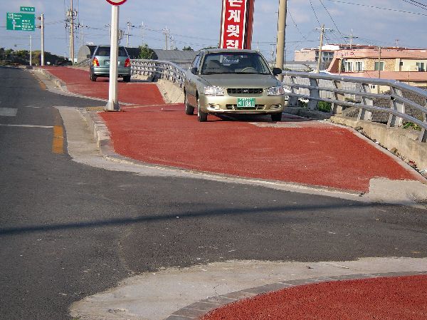
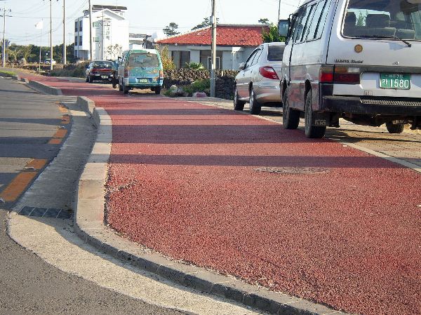
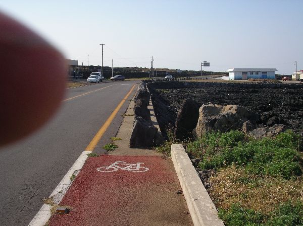
This is a typical red and green sidewalk linking Gyeongju and Lake Bomun Resort area. The green is intended for pedestrians and the red is for bicyclists. The street trees are in the pedestrian half so they shouldn't affect bicyclists too much, unless pedestrians step into the path of a bicyclist to avoid a tree. The uneven surface of the pavers is annoying for cycling and totally discouraging for inline skaters. |
 |
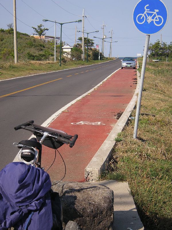
On the other side of the road from the facility above is the facility shown on the left. It is divided into two lanes and wide enough for two-way traffic. It is generally smooth enough for inline skaters. It also has some nice features like barriers to discourage cars from driving down or parking on the path and pull-out parking areas for bicycles (upper center of the photo). |
 |
This trail is seen going
from Lake Bomun on the north side of Bukcheon towards Gyeongju. The road on the west side
of Lake Bomun has a bike facility/sidewalk on only one side of the road.
|
Sangju (Bicycle Capital of South Korea) |
|
 |
 The
bicycle facilities in Sangju start well before you get into town, but first
impressions might make you apprehensive. The spaces is wide enough and
generally smooth enough to be admirable, but they have a lot of penetrations
(driveways and cross traffic) and suffer from the chronic phenomena of being
used for car parking, as can be seen in both of these photos. The
bicycle facilities in Sangju start well before you get into town, but first
impressions might make you apprehensive. The spaces is wide enough and
generally smooth enough to be admirable, but they have a lot of penetrations
(driveways and cross traffic) and suffer from the chronic phenomena of being
used for car parking, as can be seen in both of these photos. |
 |
 Further
into town the Sangju's commitment becomes more apparent. The Nakdong River
and its tributaries run along the north and east side of the town. The are
trail facilities along most of the dikes, with underpass for grade separated
crossing at the major road. The city itself is set in a flat valley, among
hills, which makes it very bicycle friendly. Further
into town the Sangju's commitment becomes more apparent. The Nakdong River
and its tributaries run along the north and east side of the town. The are
trail facilities along most of the dikes, with underpass for grade separated
crossing at the major road. The city itself is set in a flat valley, among
hills, which makes it very bicycle friendly. |
 |
 As
the arterials approach the town center, the pedestrians and bicyclists are
provided separate facilities and the bike lane is separated from the motor
vehicle lane by a physical barrier so there is less parking in the bike lane.
Some bicycle transportation engineers would question the safety of this style of
barriers and segregating the bike lane with a physical barrier raises other
issues, but Sangju is at least demonstrating a commitment by investment to
bicycling. As
the arterials approach the town center, the pedestrians and bicyclists are
provided separate facilities and the bike lane is separated from the motor
vehicle lane by a physical barrier so there is less parking in the bike lane.
Some bicycle transportation engineers would question the safety of this style of
barriers and segregating the bike lane with a physical barrier raises other
issues, but Sangju is at least demonstrating a commitment by investment to
bicycling. |
 |
  Sangju
further declares its commitment to bicycle transportations with its investment
in bicycle art. The sculpture on the left is along Highway 25, the main
east-west aterial in town, and the sculpture on the right is in a riverside
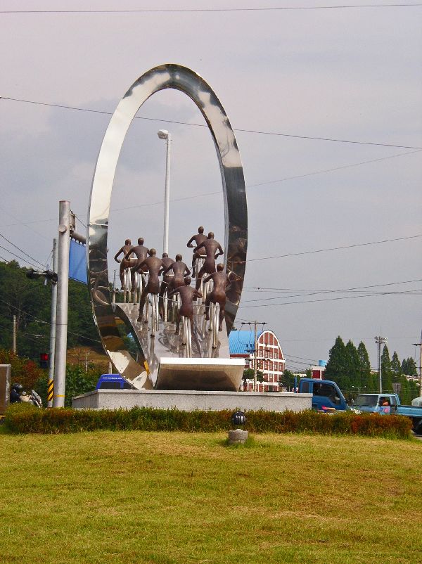
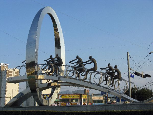
park. Sangju also host a big bicycle festival every year in the fall. Sangju
further declares its commitment to bicycle transportations with its investment
in bicycle art. The sculpture on the left is along Highway 25, the main
east-west aterial in town, and the sculpture on the right is in a riverside
park. Sangju also host a big bicycle festival every year in the fall. |
 |
This bridge on the edge of Sangju has been modified with barriers that limits access for motor vehicle to one side of the bridge and dedicates half of the bridge to bicycle traffic. In our very short survey of traffic across the bridge, the bicycle side was carrying more traffic than the motor vehicle side! |
 |
In the downtown core some of the streets around the market are blocked to motor vehicles and on the main street there are bike racks every 100 meters -- which are heavily used. City official say that there are about 85,000 bicycle in the city. An average of two bicycles per household. Elsewhere there is the statistic that Sangju has a population of about 120,000, which puts the average household at about three people. |
 |
 The number of students using bicycles
is given as approximately 14,000. When the school day ends they flood the
streets heading in all directions. The number of students using bicycles
is given as approximately 14,000. When the school day ends they flood the
streets heading in all directions. |
 |
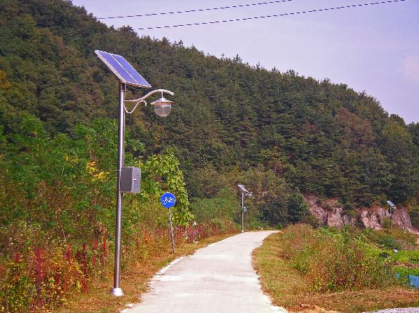
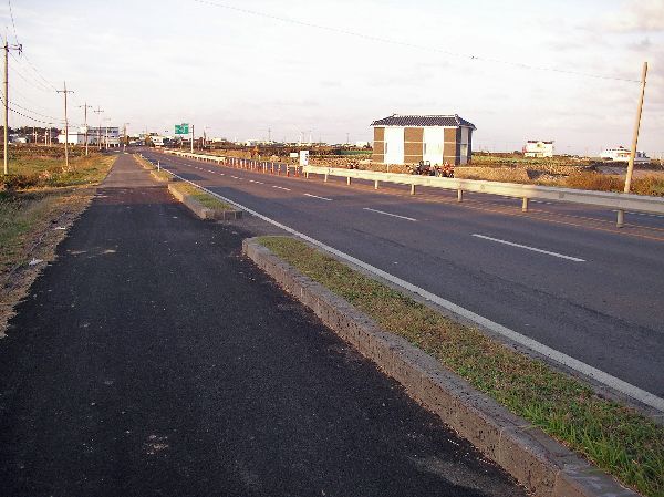
 Outside downtown, there is
a 63km-long bike path, which is paved with asphalt made from recycled rubber and
lit at night with solar powered lights (right). Outside downtown, there is
a 63km-long bike path, which is paved with asphalt made from recycled rubber and
lit at night with solar powered lights (right). |
 |
 Fittingly,
Sangju is also home to the
Bicycle Museum. It is built on the site of a closed school, about 5 km
west of the center of town. You can get there on the riverside trail, but
it is not well signed. Besides a variety of exhibits on the the history
and technology of bicycles, there are a variety of bicycle out in the front that
visitors can try for themselves. Fittingly,
Sangju is also home to the
Bicycle Museum. It is built on the site of a closed school, about 5 km
west of the center of town. You can get there on the riverside trail, but
it is not well signed. Besides a variety of exhibits on the the history
and technology of bicycles, there are a variety of bicycle out in the front that
visitors can try for themselves. |
Jeju-do (Cheju Island) |
|
|
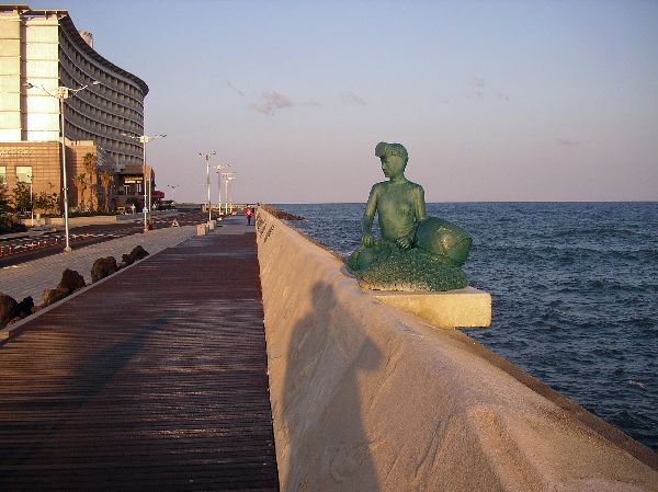
The waterfront in Jeju City, Jeju
Island, is a beautiful, broad, promenade along
a seawall. For the length of the wall there were a
variety of decorative treatments and sculptures based on local themes. It
is an excellent car-free space. Non-motorized accommodation on Jeju Island is interesting because the facilities are fairly wide spread, but rarely great. It seems to be mainly designed to serve visitors (tourism is one of Jeju's main economic sectors). But, should bicycle tourism really become popular it could be frightening because most of the facilities are for minimum capacity and poorly implemented. For better or worse, this is unlikely to occur because there is so much accommodation of motor vehicles they are on there way to dominating every corner of the island, squelching most hope to entice people on to bicycles and develop a more environmentally friendly model of tourism. |
|
A major feature of Jeju Island is almost continuous bicycle lanes on highway 12, which circumnavigates the island. Generally there are bike lanes on both sides of the roads. The facilities tend to be the best where they are least likely to be used. |
|
Outside of built-up areas the Jeju highway 12 bike lanes are separated from the main travel lanes and wide enough to be used by farm equipment and light duty trucks as access roads. Because highway 12 is often a limited access road way, several times I encounter cars and tractors driving the wrong way down the side lane to access some property. The farm equipment in particular deposits clods of mud on the track and because of the barrier between them and the main road they never get blown clean by the high speed traffic. Often they are much worse that shown here, with deposits of sand, gravel and broken glass. |
|
At this point Jeju highway 12 has been widen to add a bus stop pullout. While in some cases the bike lane was pulled back even further to accommodate a bus passenger waiting shelter between the bus pullout and the bike lane, in this and numerous other situations the shelter was built over the "bike lane". |
|
As highway 12 comes into built up areas, the bike facility tends to be grade separated and combined with a sidewalk. These sections often are also characterized by a lot of cross penetration, sharp curb lipps and undulation of the riding surface. Parked cars are another frequent obstacle. |
|
This picture highlights the large lip that is common at curb ramps, the numerous cross penetration of the facility, the undulation and the use of the non-motorized facility by motor-vehicles. Because of the "friction" bicycle travel in these sections is very slow. Or, the inclination is move to the more free-flowing and much better road surface, but cars seem to react with the attitude of "get off the road and on to the bike path!" While in most of South Korea, drivers were very patient with bicyclist, Jeju Island tend to be one of the exception. |
|
 One of the nicest aspects of Jeju Island are the "shore roads". In 2004, these were discontinuous,
which kept motor-vehicle traffic volumes down, the scenery uncluttered and the atmosphere tranquil.
But, the bike lane adjacent to the road is
even more discontinuous, and where they exists they are often used for parking. One of the nicest aspects of Jeju Island are the "shore roads". In 2004, these were discontinuous,
which kept motor-vehicle traffic volumes down, the scenery uncluttered and the atmosphere tranquil.
But, the bike lane adjacent to the road is
even more discontinuous, and where they exists they are often used for parking. |
 |
 Currently, the "shore
road" still has missing links and goes through the narrow streets of many seaside villages. This
"road diet" keeping the buses off much of the route and slows cars down so
that they choose to take highway 12 instead. Unfortunately, there is currently a project
to connect many of the isolated sections of shore road by building big roads
through and on the coastal side many of these villages, bisecting them or
cutting them off from the shore. Consequently they are destroy some of
the islands reserves of tranquility and opportunities to promote strong high
quality ecotourism. We predict that both lost opportunities that will
be deeply regretted in twenty years. Currently, the "shore
road" still has missing links and goes through the narrow streets of many seaside villages. This
"road diet" keeping the buses off much of the route and slows cars down so
that they choose to take highway 12 instead. Unfortunately, there is currently a project
to connect many of the isolated sections of shore road by building big roads
through and on the coastal side many of these villages, bisecting them or
cutting them off from the shore. Consequently they are destroy some of
the islands reserves of tranquility and opportunities to promote strong high
quality ecotourism. We predict that both lost opportunities that will
be deeply regretted in twenty years. |
|
Here the bike lane on the shore road abruptly ends. Presumably you are suppose to wait for a helicopter to take you to the next section or turn back. If you turn back, you will find that there is a bike lane on only one side of the road. In the off season traffic volumes are pretty low so it is not a problem to ride in the road. Many people seem to feel like they should ride the wrong way in the narrow bike lane, which when they meet an on-coming cyclists and on coming traffic together, creates a potential very dangerous situation. |
|
Another of the frequent cars parked in the bike lane. This picture is clearer that there is only a bike lane on one side of the road. This bike lane is very discontinuous as well. There is a critical need for additional training in bicycle traffic engineering for the road engineers of the local jurisdiction. |
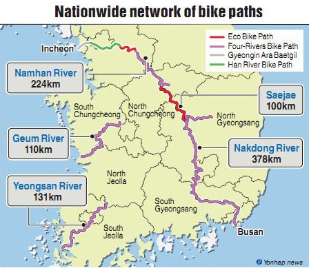
Nationwide Bike Path Network |
|
 |
Koreans has long had an
extensive networks of hiking trails throughout the forests and mountains of the country. Ernest activity to
developing nationwide bikeway
network dates from about 2008-09. As with most large bike network, this
one has a variety of different characters.
In Seoul, and several other communities, scattered bike facilities have previously have been periodically installed as part of local improvement initiatives. The were notoriously discontinuous and sometimes built to very marginal and inconsistent design standards. The trend taking on local bicycle infrastructure improvements seems to have accelerated in the first decade of the new millennium, without any regional coordination.
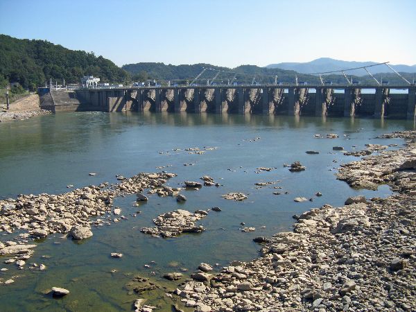
The Four Rivers Project was first announced as part of the “Green New Deal” policy launched in January 2009. Most of the work is suppose to be completed by 2012. Of the landscape-heavy projects; dam construction, river bottom shoveling and dredging, channelization of the river banks, it is debatable whether the initiative is more destructive or constructive for the environment, but the upland non-motorized trail facility opens up some beautiful opportunities for walkers, bladers and bicyclists. |
 |
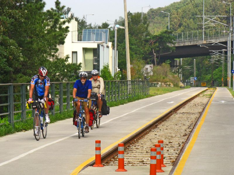
Through Seoul, from Inchon on the west to Pallang Dam on the east, much of the
70 km Han River trail, on
the south bank, was developed (or under development) prior to the Four Rivers
Project.
|
 |
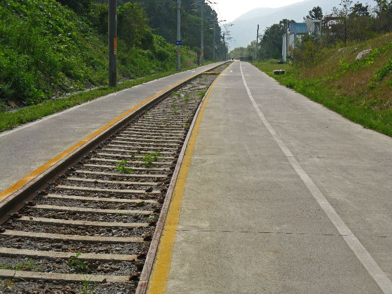
 The Namhangang Rail Trail goes from Pallang Dam to Yangpyeong,
mostly on an old railroad alignment. Presumably to tell the story they
have left some of the tracks in around an old station. The engineers have
also taken advantage of the old tunnels. The Namhangang Rail Trail goes from Pallang Dam to Yangpyeong,
mostly on an old railroad alignment. Presumably to tell the story they
have left some of the tracks in around an old station. The engineers have
also taken advantage of the old tunnels. |
 |
At Yangpyeong there is no obvious route on the north bank, but there are bridges that cross the river. On the south bank it is 16km (10 miles) as the crow flies until there is more evidence of shoreline trail facilities. [2011] |
 |
 A
south bank trail shows up again around Guemsa but is discontinuous toward Yeoju.
In Yeoju the trail is completed along the river through town.
At the south end of Yeoju the riverside trail ends and there is a pig tail bridge connecting
the trail with a bridge to get users to the north bank, but
(as of late 2011) there were not obvious non-motorized facilities heading on
(south or east) from there. A
south bank trail shows up again around Guemsa but is discontinuous toward Yeoju.
In Yeoju the trail is completed along the river through town.
At the south end of Yeoju the riverside trail ends and there is a pig tail bridge connecting
the trail with a bridge to get users to the north bank, but
(as of late 2011) there were not obvious non-motorized facilities heading on
(south or east) from there. |
 |
 From Yeoju, there only seem to be on-road routes until you go from Gyeongii-do
to Gangwon-do, over the old Seomgang bridge (Island River, a tributary of the
Namhan River) and a sign directs bicyclists not to proceed any further on the
main road and directs them on to cross the road to an access road that drops down
under the bridge and to the river bank and onto 5 km (3 miles) of riverside trail to Buron.
If you are traveling northbound, towards Seoul, you can connect with this by head to the bridge crossing the Namhan at Buron and
riding up the trail on the east bank. From Yeoju, there only seem to be on-road routes until you go from Gyeongii-do
to Gangwon-do, over the old Seomgang bridge (Island River, a tributary of the
Namhan River) and a sign directs bicyclists not to proceed any further on the
main road and directs them on to cross the road to an access road that drops down
under the bridge and to the river bank and onto 5 km (3 miles) of riverside trail to Buron.
If you are traveling northbound, towards Seoul, you can connect with this by head to the bridge crossing the Namhan at Buron and
riding up the trail on the east bank.Continuing south from Buron, to the west side of the Jojeonji Dam (across the Namhan River, north of Chungju,) currently the key is search out the coming and going of road 599. There are no sign of any bike specific facilities in the works. [2011] |
 |
From just south of the Jojeonji Dam, most of the way to the turn-off for the Jangang pagoda, a viaduct-type trail has been build above the river / lake shore. This is a great improvement because it give bicyclists an option from a narrow, winding road, with heavy traffic. There is a local network of trails around Jangang pagoda, but these all seem to be for local access. Additional connection would be required to tie these into the national network.
For the last leg into Chungju, the bicycle-friendly route from the west, is currently an unsigned, almost zero traffic, route on some farm roads. |
 |
South of Chungju any sign of a nationwide bikeway network disappears again for a while. At this point you leave the Namhan River system and the route is being developed as the "Saejae Eco Bike Path". The first evidence we found [2011] of the Saejae section was around Suhoe-ri, where a non-motorized side path is cantilevered off the highway on the Westside of the road. Using this, some farm roads and old roads your can reduce the distance spent bicycling on the highway and reach Suambo fairly expeditiously and enjoyably. If you are traveling northbound, towards Seoul, it would be hard to pick-up this alternative route. |
 |
After Suambo, again, there is no
obvious accommodation for bicyclist for the next 16 km (ten mile). The
preferred route for bicycling is the old Hwy 3. It
generally has very light traffic volumes so the lack of any development of the
national network is not much of an issue. At Yeonpung the "bike route"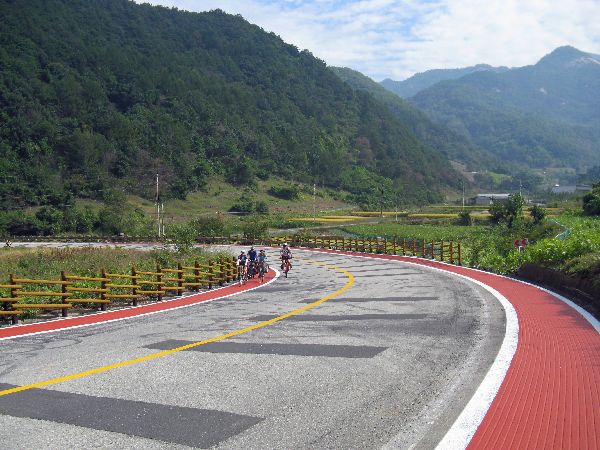 passes
under the new Hwy 3 and heads up towards Ihwalyeong Pass as a real thing. In 2011 bike
lanes and several view points were added on both sides of the road up to the pass. On the corners
and sharp curves
the bike lanes are identified with red asphalt. passes
under the new Hwy 3 and heads up towards Ihwalyeong Pass as a real thing. In 2011 bike
lanes and several view points were added on both sides of the road up to the pass. On the corners
and sharp curves
the bike lanes are identified with red asphalt.Descending the east side of the pass is a breeze, but at the bottom, if you aren't diligent, before you know it, you will fly on to the new Hwy 3, without any easy escape. The solution, though it is not signed, is to turn left and pass under Hwy 3 just before the stealth on-ramp. Hopefully by the time the National Network is fully built out better signage will appear. |
|
 From
Mungyeongsaejae to Mungyeong (over 30 km, 18 miles) there are a variety of back
roads, farm roads, village roads, paved trails and virtually abandoned highways that can be
strung together for an esthetically enjoyable bike ride. Unfortunately, at
the present [2011] it is not signed, and best route is often close at hand but rarely obvious or intuitive. From
Mungyeongsaejae to Mungyeong (over 30 km, 18 miles) there are a variety of back
roads, farm roads, village roads, paved trails and virtually abandoned highways that can be
strung together for an esthetically enjoyable bike ride. Unfortunately, at
the present [2011] it is not signed, and best route is often close at hand but rarely obvious or intuitive.
From Mungyeong the national route follows the Nakdong River.
There is a If you travel along the Nakdong River south of Mungyeong we would love to hear about what you find in the way of bicycle facilities, especially those that might be part of the national network. |
| Etc. | |
|
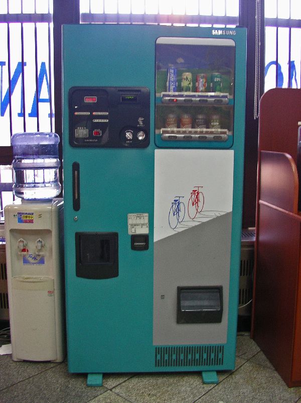
Anecdotally, the amount of coffee drunken by bicyclists
makes the coffee machine part of the bicycle infrastructure. Coffee machines are (or were) almost
ubiquitous and seemed to be synonymous with daily life, as well as bicycle touring. They can
(or could) be found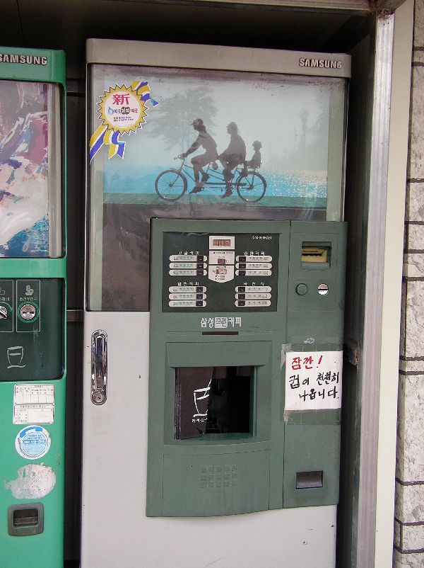 on almost every block in a city, inside business,
at any kind of roadside attraction and standing alone in a gravel parking lot --
as long as there was electric service that could be dropped in.
The machine on the left is inside a bank and features a
bicycle graphic. The machine on the right,
located next to the parking lot at the visitors center for a dam projects,
features a bicycle for three -- a nice family outing. I saw three people
on a bike, but it was a regular one-seat bike. on almost every block in a city, inside business,
at any kind of roadside attraction and standing alone in a gravel parking lot --
as long as there was electric service that could be dropped in.
The machine on the left is inside a bank and features a
bicycle graphic. The machine on the right,
located next to the parking lot at the visitors center for a dam projects,
features a bicycle for three -- a nice family outing. I saw three people
on a bike, but it was a regular one-seat bike.Into the twenty-first century the iconic coffee machine is starting to fade. In the cities there are now countless chains of coffee shops and in the small towns the mini-mart will sell you a single-serving of instant coffee and has an instant-hot water tap. |


IBF's Bibliography: Korea
Eurasia & Pacific
Digest
Korea Bicycle Tours
Home | About Us | Contact Us | Contributions | Economics | Education | Encouragement | Engineering | Environment | Bibliography | Essay Contest | Ibike Tours | Library | Links | Site Map | Search
![]()
The International Bicycle Fund is an independent, non-profit organization. Its primary purpose is to promote bicycle transportation. Most IBF projects and activities fall into one of four categories: planning and engineering, safety education, economic development assistance and promoting international understanding. IBF's objective is to create a sustainable, people-friendly environment by creating opportunities of the highest practicable quality for bicycle transportation. IBF is funded by private donation. Contributions are always welcome and are U.S. tax-deductible to the extent allowed by law.
![]()
![]() Please write if you have questions, comment, criticism, praise or
additional information for us, to report bad links, or if you would like to be
added to IBF's mailing list. (Also let us know how you found this site.)
Please write if you have questions, comment, criticism, praise or
additional information for us, to report bad links, or if you would like to be
added to IBF's mailing list. (Also let us know how you found this site.)