 |
|
|
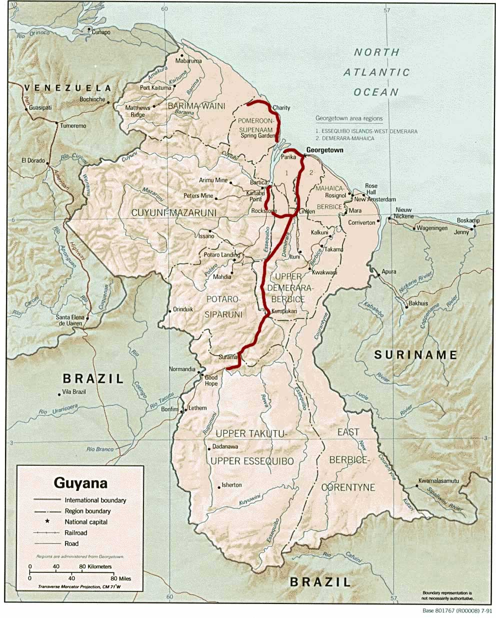
Guyana (Guiana) Tour |
||
|
||
|
|
||
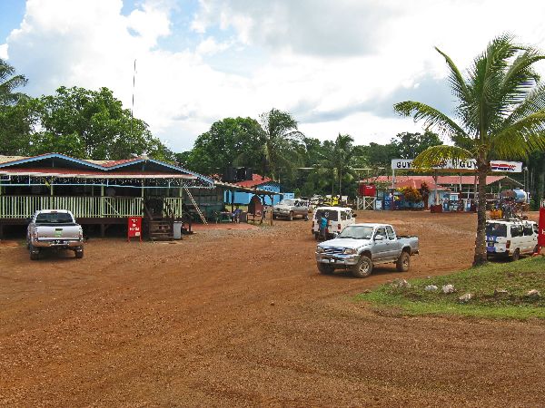 |
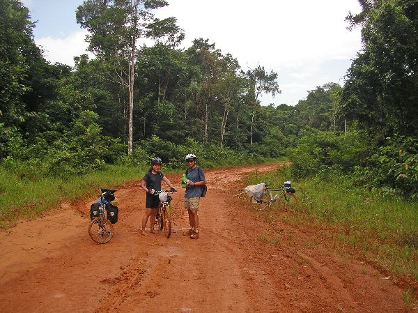
 Roughly,
halfway between Kurupukari and Linden is a placed called "Mile 58".
The name is a bit curious because it is 106km (65 miles) from Linden and
124km (77 miles) from Kurupukari. What it is, is about 58 miles from
Rockstone junction. There is almost no commercial development between
the three times, so whether out of ritual or necessity, almost everyone
traveling the road stops at Mile 58. It now has its own cell tower and
sometimes Wifi. Roughly,
halfway between Kurupukari and Linden is a placed called "Mile 58".
The name is a bit curious because it is 106km (65 miles) from Linden and
124km (77 miles) from Kurupukari. What it is, is about 58 miles from
Rockstone junction. There is almost no commercial development between
the three times, so whether out of ritual or necessity, almost everyone
traveling the road stops at Mile 58. It now has its own cell tower and
sometimes Wifi. |
|
 |
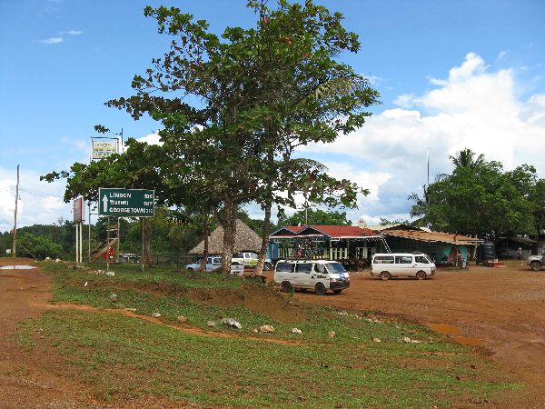
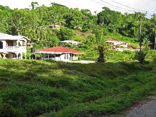
 Linden
straddles the Demerara River. Since 1916, the center of its economy has been
open pit Bauxite mines and several processing plant. When the Alumina
plant
operation closed, a chunk of the rest of Linden economy went with it. For
decades Linden was the second largest town in Guyana, but that is probably no
longer the case. If is far from a ghost town, but more subdued Linden
straddles the Demerara River. Since 1916, the center of its economy has been
open pit Bauxite mines and several processing plant. When the Alumina
plant
operation closed, a chunk of the rest of Linden economy went with it. For
decades Linden was the second largest town in Guyana, but that is probably no
longer the case. If is far from a ghost town, but more subdued |
|
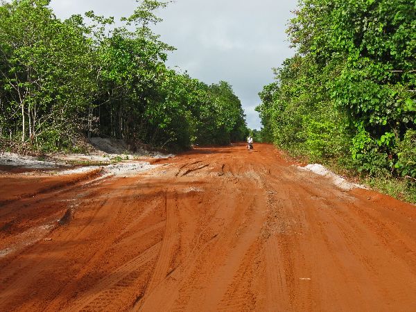 |
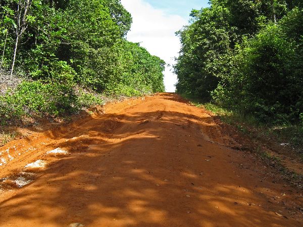
  On the road from Georgetown, a
couple of miles after you cross the Demerara River, the pavement ends -- it is
either red clay or white sand.. While 100 km from the coast the area is
generally less than 50m above sea level. If you do the math and average it
out, the area is pretty flat. On the road from Georgetown, a
couple of miles after you cross the Demerara River, the pavement ends -- it is
either red clay or white sand.. While 100 km from the coast the area is
generally less than 50m above sea level. If you do the math and average it
out, the area is pretty flat. |
|
 |
 On
my first visit to Rockstone and in need of accommodatios, I we met Bernard at his store in the late afternoon.
In short order, he arranged for us to have a place to stay and for Fay, a older
local woman with boundless energy and volumes of stories, to cook for us. As
they had been all along, the meals were superb. During the evening
other local citizens came by to great the strangers in town. It was one of the more
interesting evenings I have spent in Guyana. On
my first visit to Rockstone and in need of accommodatios, I we met Bernard at his store in the late afternoon.
In short order, he arranged for us to have a place to stay and for Fay, a older
local woman with boundless energy and volumes of stories, to cook for us. As
they had been all along, the meals were superb. During the evening
other local citizens came by to great the strangers in town. It was one of the more
interesting evenings I have spent in Guyana. |
|
 |
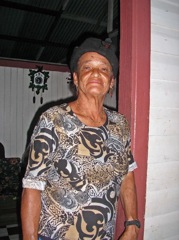
 Even
a decade later, Fay walks miles around the community and if you need something
in Rockstone, she is likely to be the "go to person." Even
a decade later, Fay walks miles around the community and if you need something
in Rockstone, she is likely to be the "go to person."The big event every year in Rockstone is the fishing tournament. We missed it -- which is fine -- but we know that they left a fish in the river. |
|
 |
It has become easier to find lodging in Rockstone with the opening of the
Rockstone Resort -- fortunately it doesn't have "resort prices." It is not
build out to what you typically expect of a "resort," but that does a lot to
keep it more environmentally friendly. There is talk of expanding the
facilities. They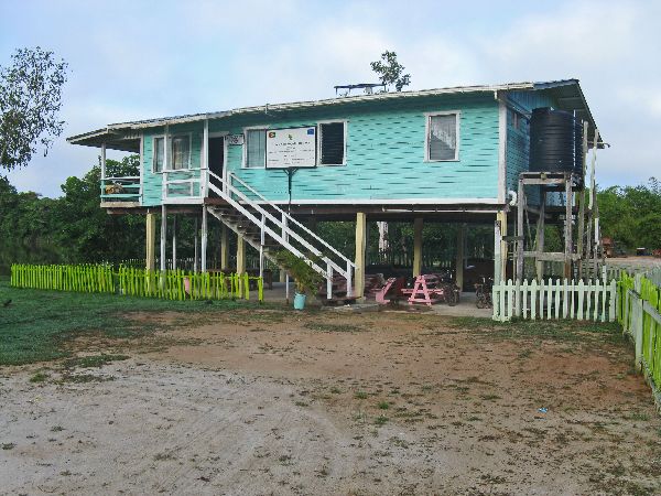 would do well to refine what they have first: clean the yard (litter and broken
glass), spruce up the showers, fix the toilets, and various minor repairs.
would do well to refine what they have first: clean the yard (litter and broken
glass), spruce up the showers, fix the toilets, and various minor repairs.Despite, or because, of its simplicity it is a very relaxing and restful place to stay. And is typical of the interior of Guyana, the people are friendly and helpful. |
|
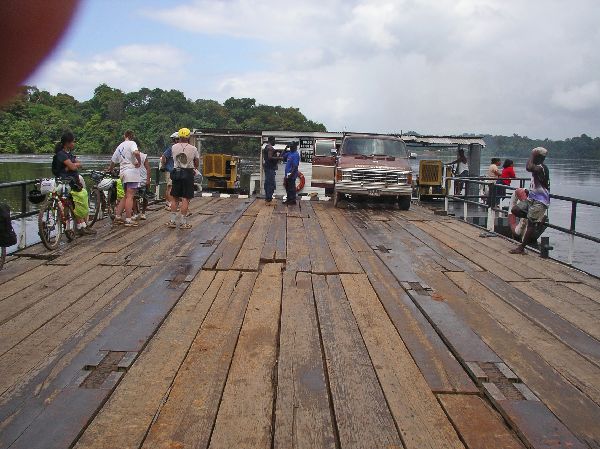 |
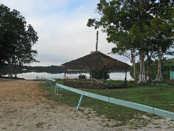
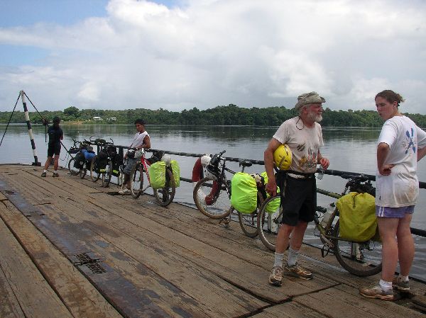
 From
Rockstone it is another 30 km to the ferry that crosses the Essequibo River. From
Rockstone it is another 30 km to the ferry that crosses the Essequibo River.If your timing isn't precise -- which is hard on these roads -- when you get to the river edge you could have to wait up to an hour for the ferry -- perhaps long if there are only bicycles on the landing. The boat only make one round-trip an hour, between 6 AM and 6 PM. If there are no motor vehicles on a cycle it may not make the trip -- bicyclists seem to be invisible to the system. |
|
|
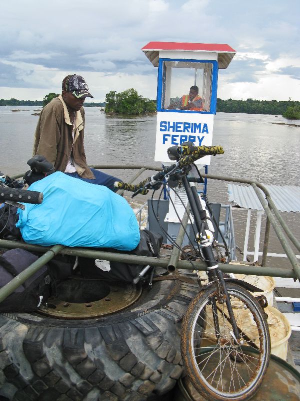
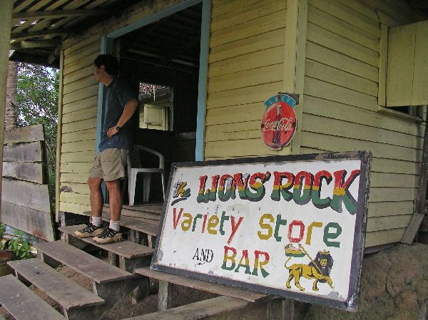
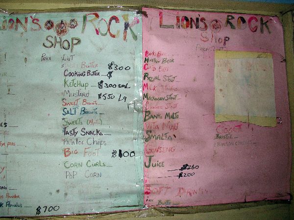 On the east bank, place to wait is the very Caribbean Rasta Lion's Rock Variety Store and Bar. Items for sale and their prices are clearly posted (right) -- the currency is the Guyana dollar. The exchange rate at the time was about 200 Guyana dollar to one U.S. dollar. Sherima, on the west bank, is the more developed of the to landings, but
don't let your imagination run wild. The group of buildings near the landing
consists of |
|
 |
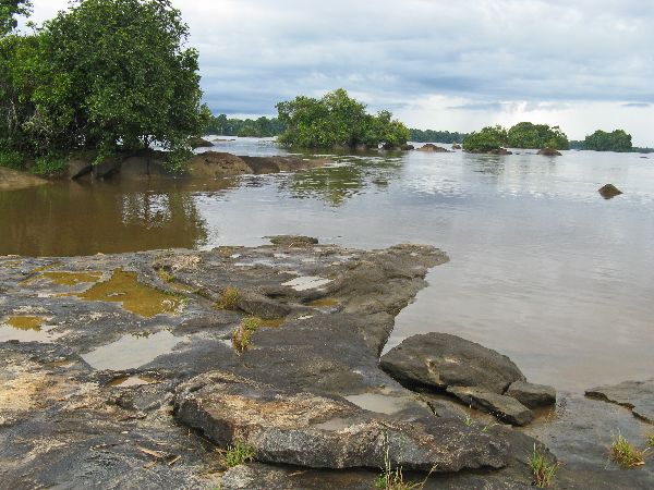
 The
Essequibo ferry is a motorized barge. One visit we were feeling unlucky for an hour or two
until a van come along, and then we were feeling very lucky. The
Essequibo ferry is a motorized barge. One visit we were feeling unlucky for an hour or two
until a van come along, and then we were feeling very lucky.On another visit we were feeling luck with the well timed arrive of a truck. It had been raining and the roads were a mess. No one hesitated when we arranged for the truck to take us the next leg of the journey. |
|
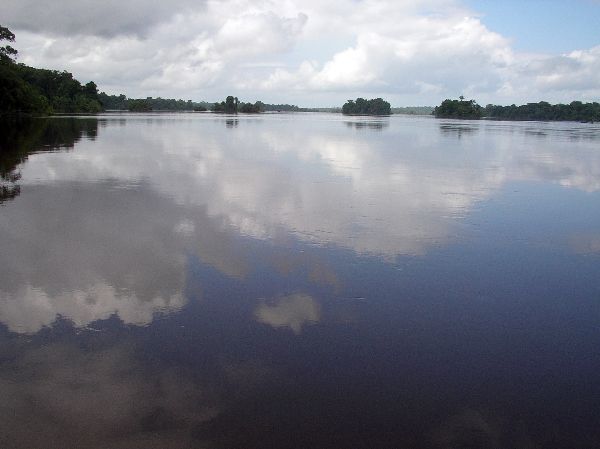 |
 I
have always made the crossing of the Essequibo River when it was very calm
and picturesque. It does not seem like it would be as nice an experience on a
stormy day; the ferry doesn't offer any cover, nor does it have a lot of freeboard. I
have always made the crossing of the Essequibo River when it was very calm
and picturesque. It does not seem like it would be as nice an experience on a
stormy day; the ferry doesn't offer any cover, nor does it have a lot of freeboard. |
|
 |
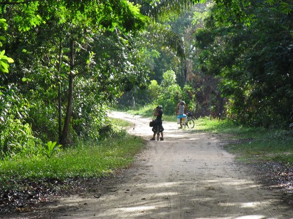
 The
roads on the west side of the Essequibo River, between Bartica and
Potaro, are mostly used to get provisions to the mining operations in the
interior. Most of the vehicle have high clearances, large tires and are
capable of all wheel drive. Truck after truck was hauling drums or tanks
of fuel inland, or returning empty. At its best the road was dry, packed,
red clay. At its worst the red clay sealing layer disappeared and we were
struggling through an inland beach The
roads on the west side of the Essequibo River, between Bartica and
Potaro, are mostly used to get provisions to the mining operations in the
interior. Most of the vehicle have high clearances, large tires and are
capable of all wheel drive. Truck after truck was hauling drums or tanks
of fuel inland, or returning empty. At its best the road was dry, packed,
red clay. At its worst the red clay sealing layer disappeared and we were
struggling through an inland beach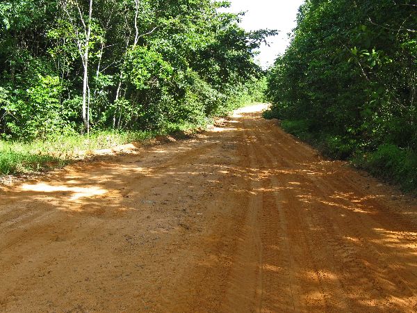 of white sand. Drawing its name from
the geology, this
section is called the "white sand belt". At one time, tens of thousands of
years ago, the coastline actually was here. of white sand. Drawing its name from
the geology, this
section is called the "white sand belt". At one time, tens of thousands of
years ago, the coastline actually was here.Our conclusion is these roads are not getting regular maintenance because their condition is deteriorating. |
|
|
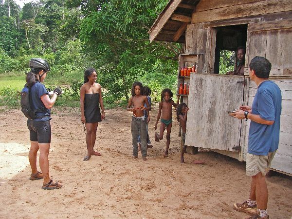
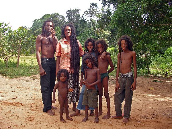 This
family is making a homestead out of the forest. Typical of Guyanese they
provide us with food and drink. One of the dishes was a tasty mix of rice,
corn, beans and other vegetables -- all organic and grown on their farm. This
family is making a homestead out of the forest. Typical of Guyanese they
provide us with food and drink. One of the dishes was a tasty mix of rice,
corn, beans and other vegetables -- all organic and grown on their farm. |
|
 |
 |
|
|
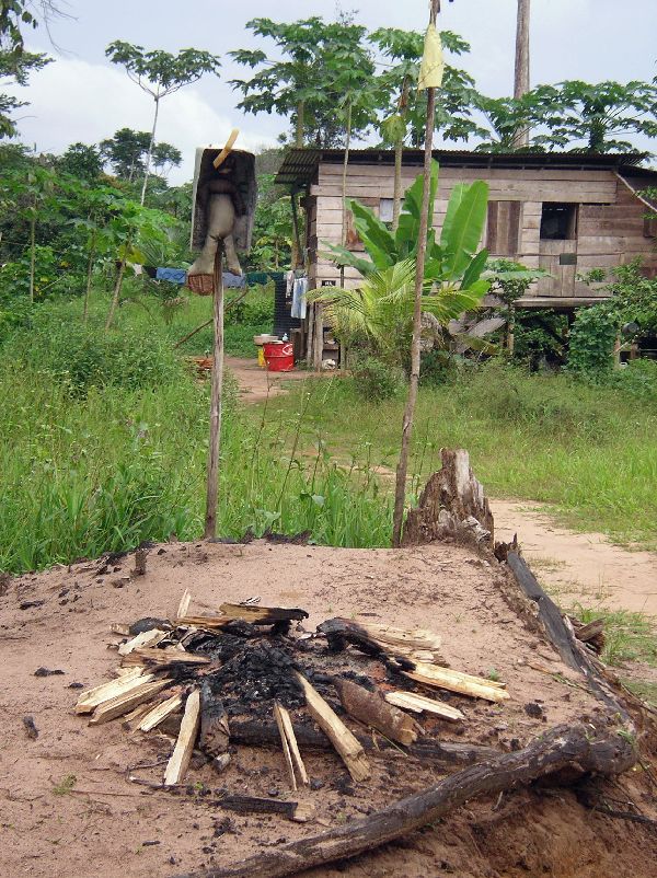
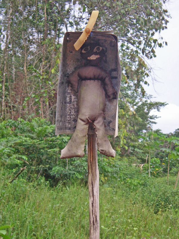 This
house further down the road had an conspicuous and interesting item along the
road. On a pole above a fire pit was a stuffed human-like figure, with a
cover above its head, most likely to protect it from the weather. No one
was around to give us information on the specific purpose of the display. This
house further down the road had an conspicuous and interesting item along the
road. On a pole above a fire pit was a stuffed human-like figure, with a
cover above its head, most likely to protect it from the weather. No one
was around to give us information on the specific purpose of the display. |
|
 |
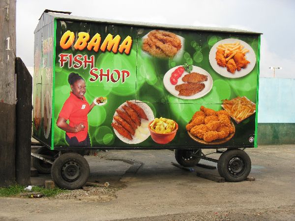 Somehow
I keep passing through Bartica without taking many pictures. I know
have two; one on the outskirts and the Obama Fish Shop trailer. The trailer is
open at night. Bartica is more photogenic than is represented here and
deserves better. While the economy of the town is primarily dependent
upon the outlying mining camps, some of which are hundreds of miles away,
there is no heavy industry associated mining in the town and it has nice
character to it -- though fairly load in the center of town on a weekend
night. Somehow
I keep passing through Bartica without taking many pictures. I know
have two; one on the outskirts and the Obama Fish Shop trailer. The trailer is
open at night. Bartica is more photogenic than is represented here and
deserves better. While the economy of the town is primarily dependent
upon the outlying mining camps, some of which are hundreds of miles away,
there is no heavy industry associated mining in the town and it has nice
character to it -- though fairly load in the center of town on a weekend
night. |
|
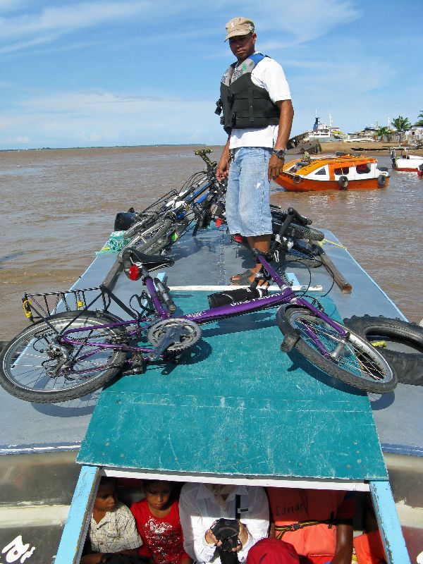 |
For a bicyclist, the easier way to get to and from Bartica is by boat. |
|
|
|
||
|
|
||
|
"Hosted by
DreamHost - earth friendly web hosting"
|
||
 Guyana
Cultural Tour: Essequibo River, Linden, Rockstone, Sherima, Bartica
Guyana
Cultural Tour: Essequibo River, Linden, Rockstone, Sherima, Bartica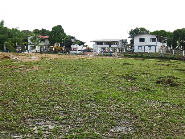


 Please
contact us
Please
contact us