Ibike Korea People-to-People Program
 Photo essay: West
Coast, South Korea -
Photo essay: West
Coast, South Korea -
Buan, Naesosa, Chaeseokgang, Saemangeum, Iksan
Buan to Gunsan: We touch
coastline, see fishing village and breath sea air.
Points of Interest: Naesosa, Saemangeum Seawall, and Gunsan
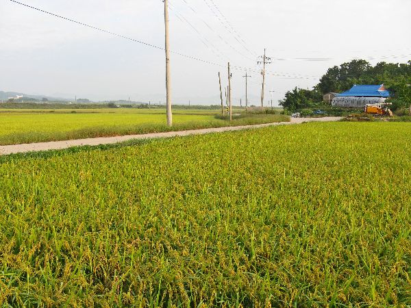
 Following
farm roads through the rice fields of Sapo-ri, Heungdeok-myeon, Gochang-gun, we passed Gim
So-hui's birthplace. I haven't been able to determine whether Gim is a
historic figure or contemporary figure. The name appears in both contexts.
Following
farm roads through the rice fields of Sapo-ri, Heungdeok-myeon, Gochang-gun, we passed Gim
So-hui's birthplace. I haven't been able to determine whether Gim is a
historic figure or contemporary figure. The name appears in both contexts.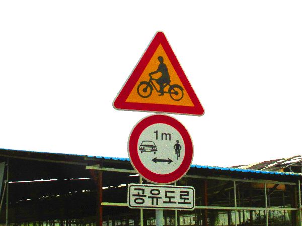
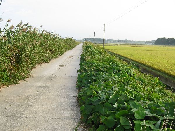
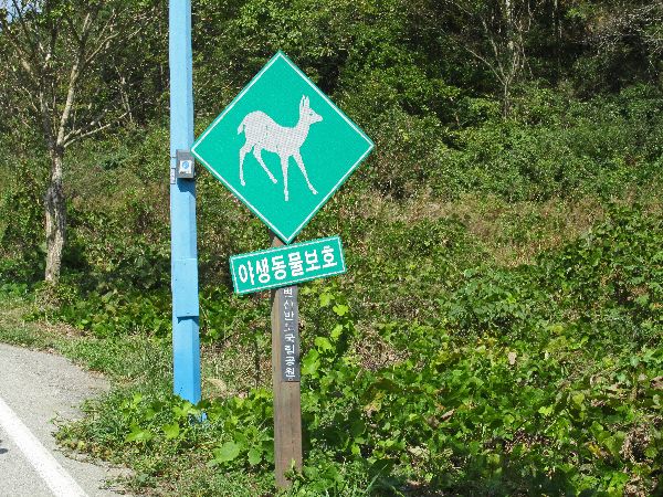
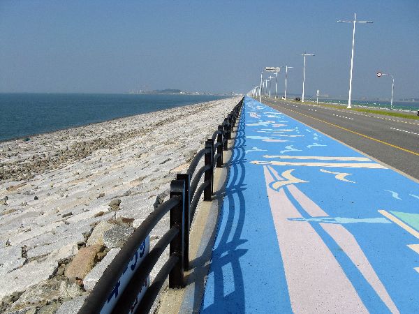
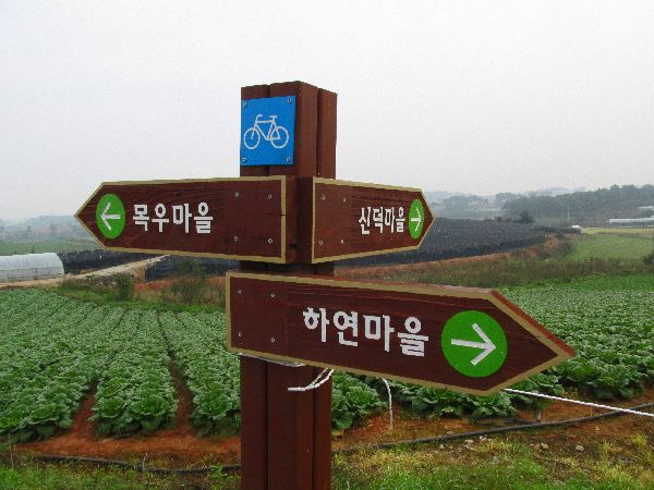 The
development of rural Korea's bicycle infrastructure is starting to move beyond
river trails and farm road (2016). On-road way finding aids are starting to
appear. The placard below the round 'give bicyclist a meter' sign (left), says
"share the road".
The
development of rural Korea's bicycle infrastructure is starting to move beyond
river trails and farm road (2016). On-road way finding aids are starting to
appear. The placard below the round 'give bicyclist a meter' sign (left), says
"share the road". 

 Locally
they say that Buan-gun is where the world's foremost inlaid Goryeo celadon
porcelain was produced. The appropriately colored Buan Celadon Museum (left) has 200 artifacts of
Goryeo celadon porcelain on display.
Locally
they say that Buan-gun is where the world's foremost inlaid Goryeo celadon
porcelain was produced. The appropriately colored Buan Celadon Museum (left) has 200 artifacts of
Goryeo celadon porcelain on display.Among the fields and forest is a building that looks to have been a seowon (right).
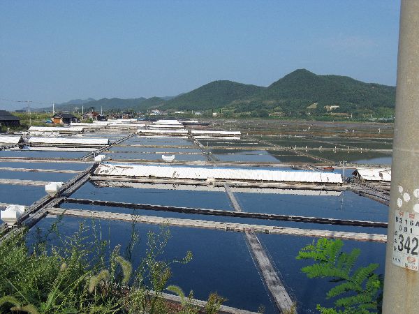
Gomso is known for its sundried sea salt production, on large salt pans, and preparation of assorted salted fish, a preserved food made from the fresh fish provided by local fisherman.


 Naesosa
(temple)
is located at the foot of Kwanuoombong, Neungka mountain. It was built in
633, during the Baekje Dynasty, by monk Hyeguduta. The temple includes a
600m long, tree lined road stretching from Iljumun (the first gate) to
Cheonwangmun (the guardian gate dedicated to the Four Devas).
Naesosa
(temple)
is located at the foot of Kwanuoombong, Neungka mountain. It was built in
633, during the Baekje Dynasty, by monk Hyeguduta. The temple includes a
600m long, tree lined road stretching from Iljumun (the first gate) to
Cheonwangmun (the guardian gate dedicated to the Four Devas).  Initially
there was a large and small temple, but the big one was destroyed by fire. The
present temple was rebuilt in 1633 and repaired in 1865.
Initially
there was a large and small temple, but the big one was destroyed by fire. The
present temple was rebuilt in 1633 and repaired in 1865.Though it is designated a National Treasure, the sanctity and purity of the space is crushed by cars driving up to and parking right at the entrance.
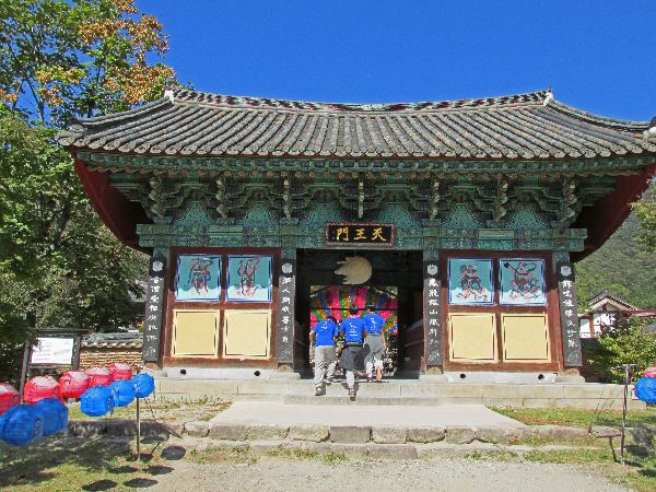
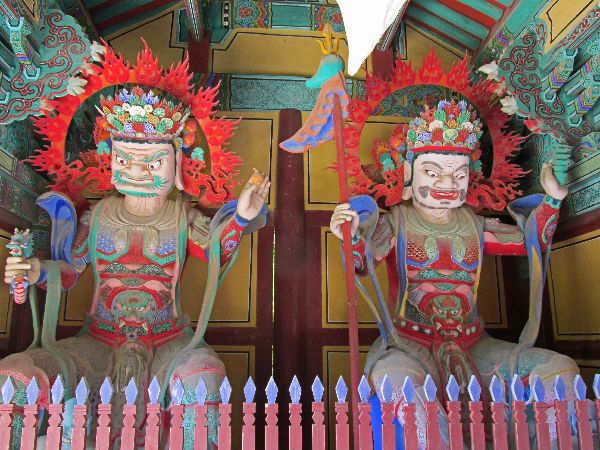
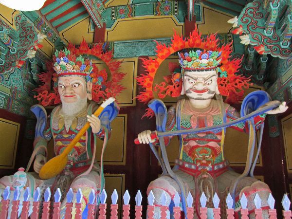 The
four Devas of the Guardian Gate are of Hindu origins, as devotees of Buddha, these figures guard
Buddhist cannons and are the protective deities over monks and the faithful.
The Jiguk Deva (lute) rules over the east, the Jeungjang Deva (sword) over the
south, the Gwangmok Deva (dragon) over the west and the Damun Deva (pagoda) over the north. At the
center of the four quarters is Sumisan. Sumisan is where Buddha lives -- a
temple is symbolic of Sumisan, therefore, if one passes this gate he or she is
likely to enter the world of Buddha.
The
four Devas of the Guardian Gate are of Hindu origins, as devotees of Buddha, these figures guard
Buddhist cannons and are the protective deities over monks and the faithful.
The Jiguk Deva (lute) rules over the east, the Jeungjang Deva (sword) over the
south, the Gwangmok Deva (dragon) over the west and the Damun Deva (pagoda) over the north. At the
center of the four quarters is Sumisan. Sumisan is where Buddha lives -- a
temple is symbolic of Sumisan, therefore, if one passes this gate he or she is
likely to enter the world of Buddha.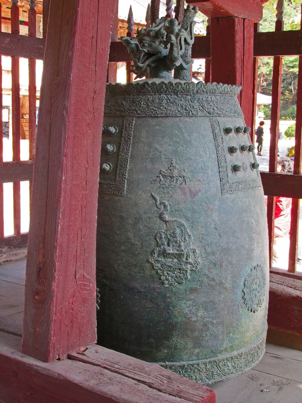

 The
drum and bell pavilion has the usual set of instruments: a large metal bell, a
large cowhide covered drum, a wooden slit drum in the form of a fish, and a
metal cloud gong in the form of a cloud. Collectively, when the are played, they
call together all the creatures in the universe.
The
drum and bell pavilion has the usual set of instruments: a large metal bell, a
large cowhide covered drum, a wooden slit drum in the form of a fish, and a
metal cloud gong in the form of a cloud. Collectively, when the are played, they
call together all the creatures in the universe.The bell, which is in a style typical of the Goryeo period, was made in 1222 and weighs 420kg. It was move to Naesosa in 1850. The hanging ring of the bell has a carved dragon. The principal Buddha engraved on the center is seated on a lotus flower, two Bodhisattvas are standing on either side. The strike point is in the shape of a lotus flower.
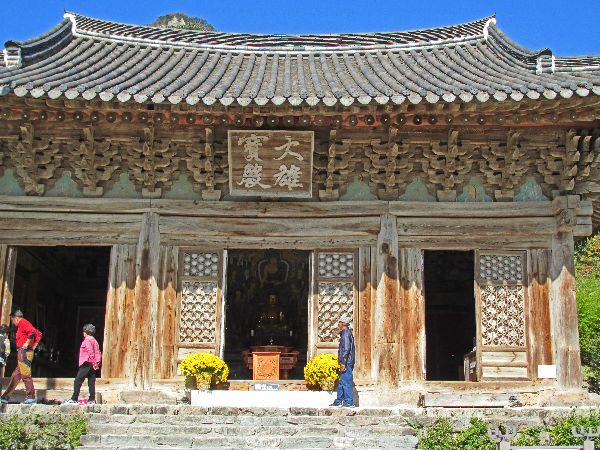
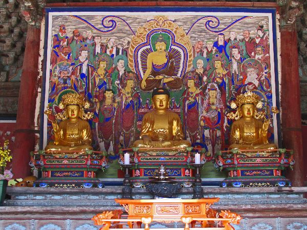
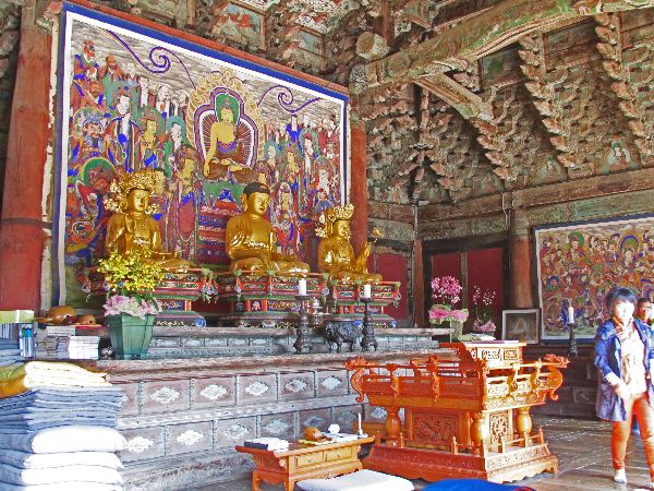 This
is the main sanctuary, with Sakyamuni Buddha in the center, flanked by
Samantabhadra to the right and Majusri to the left. The temple was built
at the end of the Joseon dynasty, only of wood, without nails.
This
is the main sanctuary, with Sakyamuni Buddha in the center, flanked by
Samantabhadra to the right and Majusri to the left. The temple was built
at the end of the Joseon dynasty, only of wood, without nails.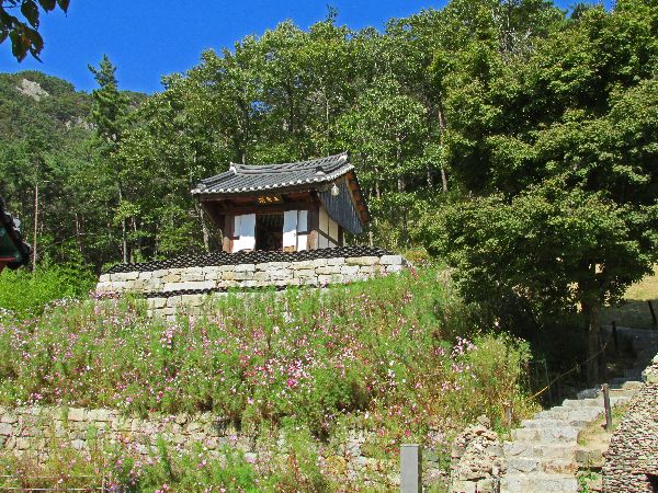
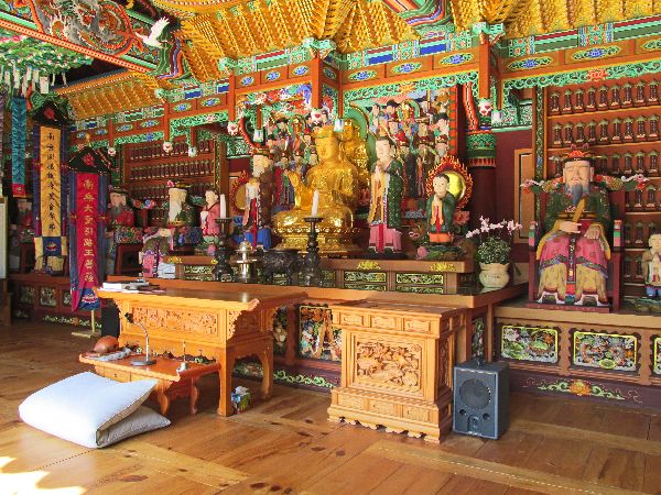 Naesosa
is relatively compact and eye catching at every corner:
Naesosa
is relatively compact and eye catching at every corner:Buildings are set on different layers, such as the Shrine of the mountain god (left), which has a suitable lofty perch.
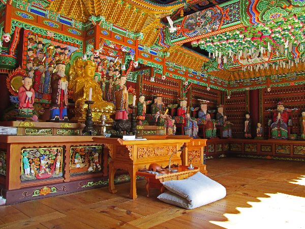
Each interior is unique. The Shrine of ancestors (right) is ringed by statues of a council of elders..

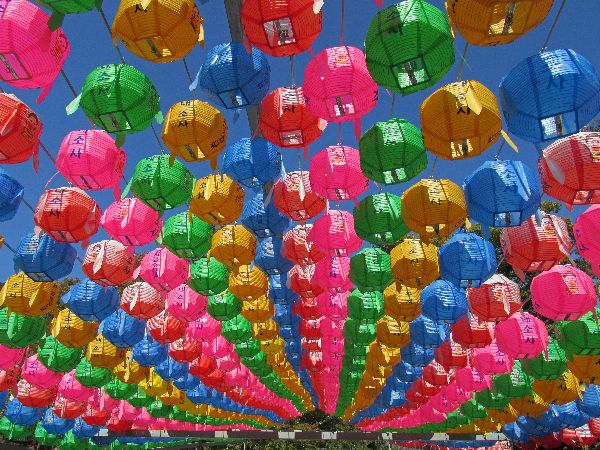
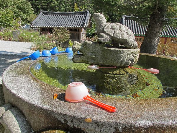
 In
additional to the general setting and layout of building, terraces and gardens,
the grounds have nice details that add to there aesthetic, such as the stone
pagoda, carved granite drinking fountain and display of paper lanterns.
In
additional to the general setting and layout of building, terraces and gardens,
the grounds have nice details that add to there aesthetic, such as the stone
pagoda, carved granite drinking fountain and display of paper lanterns.
Gomso Bay fills most of the photo (left) but additional salt ponds can seen behind the Madong Seawall on the left side.
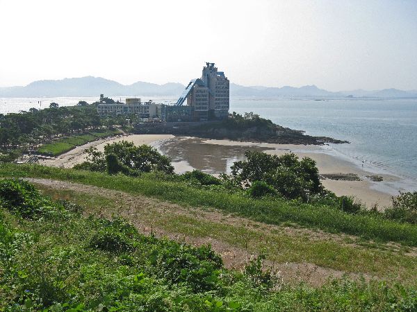
Any philosophy about planning with nature was left off the table at Mohang. It has a nice harbor, beautiful beach and picturesque views, except for the eyesore Mahong Resort Hotel.


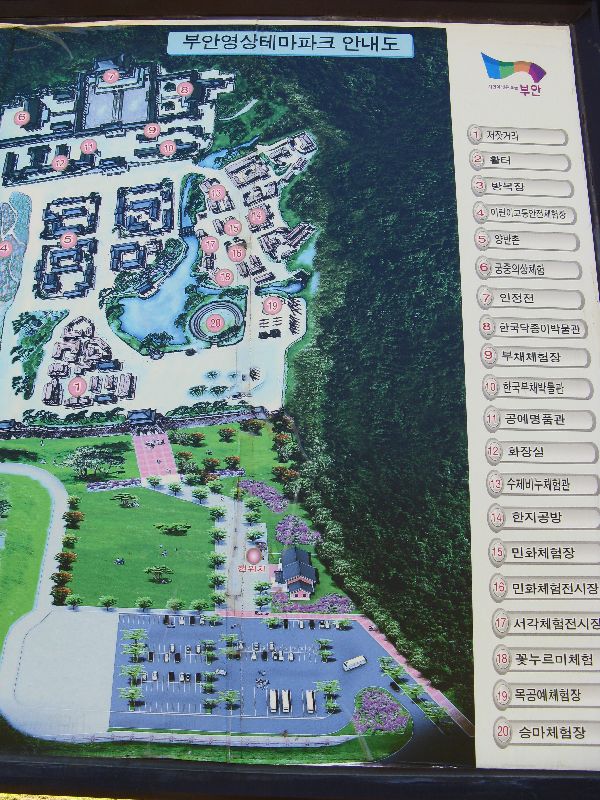 The
Buan Movie Theme Park, near Gyeokpo, is dedicated to historical productions. It
encompasses 37.5-acre of
land featuring exact replicas of a middle Joseon period palace, noblemen’s village,
scholarly bureaucrats’ houses, oriental medicine area, pottery area, craft area
and market streets with 24 palatial buildings, 11 tile-roofed commoner’s houses,
15 herbal shops, 17 craft workshops, 200 meters of town walls, as well as
pavilions and ponds.
The
Buan Movie Theme Park, near Gyeokpo, is dedicated to historical productions. It
encompasses 37.5-acre of
land featuring exact replicas of a middle Joseon period palace, noblemen’s village,
scholarly bureaucrats’ houses, oriental medicine area, pottery area, craft area
and market streets with 24 palatial buildings, 11 tile-roofed commoner’s houses,
15 herbal shops, 17 craft workshops, 200 meters of town walls, as well as
pavilions and ponds.It was the set for several historical dramas.
 Gyeokpo
is a small picturesque fishing village, tucked between hills, surrounded by
farmland, and now protected by two breakwaters with a
Gyeokpo
is a small picturesque fishing village, tucked between hills, surrounded by
farmland, and now protected by two breakwaters with a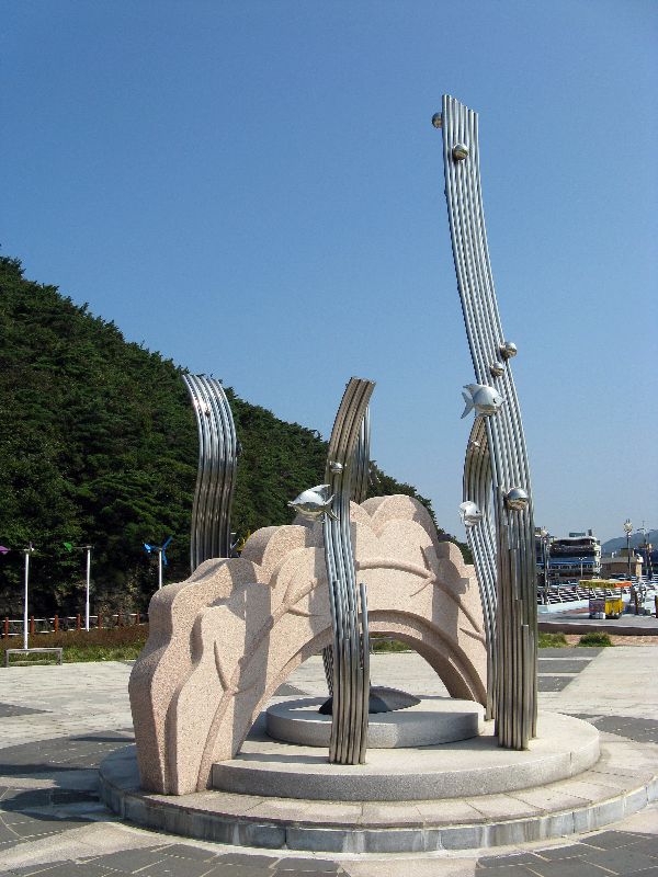 lighthouse at the end of
each one. Tourism is a major part of the economy the area
so the infrastructure to support it is well developed. A park at the north
end of the marina has some sculptures and interpretive information on Chaeseonkgang Cliff.
lighthouse at the end of
each one. Tourism is a major part of the economy the area
so the infrastructure to support it is well developed. A park at the north
end of the marina has some sculptures and interpretive information on Chaeseonkgang Cliff.There are trails at both ends of the harbor area. To the north, the trail leads up to the high bluff where there is an observation pavilion offering fantastic coastal vistas, with small islands visible offshore. The south bluff has a park, and is a shorter climb. A boardwalk allows visitors to walk out to the end of the south jetty.
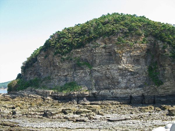
 The
Chaeseokgang Cliffs, offer a couple of quick lessons in geology:
The soil in this area has a basal layer composed of Precambrian granite and gneiss and a
stratification of sedimentary rock heaped in the Cretaceous Period (some 70
million years ago) of Mesozoic Period, forming a layer stacked as if with tens
of thousands of books. If look hard you might be inspired with the mystery of nature.
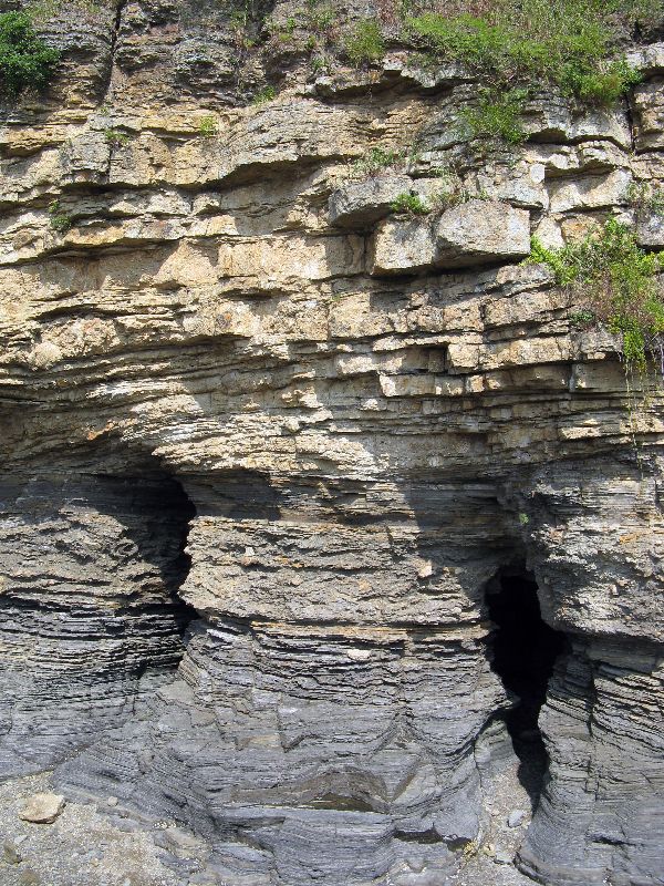
There is a lot to be seen in the eroded face: Photo
1) shows a fold in the sedimentary layer, 2) shows a number of sedimentary
layers and caves eroded into the face of the cliff, and 3) shows a fault line
crossing the sedimentary layers. The origin of the name comes from China, from
the story of Lee Tae-Baek, while drinking wine on a ship, he saw the moon
reflected in the river and jumped into the water to grab it. The name
Chaeseokgang was adapted as it resembles the Chinese equivalent of this
location.
The
Chaeseokgang Cliffs, offer a couple of quick lessons in geology:
The soil in this area has a basal layer composed of Precambrian granite and gneiss and a
stratification of sedimentary rock heaped in the Cretaceous Period (some 70
million years ago) of Mesozoic Period, forming a layer stacked as if with tens
of thousands of books. If look hard you might be inspired with the mystery of nature.
There is a lot to be seen in the eroded face: Photo
1) shows a fold in the sedimentary layer, 2) shows a number of sedimentary
layers and caves eroded into the face of the cliff, and 3) shows a fault line
crossing the sedimentary layers. The origin of the name comes from China, from
the story of Lee Tae-Baek, while drinking wine on a ship, he saw the moon
reflected in the river and jumped into the water to grab it. The name
Chaeseokgang was adapted as it resembles the Chinese equivalent of this
location.
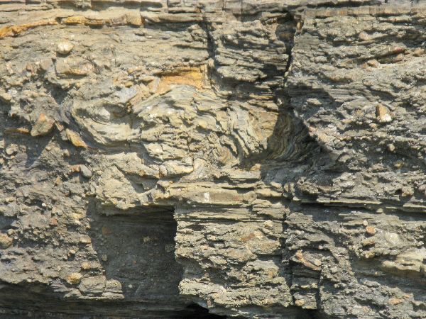 1)
1)
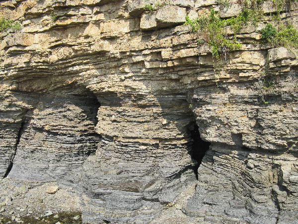 2).
2).
 3)
3)FYI: Sedimentary folds can be from microscopic to the size of mountains, and have a half-dozen causes. Books have been written about them, so if this one peaks your curiosity, start researching.


 Cutting
through the Byeonsan mountains provides additional scenic rewards.
Cutting
through the Byeonsan mountains provides additional scenic rewards.
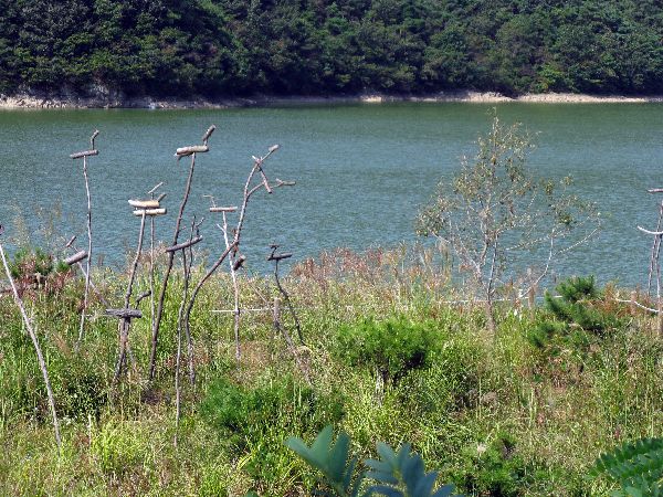 At Yuyu
Lake there is a flock of So-tae, wooden birds on poles.
Traditionally these marked the boundaries of a village and were for good luck.
Contemporarily they are used more as decorative art.
At Yuyu
Lake there is a flock of So-tae, wooden birds on poles.
Traditionally these marked the boundaries of a village and were for good luck.
Contemporarily they are used more as decorative art.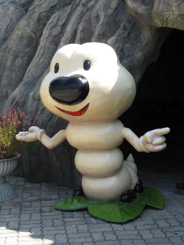
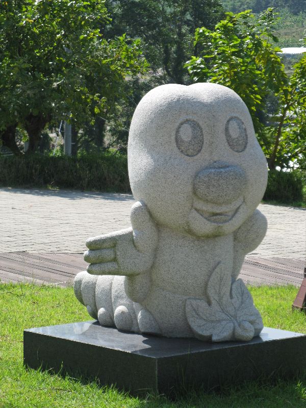 Korea
not only seems to have museums and festivals for everything, and sometimes they
celebrate parts of things. In this case it is not a silk museum, but a
museum that honors the essential contribution and accomplishment of the silk
worm. The museum is in the village of Yuyu, Mapo-ri, which has a 150 year
history with silk worms and mulberry trees. In celebrating the silk worm
they have also caricatured it a dozen different ways.
Korea
not only seems to have museums and festivals for everything, and sometimes they
celebrate parts of things. In this case it is not a silk museum, but a
museum that honors the essential contribution and accomplishment of the silk
worm. The museum is in the village of Yuyu, Mapo-ri, which has a 150 year
history with silk worms and mulberry trees. In celebrating the silk worm
they have also caricatured it a dozen different ways.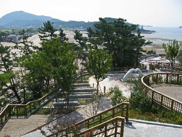
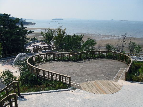
The view point above Byeonsan Beach has an octagonal pavilion that provides a nice panorama of the beach and view of off-shore islands. From this perspective you realize that the decking is heart shaped and there are a variety of romantically inspired sculptures -- another theme park!
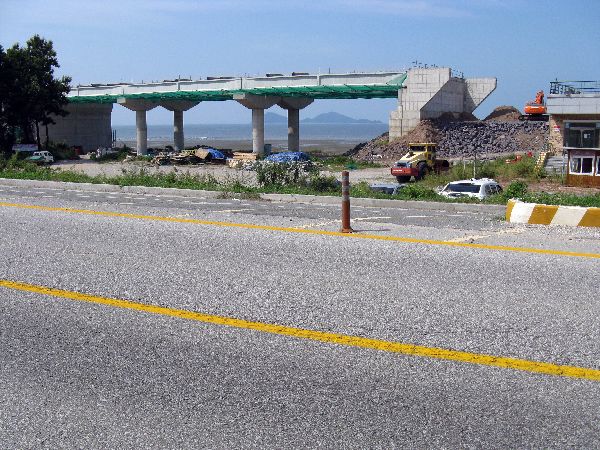
 It
is rare that you go a dozen miles
in Korea without coming to a major construction projects, even on the secondary
roads, which are the primary avenues for this journey. A lot of the
construction is for projects that cross the route for a moment and are off in
another direction, but this one lingered. It parallels the old road and
bombs the view. At this spot it is minimal because the highway is on
pillars, but it continues on an embankment that blocks the view completely -- the
better view will be at 100 kph / 60 mph.
It
is rare that you go a dozen miles
in Korea without coming to a major construction projects, even on the secondary
roads, which are the primary avenues for this journey. A lot of the
construction is for projects that cross the route for a moment and are off in
another direction, but this one lingered. It parallels the old road and
bombs the view. At this spot it is minimal because the highway is on
pillars, but it continues on an embankment that blocks the view completely -- the
better view will be at 100 kph / 60 mph.
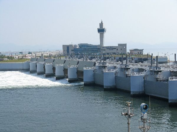
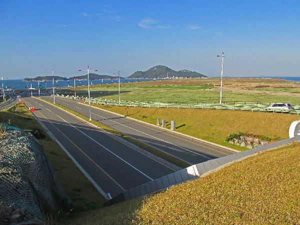
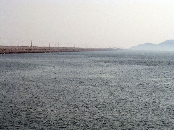
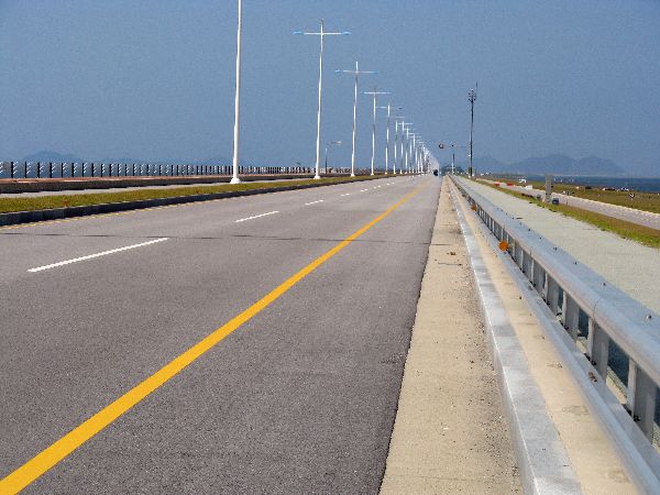 At
this point we meet the Saemangeum Seawall, or dike, or embankment, which
connects an archipelago between Byeonsan and Gunsan. To make it
more than just a long, boring, mostly straight road we have a few stories to tell:
At
this point we meet the Saemangeum Seawall, or dike, or embankment, which
connects an archipelago between Byeonsan and Gunsan. To make it
more than just a long, boring, mostly straight road we have a few stories to tell:At both terminus of the Saemangeum Seawall there are stone monument (no photo) for Saemangeum being the world's longest sea dike, at 33.9 km, as certified by the people who do Guinness Records. [The previous title holder is Afsluit Seawall (32.5 km) in The Netherland, which goes from coast-to-coast, in contrast to from island-to-island-to-island-to-island. The Dutch still claim to posses the world's longest sea wall. There are reports that India plans a longer one.]

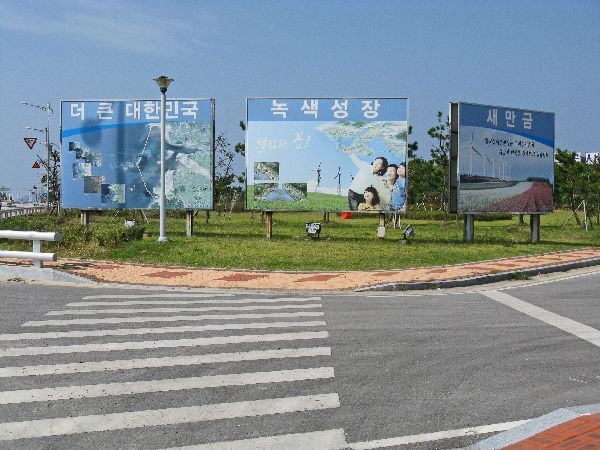
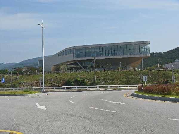 The
idea for the project dates back to the first half of the twentieth century --
after the civil war, when South Korea was having trouble feeding itself. The modern announcement that the project was underway came in 1987. At the
southern terminus there is also a multi-story Information Center. The center has
large viewing windows, and exhibits on the natural and
human history of the sea, mudflats and coastal plains, the technology for
building the seawall, and visions of a "Land of Opportunity and Promise," "New
Global City," and "Saemangeum in the World."
The
idea for the project dates back to the first half of the twentieth century --
after the civil war, when South Korea was having trouble feeding itself. The modern announcement that the project was underway came in 1987. At the
southern terminus there is also a multi-story Information Center. The center has
large viewing windows, and exhibits on the natural and
human history of the sea, mudflats and coastal plains, the technology for
building the seawall, and visions of a "Land of Opportunity and Promise," "New
Global City," and "Saemangeum in the World."
Korean and international environmentalists tried to say "Not so fast," several times, but lost in the end.
I have barely gone ten percent of the distance and there is all ready a barrage of communiqué the message of which are: Look at this is a great industrial and economic growth project, with a rinse of how good it is for the environment. Perhaps too much of a cynic, each new configuration of the message made me more skeptical, not more converted. A lot of the message seems like chauvinism, self-praise and braggadocio.


With that rant, as rock and concrete projects go, Saemangeum can be pleasing; there are many kilometers of nice views of islands to the west, most of the railings are easy see through and some have a graceful a wave-pattern that mimics the lines of the islands and sea, the lines of the roadway and its accessories tend to be clean and there is bus service from Gunsan to Garyeok Island Sluice Gates.
 anything because they
weren't bothering any of the bicyclists.
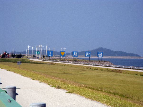
anything because they
weren't bothering any of the bicyclists.For those of you who need a reminder from the government on how you are supposed to revere their project, the management of Saemangeum has conveniently erected such a memory aid or thought prompt in the form of a sign: "I ♥ Saemangeum" -- across what would otherwise be a nice view of some islands.
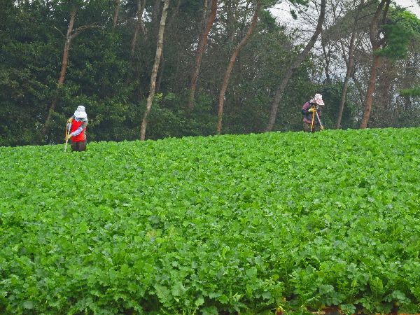
Even if new farm land is created it is not clear who will farm it. Koreas rural demographic is aging unnaturally fast as young people move to the cities.
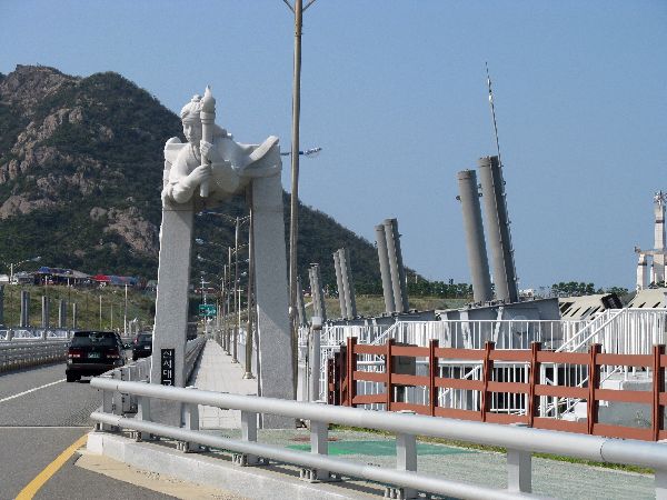

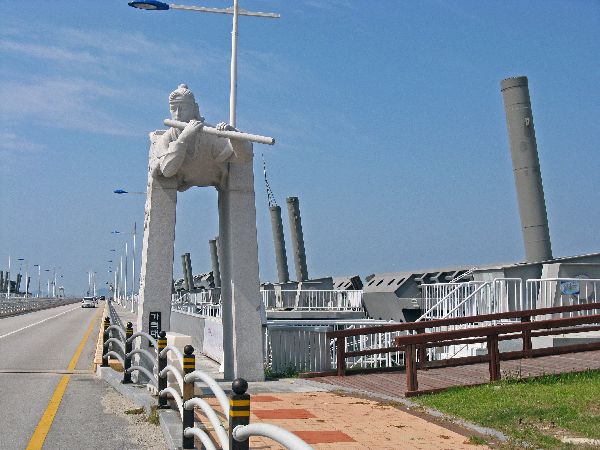
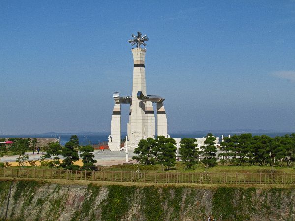
 Another
version of the Millennium Bicheon flanks the Sinsido (island) Sluice Gates. In
this case Bicheon carries a torch to light the way into the future.
Another
version of the Millennium Bicheon flanks the Sinsido (island) Sluice Gates. In
this case Bicheon carries a torch to light the way into the future.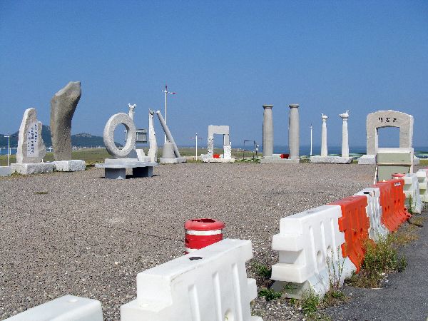
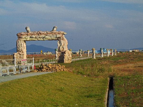
The collection of sculptures (left) seemed to be waiting to be placed.

 The complex also includes the 'completion monument' named "Land of Promise:" An
inscription says that Korea will enhance its capability to stand firm in Asia
after making harmony among humans, culture and environment, and leap forward.
The complex also includes the 'completion monument' named "Land of Promise:" An
inscription says that Korea will enhance its capability to stand firm in Asia
after making harmony among humans, culture and environment, and leap forward.
Behind
the columns: The panel on the left includes a pipe from an industrial plant,
fish, birds and maybe the atoms of atomic energy.
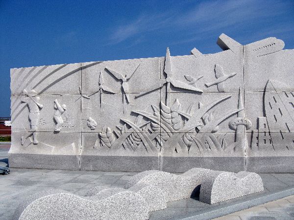

 The center block
includes trucks dumping boulders to build the dike, people waving flags and
banners and cheering, and boats slowing being obscured in the background. The
plague in the foreground says, "Republic of Korea Green Hope." The left mural
includes golfers, grains, an airplane and a futuristic city.
The center block
includes trucks dumping boulders to build the dike, people waving flags and
banners and cheering, and boats slowing being obscured in the background. The
plague in the foreground says, "Republic of Korea Green Hope." The left mural
includes golfers, grains, an airplane and a futuristic city.
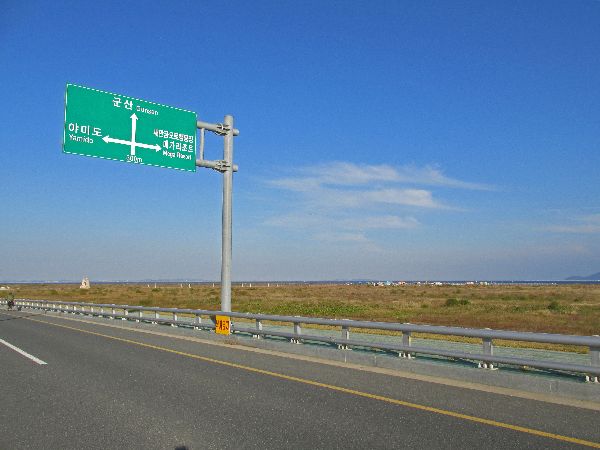
 A huge, 2.7 km long swath of land has been filled between Sinsido and Yamido (background of
the photo), joining the two islands and essentially creating one large island. It is currently (2013-15) just a
flat brown field, but there are already signs up directing people to a
nonexistent "Mega Resort" -- well there is a grand entrance! The development corporation is promoting that because
the long held names Sinsido means "island of new city" and Yamido means "island
of night beauty", the mega resort is just fulfilling their fate.
A huge, 2.7 km long swath of land has been filled between Sinsido and Yamido (background of
the photo), joining the two islands and essentially creating one large island. It is currently (2013-15) just a
flat brown field, but there are already signs up directing people to a
nonexistent "Mega Resort" -- well there is a grand entrance! The development corporation is promoting that because
the long held names Sinsido means "island of new city" and Yamido means "island
of night beauty", the mega resort is just fulfilling their fate.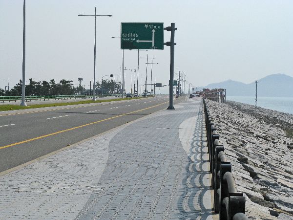
 Saemangeum Factoid:
In some areas the dike is built across water that is more than 50m (165 ft) deep.
The base is 600m wide for some stretches.
910,000 pieces of heavy equipment, including dump trucks and dredging ships were used in the construction.
The number workers mobilized annually for the construction of the dike is given as 2.37 m people.
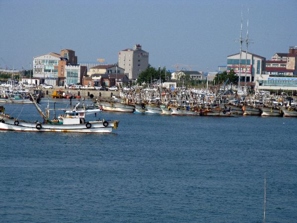

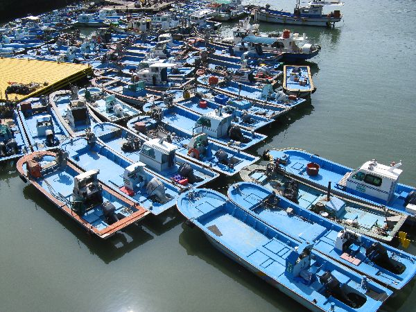
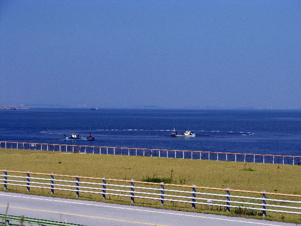
 At
the end of the main causeway is new Bieunghang (port). Currently it has a
colorful fishing fleet and onshore seafood processing and distribution
businesses. Plans call for a greater roll in marine tourism.
At
the end of the main causeway is new Bieunghang (port). Currently it has a
colorful fishing fleet and onshore seafood processing and distribution
businesses. Plans call for a greater roll in marine tourism.
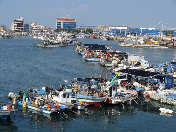
 Besides
the colorful boats, I liked the large bone yard of anchors. There are
literally hundreds of large anchors rusting on one side of town. The were
no obvious clues as to whether the main purpose of their existence was in their past
or will be coming in their future.
Besides
the colorful boats, I liked the large bone yard of anchors. There are
literally hundreds of large anchors rusting on one side of town. The were
no obvious clues as to whether the main purpose of their existence was in their past
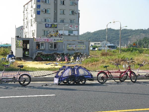
or will be coming in their future.One inkling of tourism in Bieunghang is a bicycle rental shop that included in its inventory tandems and bicycle trailers. Bravo.
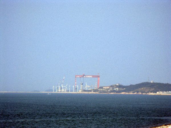
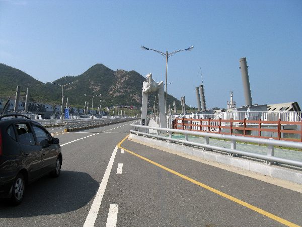
 The
road takes a ninety-degree turn to the east at Bieunghang toward Gunsan. To the west is
Bieungdo (island). Bieungdo is the home of the Saemangeum Wind Farm
and Hyundai Heavy Industries. The towers for the wind turbines are 45
meters tall and the blades are 24 meters long, so the structures can 69 meters
high. Hyundai's mammoth overhead crane dwarfs everything in the vicinity; wind turbines,
buildings, hills, etc.
The
road takes a ninety-degree turn to the east at Bieunghang toward Gunsan. To the west is
Bieungdo (island). Bieungdo is the home of the Saemangeum Wind Farm
and Hyundai Heavy Industries. The towers for the wind turbines are 45
meters tall and the blades are 24 meters long, so the structures can 69 meters
high. Hyundai's mammoth overhead crane dwarfs everything in the vicinity; wind turbines,
buildings, hills, etc.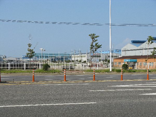
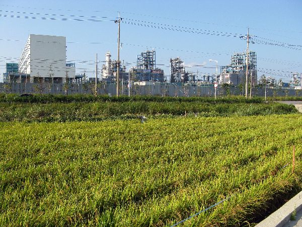
Traveling along this transitions to the original Gunsan National Industrial Complex. This section is older, has some parks and residential building, and for a long section there are rice farm across the street from chemical plants (right).
Which brings us to Gunsan.

If you want to bypass the causeway (and Gunsan) you can head north at Julpo and find alternative routes. The goal is to weave past a number of cities in the area and stay on rural road.
On February 17, the militia, led by General Jeon Bong-jun, captured the government office of Gobu-gun and forced the corrupt magistrate from his post.
In March, the militia incited another uprising in the Baesan Mountains.
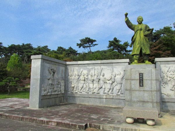
 On
May 11, the militia launched a successful early morning surprise attack on the
Jeolla Provincial Garrison, who was camped on Hwangtohyeon Hill, preparing to
subdue the peasant troops. With this victory the morale of the farmers militia
rose to new heights. They organized with messages of, "down with the tyrannous
officials, protect the people," "promote national interests and provide
welfare for the people," and "shut out foreign influence." These spread well
among the rural population. Eventually, they were able to capture the
provincial capital fortress at Jeonju, about 16km, 10 miles, to the north.
On
May 11, the militia launched a successful early morning surprise attack on the
Jeolla Provincial Garrison, who was camped on Hwangtohyeon Hill, preparing to
subdue the peasant troops. With this victory the morale of the farmers militia
rose to new heights. They organized with messages of, "down with the tyrannous
officials, protect the people," "promote national interests and provide
welfare for the people," and "shut out foreign influence." These spread well
among the rural population. Eventually, they were able to capture the
provincial capital fortress at Jeonju, about 16km, 10 miles, to the north.
Unfortunately, it was at this time that the China advanced into Korea, which prompted an intervention by the Japanese. For the sake of the country the Farmers Militia agreed to a cease-fire with the government forces and coordinated their efforts at the foreigners, first the Chinese and then the Japanese.
Once the Japanese troops defeated the Chinese army, they pivoted to what was probably their real goal from the beginning and invaded Korea. The Donghak Farmers Militia put up a fierce opposition but could not match the modern weaponry of the Japanese and suffered a decisive defeat. Eventually their leader was captured and executed, and 300,000 fighters died. In the end, the rebellion that hoped to eliminate corrupt politics, defend the country from foreign invasion and build a new Korea, failed, but it continued to inspire resistance against the Japanese, and is still considered an inspiration to this day.

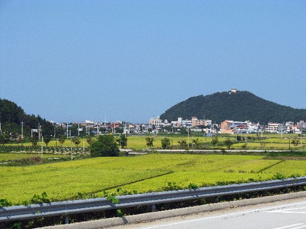
It is always nice to see a city in the distance, that stays there as you traverse the countryside. Rising in the distance from the rice fields is Gimje. This was about our best view of it. To the east was the even larger city of Jeonju. We avoided with an even greater margin.

Our city visit for the day was Iksan, a major railroad center among other thing. Like other cities it has multiple hotels, a variety of restaurants, a fashion street to confirm we were still in Korea, banks, convenience stores and a good selection of other consumer businesses.


 Please
contact us if you would like to be added to
Ibike's mailing list or have questions, comments, corrections or criticism. (Also, please let us know how you learned about us and
found this site.) Privacy policy.
Please
contact us if you would like to be added to
Ibike's mailing list or have questions, comments, corrections or criticism. (Also, please let us know how you learned about us and
found this site.) Privacy policy.
![]() IBF Homepage
IBF Homepage ![]() Ibike Programs
Ibike Programs
![]() Ibike Schedule
Ibike Schedule
![]() Search
Search