Ibike Korea People-to-People Program
 Photo essay: Geum River
Trail (east) -
Photo essay: Geum River
Trail (east) -
Gongju, Sejong, Daejeon
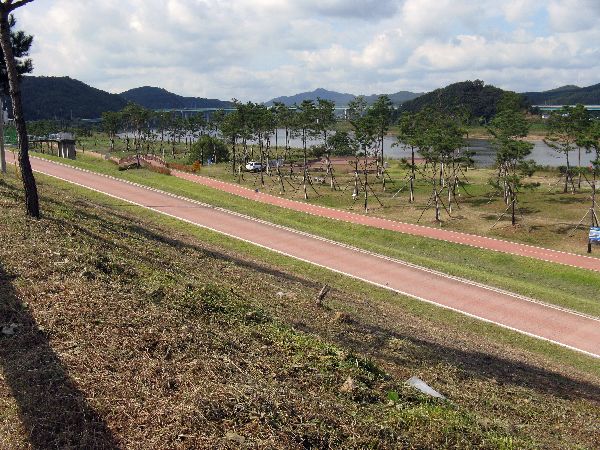
Geum River Trail (200km, 120mi) Mostly riverside and dike-top trail, with the occasional headland.
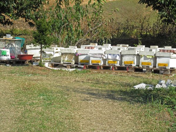
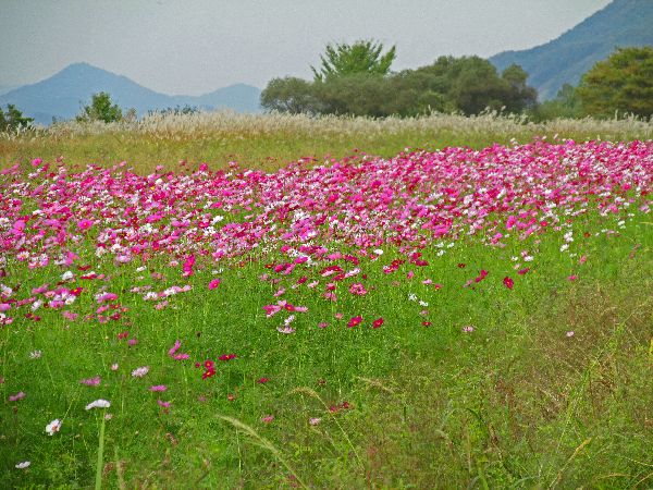
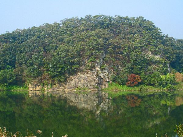
To keep some grasp of reality there are some it is worth noting that the real economy carried on near by; in by comparison, what is a scruffy agriculture villages there is a large apiary and agricultural produce was being processed -- though it should be noted that by world standards neither the village nor apiary were scruffy, they were just active and alive.
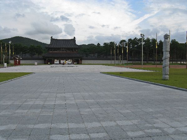
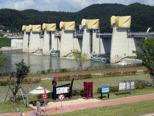
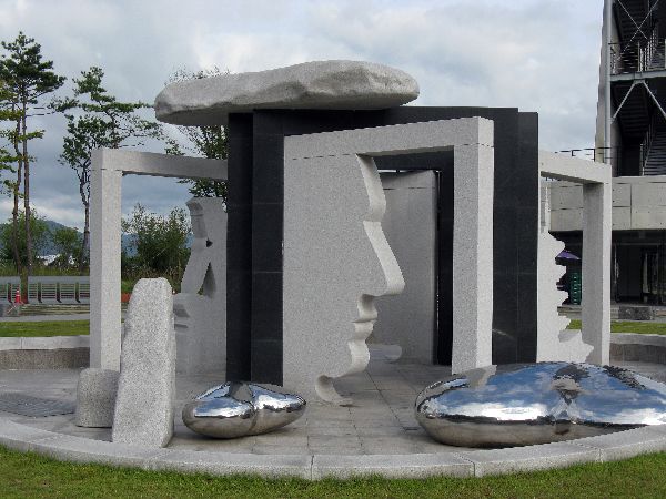 Like
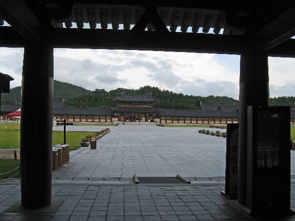
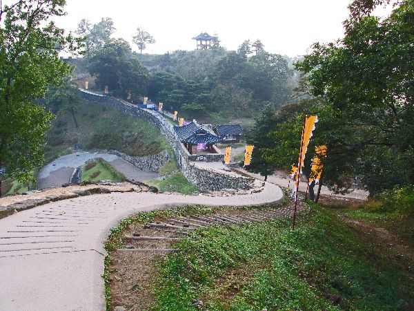
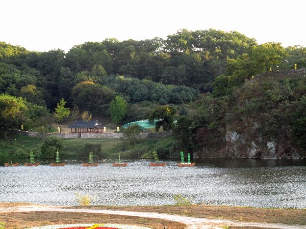
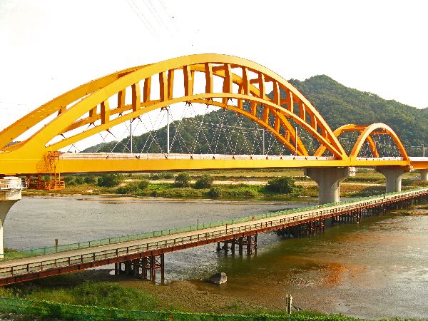
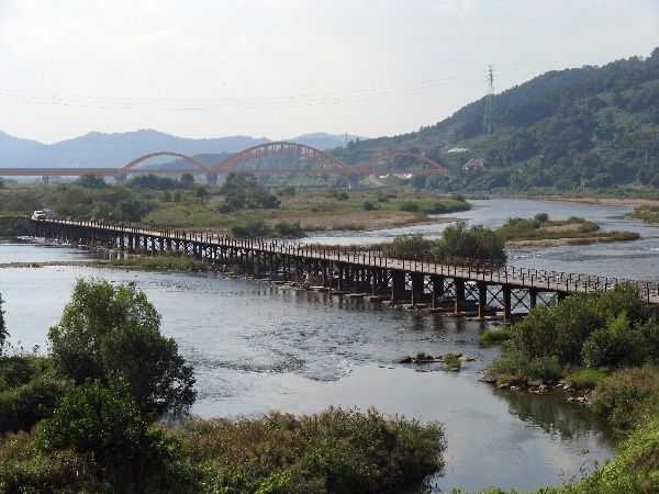
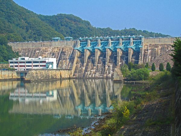
all of the large weirs across the river, Baekjebo has a unique façade and
includes it own original art, landscape design and site museum.
Like
all of the large weirs across the river, Baekjebo has a unique façade and
includes it own original art, landscape design and site museum.
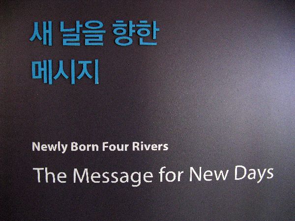
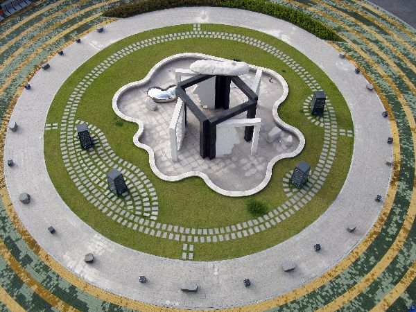
 One of the
initial signs at the exhibit caught my eye, "Newly Born Four Rivers, The Message
for New Days." Channeling the feelings of the fish: "Do the fish see the
new dam as a 'new birth for the river'?"
One of the
initial signs at the exhibit caught my eye, "Newly Born Four Rivers, The Message
for New Days." Channeling the feelings of the fish: "Do the fish see the
new dam as a 'new birth for the river'?"Baekjebo seems to regularly have temporary art installations as well.
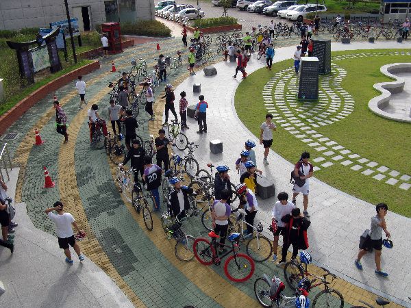
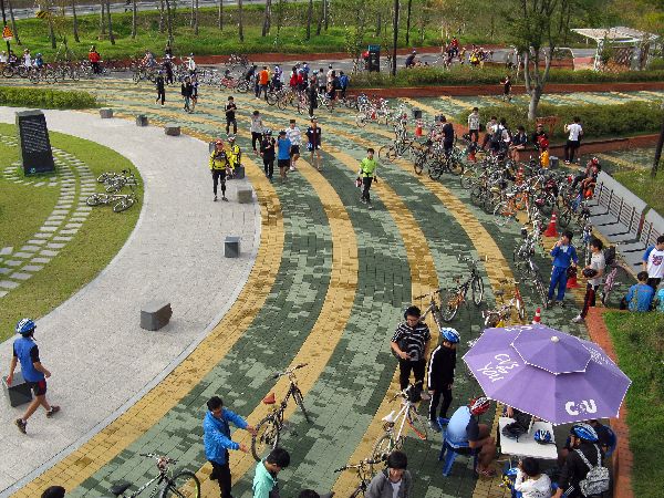 On
one visit, one-hundred
and fifty plus high school students from Buyeo arrived at Baekjebo shortly after
we did. Their program was to go to Gongju, learn some history, and return --
about 60 km (37 miles) roundtrip. They were traveling on the roads with a police
escort and support vehicles. It was impressive. I wonder how many other
places in the world would organize something like this for a school field trip
-- 60km bicycle tour?
On
one visit, one-hundred
and fifty plus high school students from Buyeo arrived at Baekjebo shortly after
we did. Their program was to go to Gongju, learn some history, and return --
about 60 km (37 miles) roundtrip. They were traveling on the roads with a police
escort and support vehicles. It was impressive. I wonder how many other
places in the world would organize something like this for a school field trip
-- 60km bicycle tour?
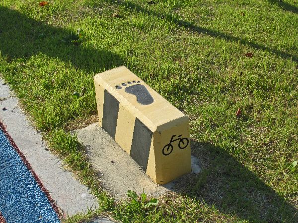
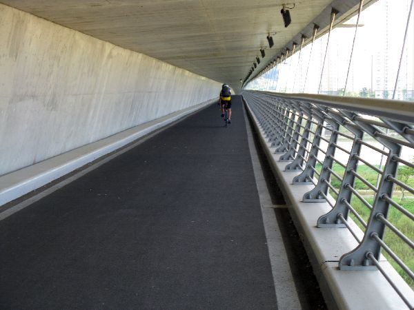
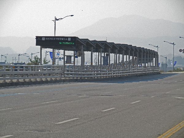
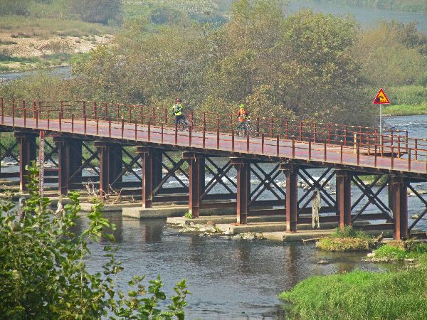
Another interesting feature of the rest stop is bicycle foot rest. It is designed for the bicyclist to roll up, stop and put there foot on the footprint. The bicyclist can continue to see on the bicycle saddle and relax.
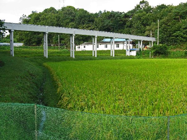
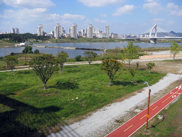
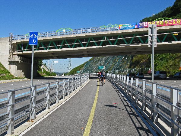
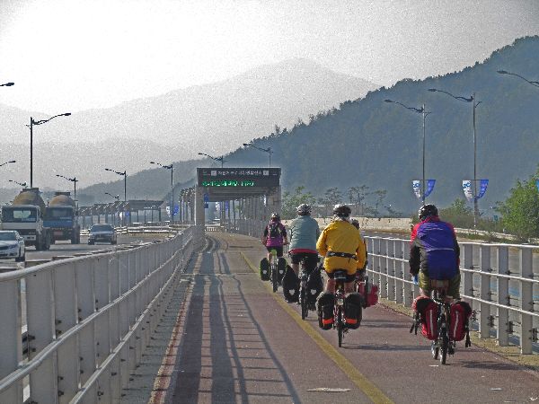
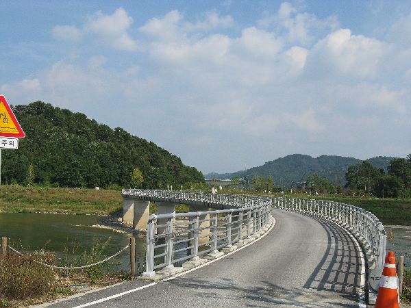
 While
much of the journey seems very rural, there are regular reminders of Korea's
extensive infrastructure. Two strands of expressway (left) score the view on the
other side of the river.
While
much of the journey seems very rural, there are regular reminders of Korea's
extensive infrastructure. Two strands of expressway (left) score the view on the
other side of the river.
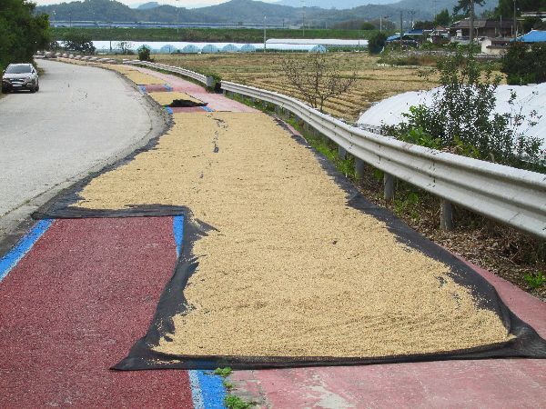
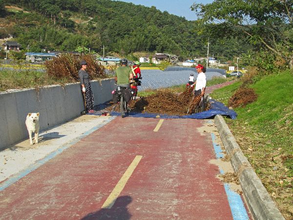
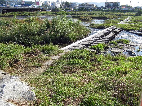
It is so rural that some locals farmers don't expect any
traffic on the trail (the blue lines indicate trail routes) and use it to process their harvest.
Fortunately, when the off-season tourists showed-up they were very
accommodating, standing back to let us pass.
 One
farmer is sorting out the sesame seeds from the perilla seed pods, and the other
bike path is being used to dry rice.
One
farmer is sorting out the sesame seeds from the perilla seed pods, and the other
bike path is being used to dry rice.
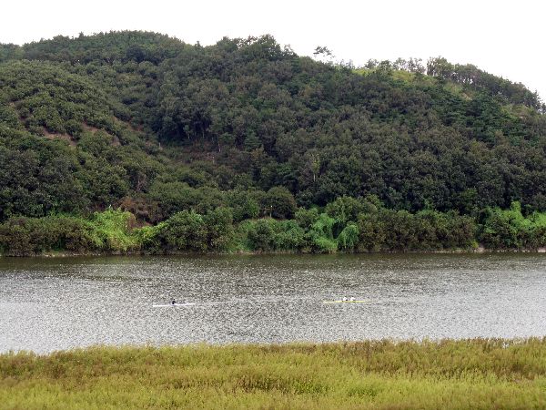
Rowers (left), in one-man and two-person shells, take advantage of the flat water to do some training.
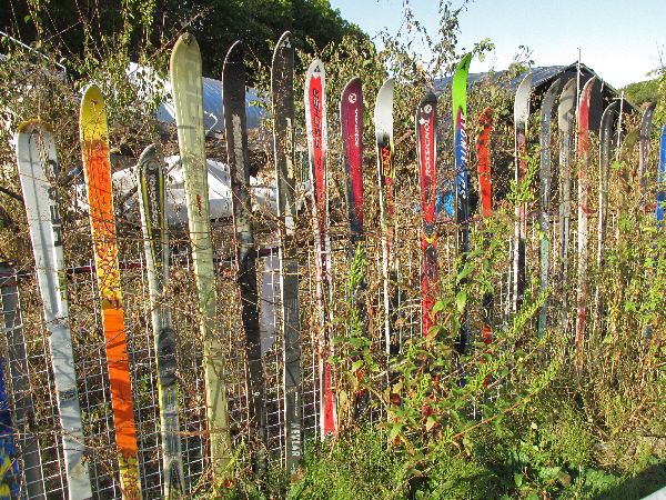 On
the light side, a local property owner built a fence with unmatched skis.
The general base elevation in the area is about 5m. On average the temperature
is always above freezing and if it drops below freezing it is only over night
and does stay there all day. There are no ski areas in the immediate vicinity so
it is unclear what the source of for a hundred skis might be or why their final
resting place is just outside of Gongju.
On
the light side, a local property owner built a fence with unmatched skis.
The general base elevation in the area is about 5m. On average the temperature
is always above freezing and if it drops below freezing it is only over night
and does stay there all day. There are no ski areas in the immediate vicinity so
it is unclear what the source of for a hundred skis might be or why their final
resting place is just outside of Gongju.

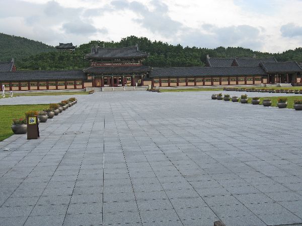
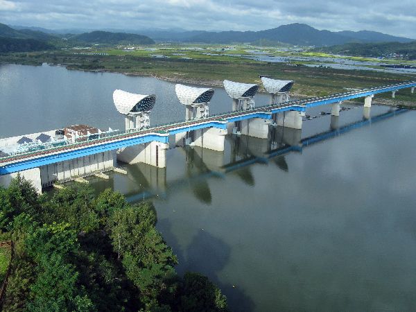
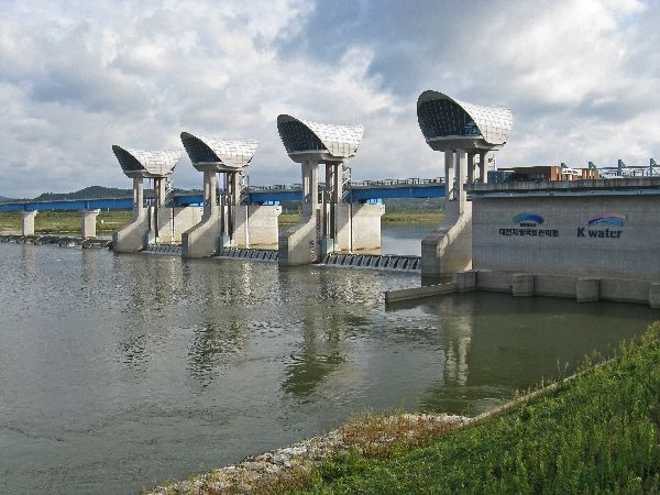
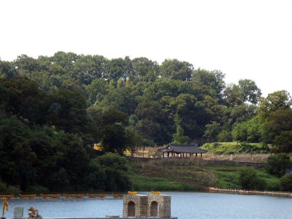
 Gongjubo
is another "Four Rivers Project." The water management project's aims were to
provide or improve water security, flood control and ecosystem vitality. It was
first announced as part of the “Green New Deal” policy launched in January 2009.
Most of the work was completed by 2012. It is debated whether is has been
more destructive or constructive for the environment. It is asserted that
the real objective of the project was for the then President to pay back his
industrialist friends. All of the major corporations got a piece of the pie. The
politics aside, recreational bicycling is a winner.
Gongjubo
is another "Four Rivers Project." The water management project's aims were to
provide or improve water security, flood control and ecosystem vitality. It was
first announced as part of the “Green New Deal” policy launched in January 2009.
Most of the work was completed by 2012. It is debated whether is has been
more destructive or constructive for the environment. It is asserted that
the real objective of the project was for the then President to pay back his
industrialist friends. All of the major corporations got a piece of the pie. The
politics aside, recreational bicycling is a winner.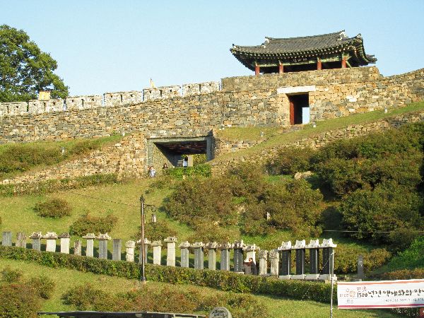
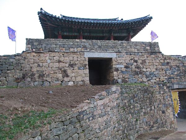 Ungjin
is the Baekje era name for current day Gongju. It was the capital of Baekje from
AD 475 to 538. The previous capital was Wiryeseong (Seoul). The move was made by
King Munju after Wiryeseong was destroyed by attacks from Goguryeo, to the
north, and his predecessor was killed.
Ungjin
is the Baekje era name for current day Gongju. It was the capital of Baekje from
AD 475 to 538. The previous capital was Wiryeseong (Seoul). The move was made by
King Munju after Wiryeseong was destroyed by attacks from Goguryeo, to the
north, and his predecessor was killed.Gongju long shoreline on the Guem and hilltop position for a fortress and surrounded by the Charyeong Mountains was an excellent geographical location for defending against enemy attacks.
In 660, Silla, allied with Chinese Tang troops, besieged Sabi, forcing Baekje King Euija to flee and take shelter at Ungjinseong (aka Gongsanseong and Gongju Fortress.) With the fall of Sabi, King Euija surrendered and he, along with two of his sons, 88 retainers, and 12,807 Baekje peasants were taken to China.
 Legends
has it that 3,000 ladies of court jumped from Nakhwaam (“Rock of
Falling Flowers”) to preserve their virtue. Later, loyal subjects
and local powers of Baekje initiated counter-offenses. With reinforcements based
at Juryu Fortress and Imjon Fortress, they retook over 200 fortresses. But,
within a year they too were finally suppressed by the Silla-Tang alliance and
Baekji completely ceased to exist. This set up the path where Silla expelled the
Tang and unified the Three Kingdoms.
Legends
has it that 3,000 ladies of court jumped from Nakhwaam (“Rock of
Falling Flowers”) to preserve their virtue. Later, loyal subjects
and local powers of Baekje initiated counter-offenses. With reinforcements based
at Juryu Fortress and Imjon Fortress, they retook over 200 fortresses. But,
within a year they too were finally suppressed by the Silla-Tang alliance and
Baekji completely ceased to exist. This set up the path where Silla expelled the
Tang and unified the Three Kingdoms.
 Whether
is was justified or not King Euija had a notorious reputation for being a
ladies’ man, so much that the moniker “King Euija” (의자왕) itself is being used as
slang for “ladies’ man” or “playboy”.
Whether
is was justified or not King Euija had a notorious reputation for being a
ladies’ man, so much that the moniker “King Euija” (의자왕) itself is being used as
slang for “ladies’ man” or “playboy”.
 The Ungjin Baekje Period ended when the
capital was moved to Sabi (Buyeo) by King Seong.
The Ungjin Baekje Period ended when the
capital was moved to Sabi (Buyeo) by King Seong.
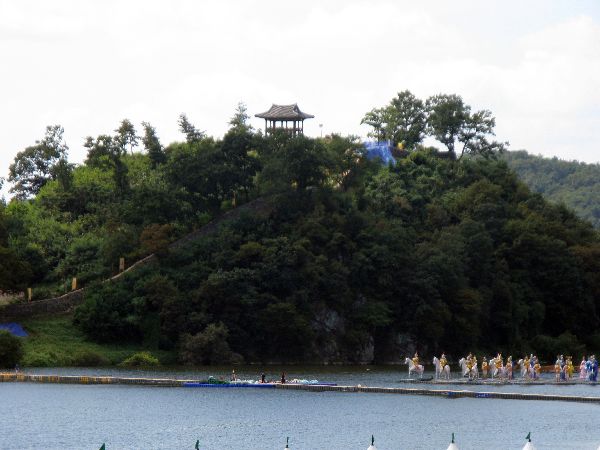
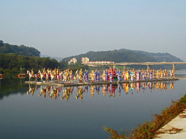
For the city festival commemorating historical events, a variety of dioramas are floated on the river.
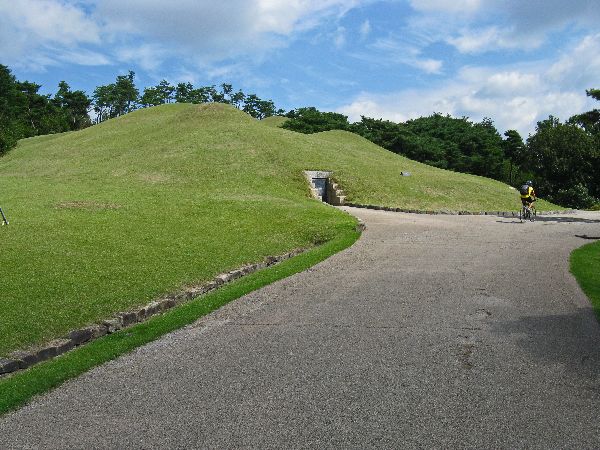
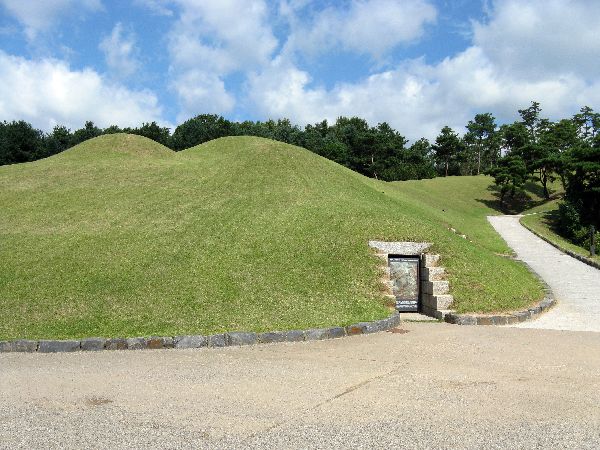 The
Royal Tomb of King Muryeong is a brick chamber, the first and only tomb of which
the identity of the occupant has been confirmed, out of the many tombs dating
from the Three Kingdoms period. This royal tomb was made with bricks fashioned
with lotus designs. Inside, two wooden coffins which housed the bodies of
the King and Queen consort, a golden diadem ornament, a huge sword adorned with
dragons and phoenix figures on the handle, and a silver bracelet decorated with
dragon designs, were found. A total of 4,687 items and 108 types of artifacts
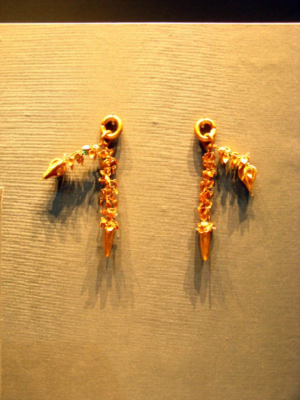
were found in this royal tomb. The metal craft works, including earrings, are of
extremely high quality, and are distinct from the artifacts produced by Goguryeo
or Silla. The Chinese pottery and porcelain found inside shows the
influence of the Chinese Southern Dynasties and attest to the international
nature of Baekje culture, which engaged in frequent exchanges with China and
whose leadership enthusiastically embraced the advanced Chinese culture.
The
Royal Tomb of King Muryeong is a brick chamber, the first and only tomb of which
the identity of the occupant has been confirmed, out of the many tombs dating
from the Three Kingdoms period. This royal tomb was made with bricks fashioned
with lotus designs. Inside, two wooden coffins which housed the bodies of
the King and Queen consort, a golden diadem ornament, a huge sword adorned with
dragons and phoenix figures on the handle, and a silver bracelet decorated with
dragon designs, were found. A total of 4,687 items and 108 types of artifacts
were found in this royal tomb. The metal craft works, including earrings, are of
extremely high quality, and are distinct from the artifacts produced by Goguryeo
or Silla. The Chinese pottery and porcelain found inside shows the
influence of the Chinese Southern Dynasties and attest to the international
nature of Baekje culture, which engaged in frequent exchanges with China and
whose leadership enthusiastically embraced the advanced Chinese culture.
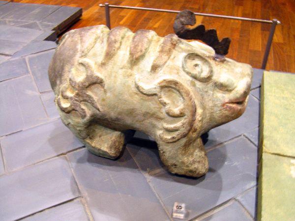
 Unreal
symbolic animals were believed to protect the tomb. The custom first began in
China. Burying estrange wooden guardian figures with deer horns was much
in vogue in the Chinese Chu Dynasty of the warring states period (403 BC – 221
BC).
Unreal
symbolic animals were believed to protect the tomb. The custom first began in
China. Burying estrange wooden guardian figures with deer horns was much
in vogue in the Chinese Chu Dynasty of the warring states period (403 BC – 221
BC).These items are in the collection of the Gongju National Museum.
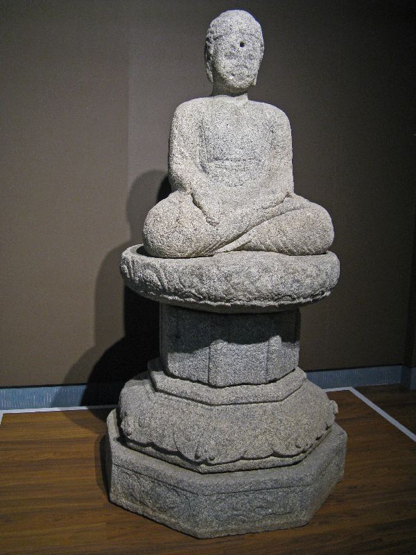
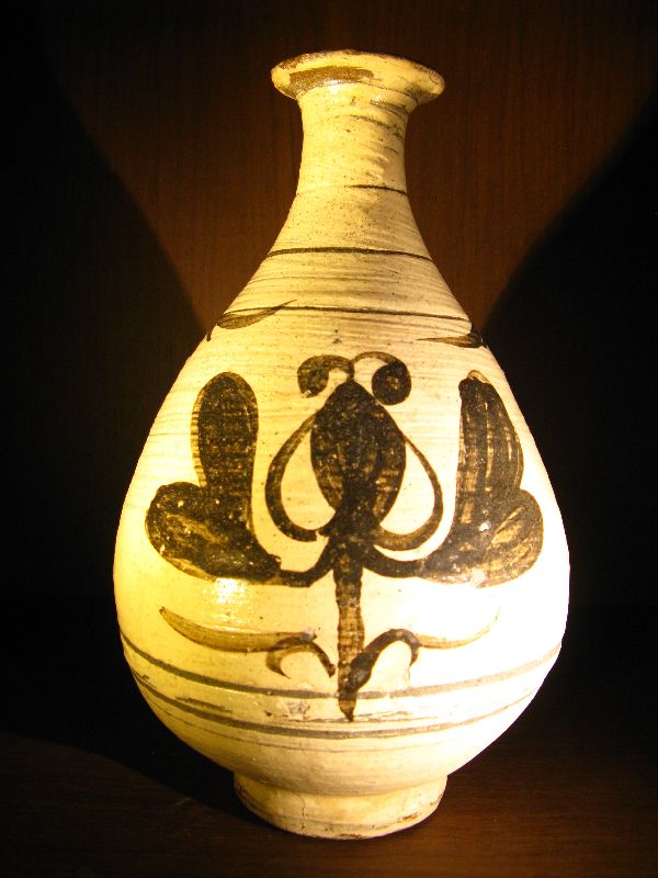
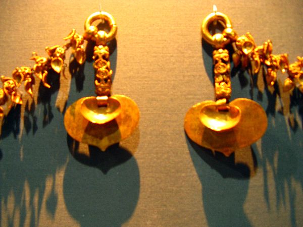 Gongju
National Museum features many items from King Muryeong’s Tomb. The majority of
the artifacts found in the tomb are precious metal works. They include a
variety of gold and silver ornaments worn by the king and his queen such as gold
crown ornaments, earrings, necklaces and belts, as well as household goods such
as bronze vessels, spoons and chopsticks, a silver cup with a
bronze stand, and a bronze mirror. These artifacts, which attest to the
outstanding aesthetic sensibility and advanced techniques of Baekje’s artisans,
were largely made by two methods; forging and molding. The surfaces of these
relics often exhibit lavish ornamentation made using a variety of techniques
such as openwork (metal ornamentation with many opening cut in set patterns),
chasing (ornamentation crafted with hand-chisels and hammers), and granulation
(ornamentation with small sphere or wires of precious metal).
Gongju
National Museum features many items from King Muryeong’s Tomb. The majority of
the artifacts found in the tomb are precious metal works. They include a
variety of gold and silver ornaments worn by the king and his queen such as gold
crown ornaments, earrings, necklaces and belts, as well as household goods such
as bronze vessels, spoons and chopsticks, a silver cup with a
bronze stand, and a bronze mirror. These artifacts, which attest to the
outstanding aesthetic sensibility and advanced techniques of Baekje’s artisans,
were largely made by two methods; forging and molding. The surfaces of these
relics often exhibit lavish ornamentation made using a variety of techniques
such as openwork (metal ornamentation with many opening cut in set patterns),
chasing (ornamentation crafted with hand-chisels and hammers), and granulation
(ornamentation with small sphere or wires of precious metal).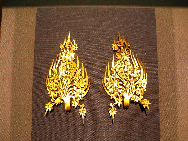 King
Muryeong is known to have been a very generous King. He reinforced the king’s
political power and sought to stabilize his kingdom. He cared for his
impoverished and war-weary people. He defeated Gorguryeo’s army and its
repetitive attacks. He also secured Baekje’s position in international
trade throughout East Asia, building good relations with Silla, Japan and the
Liang Dynasty of Southern China.
King
Muryeong is known to have been a very generous King. He reinforced the king’s
political power and sought to stabilize his kingdom. He cared for his
impoverished and war-weary people. He defeated Gorguryeo’s army and its
repetitive attacks. He also secured Baekje’s position in international
trade throughout East Asia, building good relations with Silla, Japan and the
Liang Dynasty of Southern China.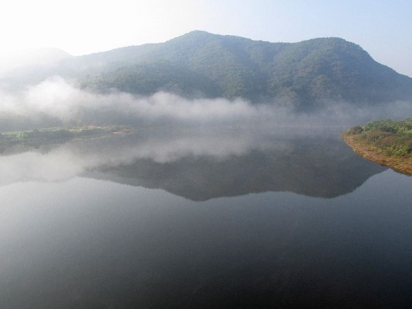
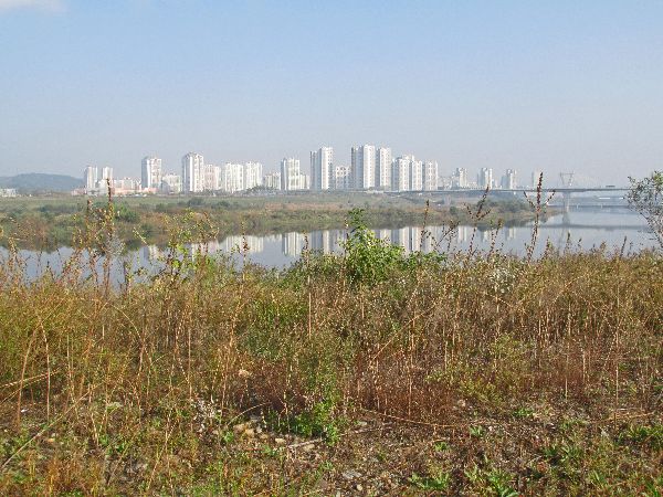
 There
are still sublime sections of the Guemgang, between Gongju and Sejong where the Morning
Calm fills all of your senses with satisfaction and contentment.
There
are still sublime sections of the Guemgang, between Gongju and Sejong where the Morning
Calm fills all of your senses with satisfaction and contentment.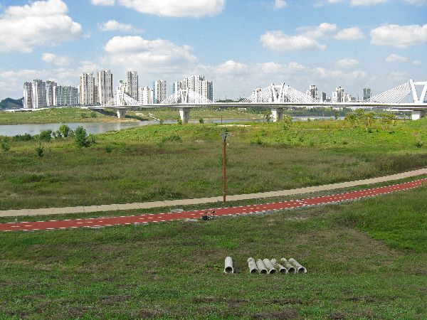
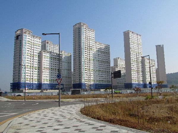
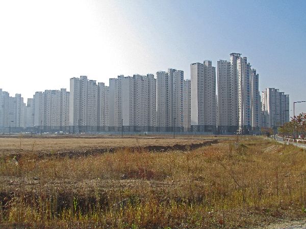
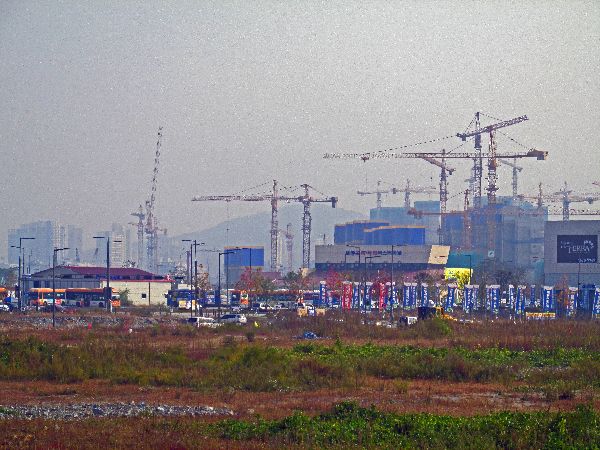
 I'd
like to call this next section the fabled city of Sejong. This is in the context
of capitals moving dozens of times in the history of the peninsula. In 2004, the
government called for the relocation of the national capital to near Gongju.
This was challenged and found unconstitutional, without changing the
constitution and holding a referendum. The government came up with a revised
plan where all of the ministries would move to the new town "Sejong" but the
executive, legislature and judiciary would stay in Seoul, so the "capital"
wouldn't be moving -- just the government.
I'd
like to call this next section the fabled city of Sejong. This is in the context
of capitals moving dozens of times in the history of the peninsula. In 2004, the
government called for the relocation of the national capital to near Gongju.
This was challenged and found unconstitutional, without changing the
constitution and holding a referendum. The government came up with a revised
plan where all of the ministries would move to the new town "Sejong" but the
executive, legislature and judiciary would stay in Seoul, so the "capital"
wouldn't be moving -- just the government.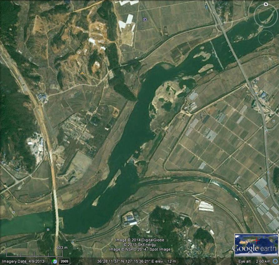
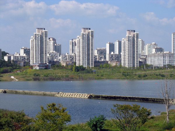
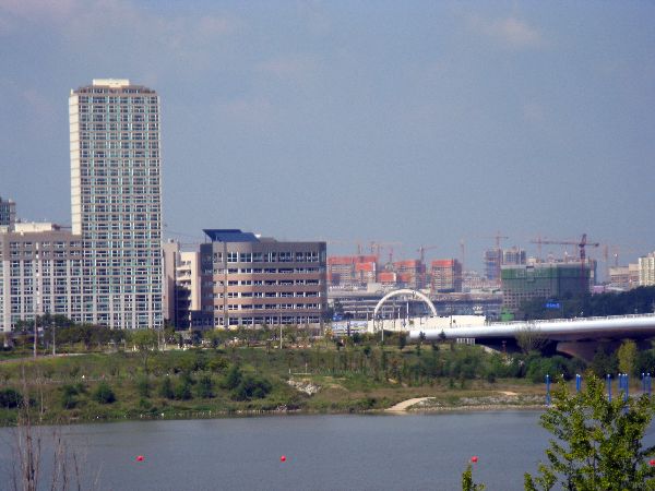
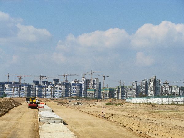
 It
is not easy to tell what happened between 2004 and April 9, 2013, but on that
date Google Earth still shows two bridges, a lot of farmland and some scared
earth. Five months later, September 2013, there were dozens of high rise
residential buildings, a hospital, day cares, pre-schools, schools, banks,
stores, restaurants, department stores, professional services, police station, a
town full of cars and a dozen construction cranes on the skyline. The
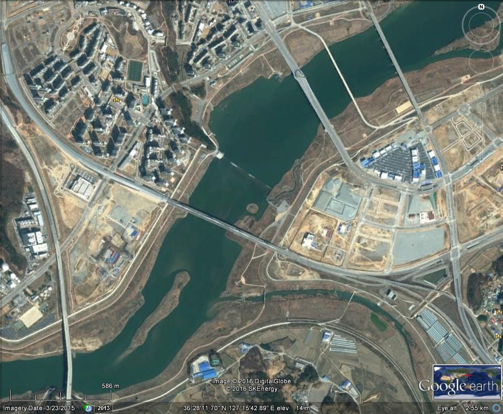
Google Earth photo from 23 March 2015 shows all the farm field are gone and the
construction boom has begun. There is even more construction out of the frame of
the photo. Poof, an
instant city.
It
is not easy to tell what happened between 2004 and April 9, 2013, but on that
date Google Earth still shows two bridges, a lot of farmland and some scared
earth. Five months later, September 2013, there were dozens of high rise
residential buildings, a hospital, day cares, pre-schools, schools, banks,
stores, restaurants, department stores, professional services, police station, a
town full of cars and a dozen construction cranes on the skyline. The
Google Earth photo from 23 March 2015 shows all the farm field are gone and the
construction boom has begun. There is even more construction out of the frame of
the photo. Poof, an
instant city.
 [As
of January 2014, a search for "Sejong, Yeongi-gun, Chungcheongnam-do" or "세종 연기
충청남도" on Google Maps, showed some of the roads or new bridges. Naver Maps has a
complete accounting of new bridges and roads. And Daum Maps maps wins,
showing an inventory bridges and road, some of which are still
under-construction and others that are only planned.]
[As
of January 2014, a search for "Sejong, Yeongi-gun, Chungcheongnam-do" or "세종 연기
충청남도" on Google Maps, showed some of the roads or new bridges. Naver Maps has a
complete accounting of new bridges and roads. And Daum Maps maps wins,
showing an inventory bridges and road, some of which are still
under-construction and others that are only planned.]
 3.
3. 4.
4. 5.
5.
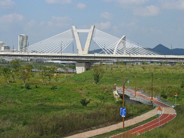
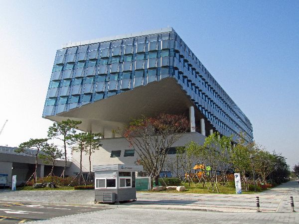
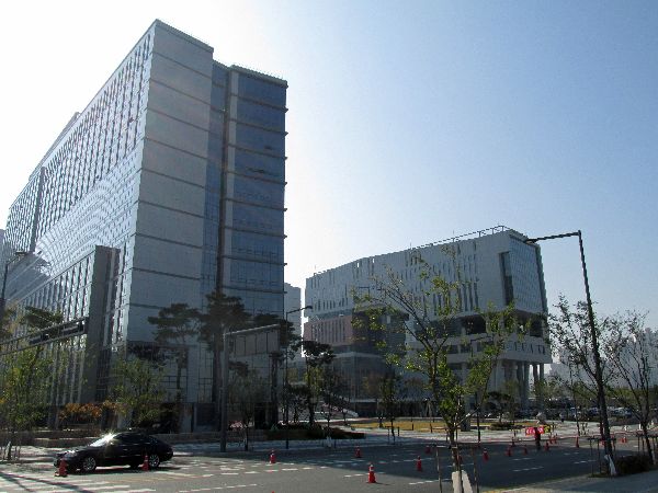
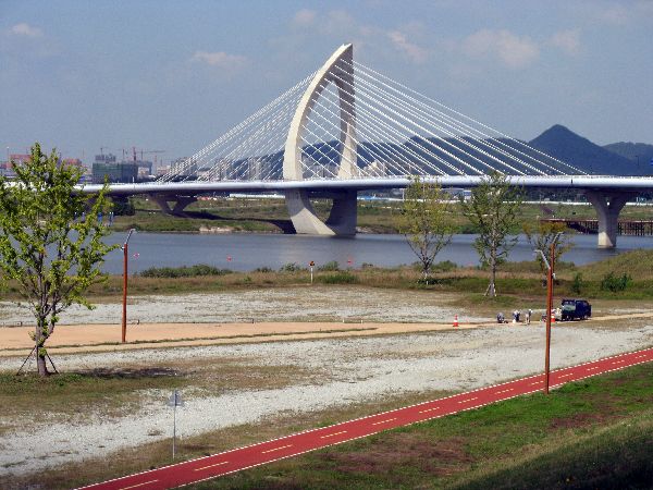
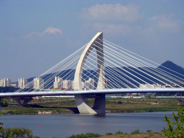
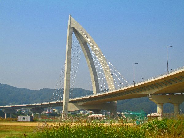
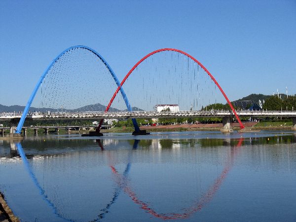
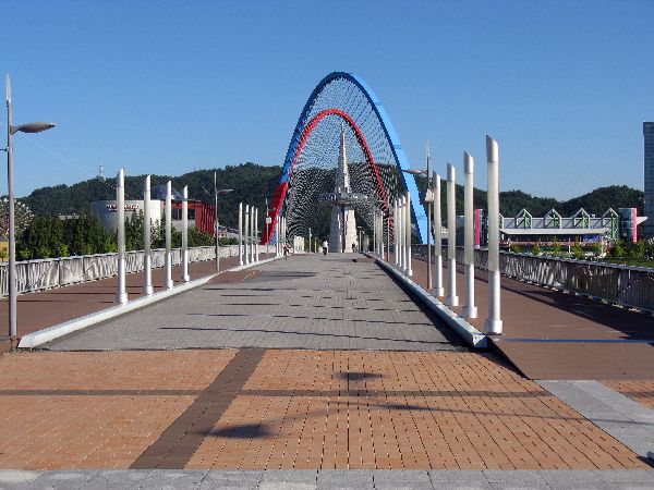
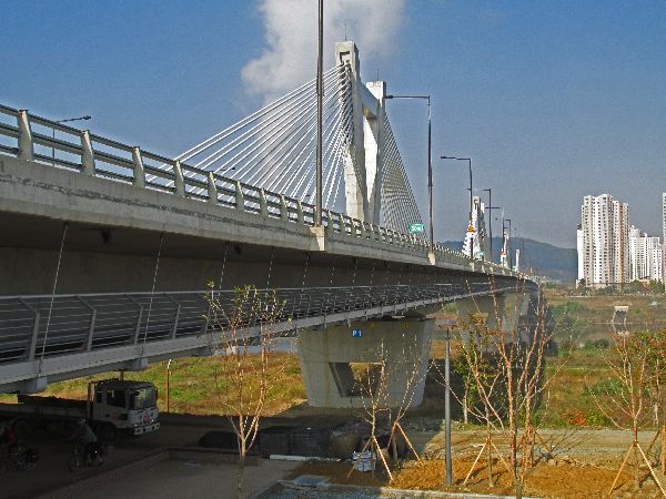 It
looks like the projects in and around Sejong are top-notch. They have elegant
fan-style and harp-style cable-stay bridges. One of the bridges has a covered
bicycle path, under the main bridge deck.
It
looks like the projects in and around Sejong are top-notch. They have elegant
fan-style and harp-style cable-stay bridges. One of the bridges has a covered
bicycle path, under the main bridge deck.
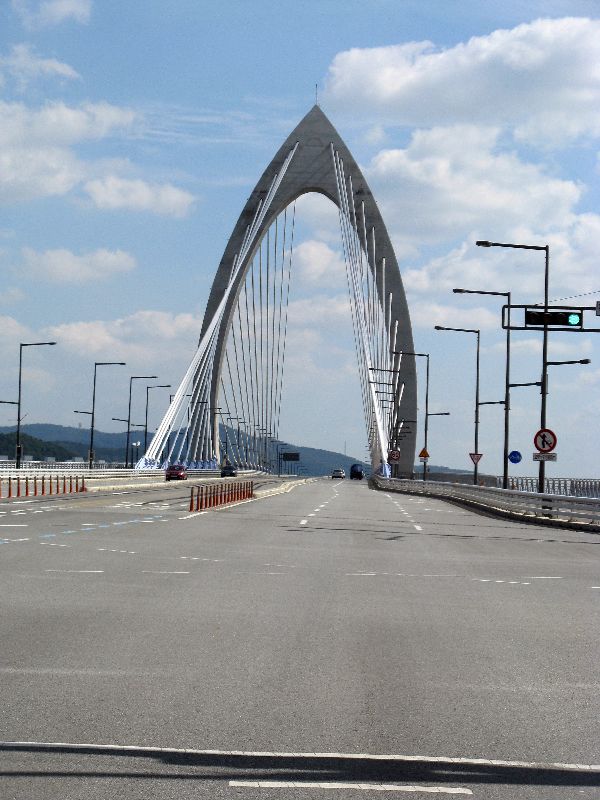
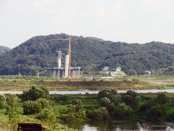
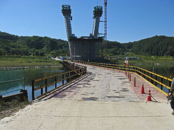
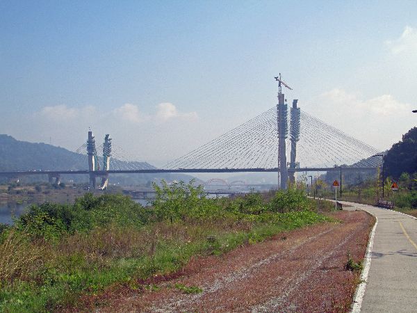
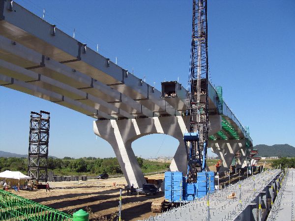 Staying
on a bridge theme -- because Korea has a bridge thing -- just northeast a few
kilometers, there is another mammoth bridge going up (2013) (completed in 2016).
Staying
on a bridge theme -- because Korea has a bridge thing -- just northeast a few
kilometers, there is another mammoth bridge going up (2013) (completed in 2016). But
there is also a more starting to be disturbing change in the area: Korea, which
up until 2015, seemed so amazingly unswerving in rural areas at keeping the flat
lands for agriculture, building housing only on the edges of valleys at the very
base of the hills, and leaving slopes for the forests, has start to breach the
covenant. In the outer environs of Sejong forests are starting to being shaved
and hillsides are being scraped for high-end, custom designed, single-family,
mini-mansions, on view property. I can't help but conclude that it is being
done to serve a value (or lack thereof) that is being brought by the elite
classes that are coming to run the ministries.
But
there is also a more starting to be disturbing change in the area: Korea, which
up until 2015, seemed so amazingly unswerving in rural areas at keeping the flat
lands for agriculture, building housing only on the edges of valleys at the very
base of the hills, and leaving slopes for the forests, has start to breach the
covenant. In the outer environs of Sejong forests are starting to being shaved
and hillsides are being scraped for high-end, custom designed, single-family,
mini-mansions, on view property. I can't help but conclude that it is being
done to serve a value (or lack thereof) that is being brought by the elite
classes that are coming to run the ministries.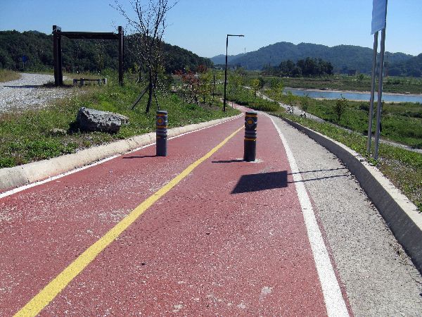
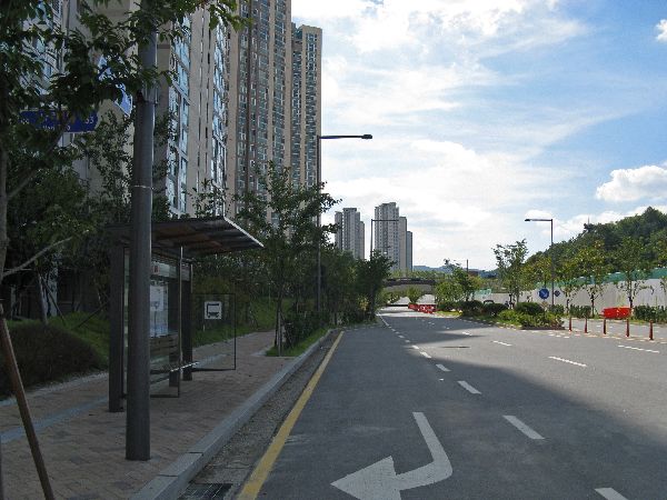
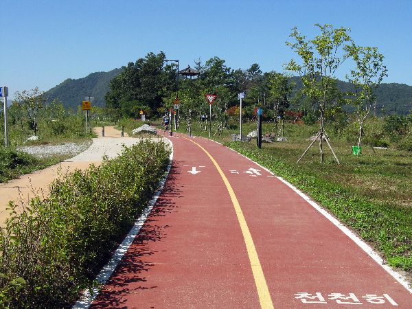
Similar to trails in other urban areas, the Guemgang Trail and in the vicinity of Sejong has a lot of other attributes and accessories. The one that caught my eye here is a therapeutic rock walk. Along there steam of rocks the size and texture changes, providing different feels of foot message, and different degrees of stress relief and circulatory stimulation.
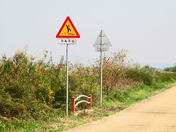
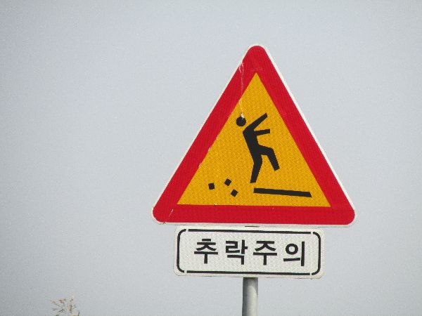 The
signs are meant to caution pedestrians against fall hazards and abrupt lane
edges, but they seem that they like the graphic could be warning against extreme
selfies, as well.
The
signs are meant to caution pedestrians against fall hazards and abrupt lane
edges, but they seem that they like the graphic could be warning against extreme
selfies, as well.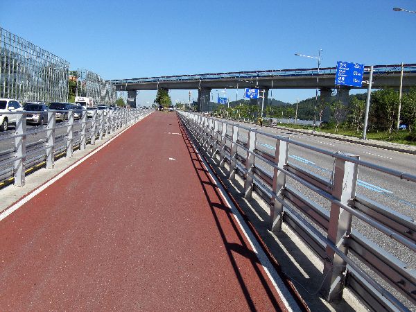
 At
Sejeong there is a unique short cut to Daejeon. It is in the middle of Road 1. That should be a scary
prospect. Given the whizzing of traffic around it you would expect it to be something
between bleak and terrifying. Here is actually what we encountered.
At
Sejeong there is a unique short cut to Daejeon. It is in the middle of Road 1. That should be a scary
prospect. Given the whizzing of traffic around it you would expect it to be something
between bleak and terrifying. Here is actually what we encountered.
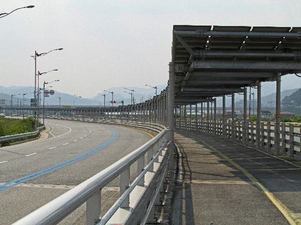
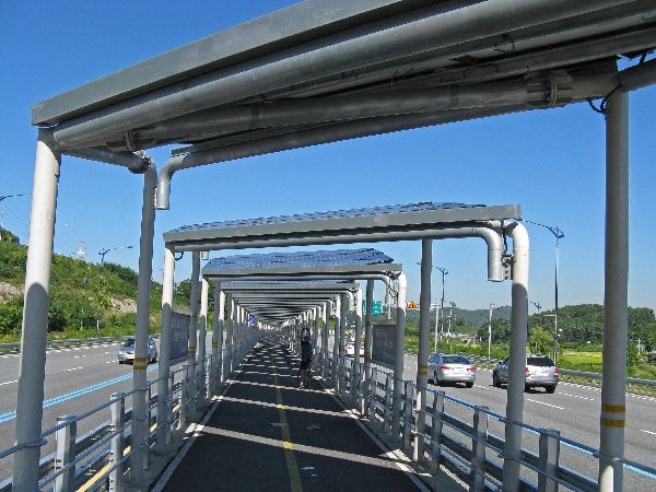
1) For starters there is a wide bike path that runs down the middle between the northbound and southbound lanes of traffic, with high barriers on both sides. This means you feel very protected, but there aren't a lot points for access and egress, but at various junctions there are stairs down to underpasses. There is zero cross traffic.
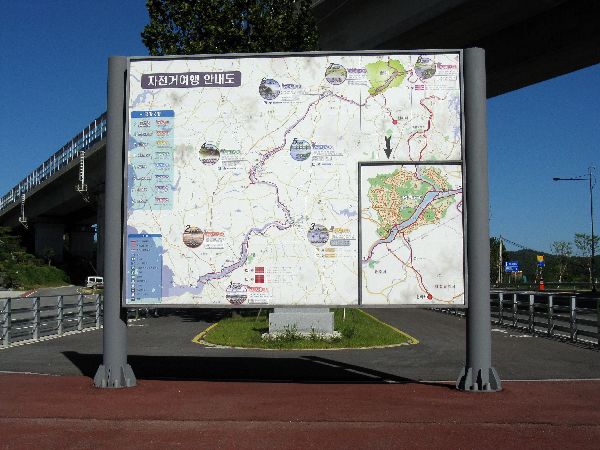
 2)
The is a large map for users with information on the Geumgang Bicycle Path from
Gunsan to Daecheon Dam, routes along the Gapcheon through Daejeon and this
facility to Sejong.
2)
The is a large map for users with information on the Geumgang Bicycle Path from
Gunsan to Daecheon Dam, routes along the Gapcheon through Daejeon and this
facility to Sejong.
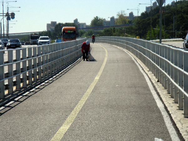
3) The facility is nearly spotless. Like so many of the highly functioning parts of Korea, this was no accident because we saw people working the path and picking up litter by hand.
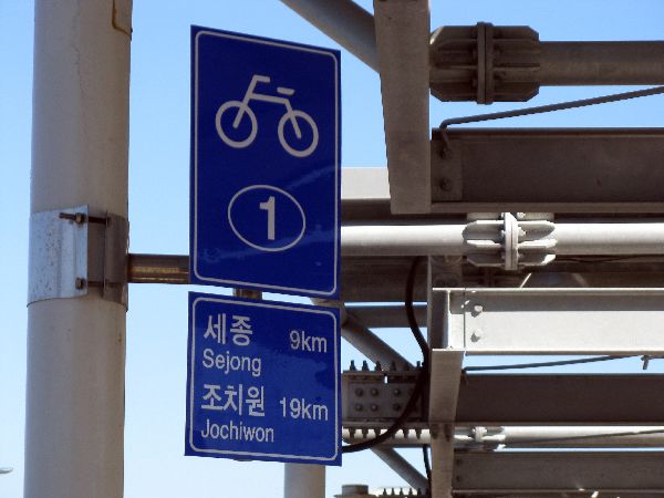
5) There are mileage and directional signs for bicycles!
If you don't take the direct route to Daejeon, you can continue on the Guemgang Trail towards Daecheong Dam, which also gives you access to Daejeon.
Just east of Sejong is a junction with the Ocheon Trail, which connects to the Saejae Trail, which links the Hangang Trail and Nakdong Trail, which lead to Seoul and Busan, respectively.
 Continuing
on the Guemgang Trail is further evidence of the Koreans delight in bridge
design: Just past some pathetically poorly placed bollards (right) is an
elegant, sweeping,
non-motorized bridge with a nice harmonic shape (left), over the Mihocheon (stream).
Continuing
on the Guemgang Trail is further evidence of the Koreans delight in bridge
design: Just past some pathetically poorly placed bollards (right) is an
elegant, sweeping,
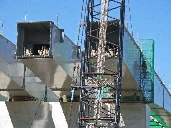
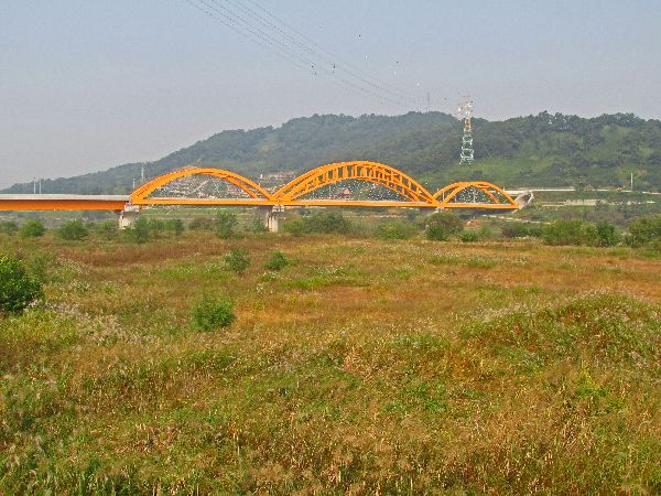
non-motorized bridge with a nice harmonic shape (left), over the Mihocheon (stream).Maintaining the pattern, around a few more corners and we are dwarfed by another new bridge project. This one didn't even have any roads it was connecting to at either end. It looks like a couple of high pylons are being constructed so it might be some type of cable-stay design. In years to come, when all the bridges are established, passers-by won't realize how much large transformation happened in such a relatively short period of time.
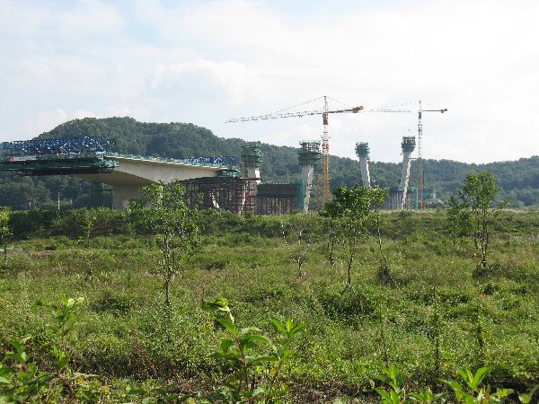
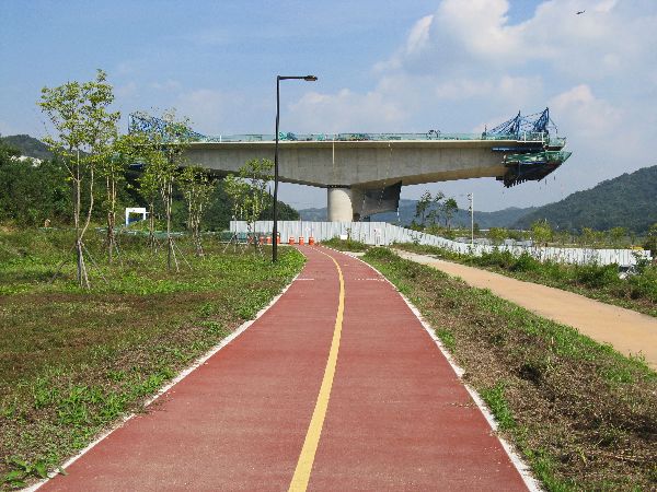
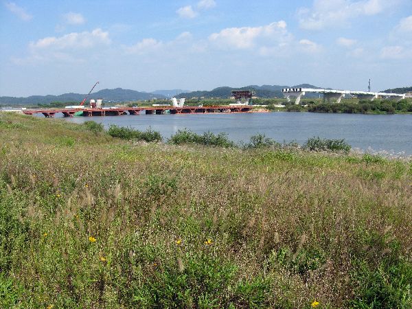
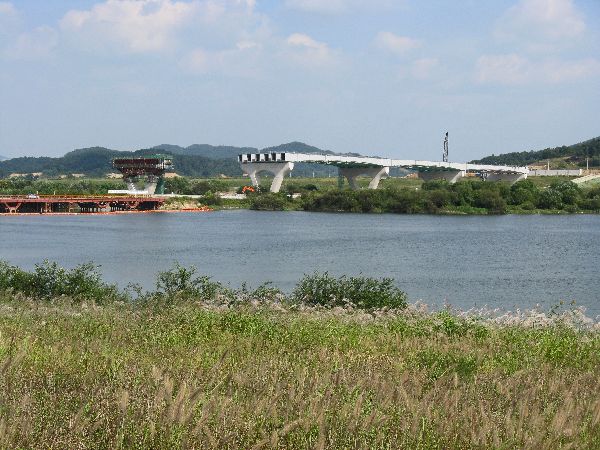
The four images to the left are from 2013. The fifth image is from 2015 and the bridge is still under construction.
 And
the next attractions are a couple of more bridges; one is a precisely engineered
bridge for a new high speed KTX train line (left) and one after that is a very
basic single-lane bridge that could be a
half-century old (right). The older bridges show up on the small-scale
paper maps. It is perfect for a bicycle bridge, but it is also shared with light
vehicles.
And
the next attractions are a couple of more bridges; one is a precisely engineered
bridge for a new high speed KTX train line (left) and one after that is a very
basic single-lane bridge that could be a
half-century old (right). The older bridges show up on the small-scale
paper maps. It is perfect for a bicycle bridge, but it is also shared with light
vehicles.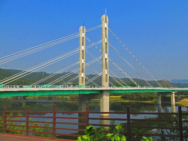
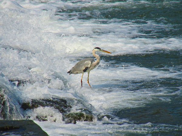 Near
the confluence of the Guemgang and the Gapcheon, the Geumgang Trail crosses the
river for the last time. At this point, it is about 7km (4.5 miles) to
Daecheongbo (dam) and about 20 km (12 miles), by trail, to Daejeon Railroad
Station. The trails are along the rivers, bridges cross the rivers, and birds
feed in the rivers. There are 16 bridges over one 14km stretch of the trail.
(Both the bridges shown here are new in 2016.)
Near
the confluence of the Guemgang and the Gapcheon, the Geumgang Trail crosses the
river for the last time. At this point, it is about 7km (4.5 miles) to
Daecheongbo (dam) and about 20 km (12 miles), by trail, to Daejeon Railroad
Station. The trails are along the rivers, bridges cross the rivers, and birds
feed in the rivers. There are 16 bridges over one 14km stretch of the trail.
(Both the bridges shown here are new in 2016.)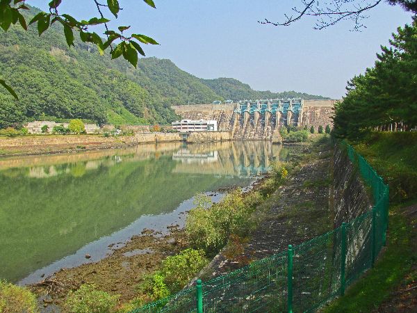
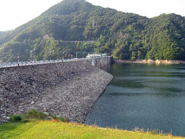
 If
you persevere long enough at any project eventually you will come to an end.
In the case, at the northern end of the Geumgang Bicycle Path, you will approach
Daecheong Dam, and if you make the last one kilometer climb to the top of the
dam wall you are rewarded with a view Daecheonho (lake), South Korea's largest
lake. This is where
the Guemgang trail ends. Congratulations!
If
you persevere long enough at any project eventually you will come to an end.
In the case, at the northern end of the Geumgang Bicycle Path, you will approach
Daecheong Dam, and if you make the last one kilometer climb to the top of the
dam wall you are rewarded with a view Daecheonho (lake), South Korea's largest
lake. This is where
the Guemgang trail ends. Congratulations!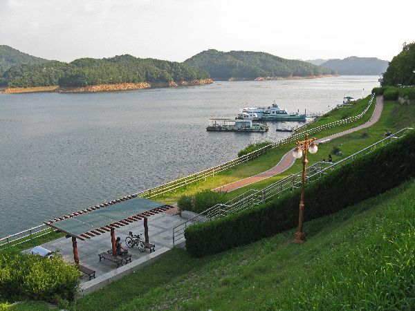
The dam is 72 m (236 ft) tall. Its purpose is flood control, water supply and hydroelectric power generation. The dam predates the Four Rivers Project. Construction on the dam began in 1975 and was completed on December 1, 1980.

 The
network of tributaries of the Gapcheon, in Daejeon, flow through many sections of the city. If
your origin and destination is linked by one of these streams, the bicycle path
system is one of the best ways to travel -- the street traffic can be fierce.
Though Daejeon is the fifth largest city in Korea and has a population of 1.5
million (2010), when you ride along the streams, at times you almost feel like
you are out in the countryside -- avoid looking at the distant skyline.
The
network of tributaries of the Gapcheon, in Daejeon, flow through many sections of the city. If
your origin and destination is linked by one of these streams, the bicycle path
system is one of the best ways to travel -- the street traffic can be fierce.
Though Daejeon is the fifth largest city in Korea and has a population of 1.5
million (2010), when you ride along the streams, at times you almost feel like
you are out in the countryside -- avoid looking at the distant skyline.
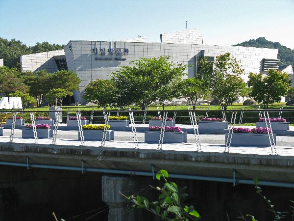
 At
the confluence of the Gapcheon and the Yudeungcheon, the two biggest streams, is
a concentration of civic activities: the large Hanbit Arboretum with a couple
dozen sections, Natural Movement Center, Youth Cultural Center, Traditional
Music Orchestra, Daejeon Culture and Arts Center, Municipal Museum of Art,
National Science Museum, Convention Complex and a bunch of residual from the 93
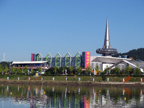
day long Daejeon Expo '93, at Expo Park.
At
the confluence of the Gapcheon and the Yudeungcheon, the two biggest streams, is
a concentration of civic activities: the large Hanbit Arboretum with a couple
dozen sections, Natural Movement Center, Youth Cultural Center, Traditional
Music Orchestra, Daejeon Culture and Arts Center, Municipal Museum of Art,
National Science Museum, Convention Complex and a bunch of residual from the 93
day long Daejeon Expo '93, at Expo Park.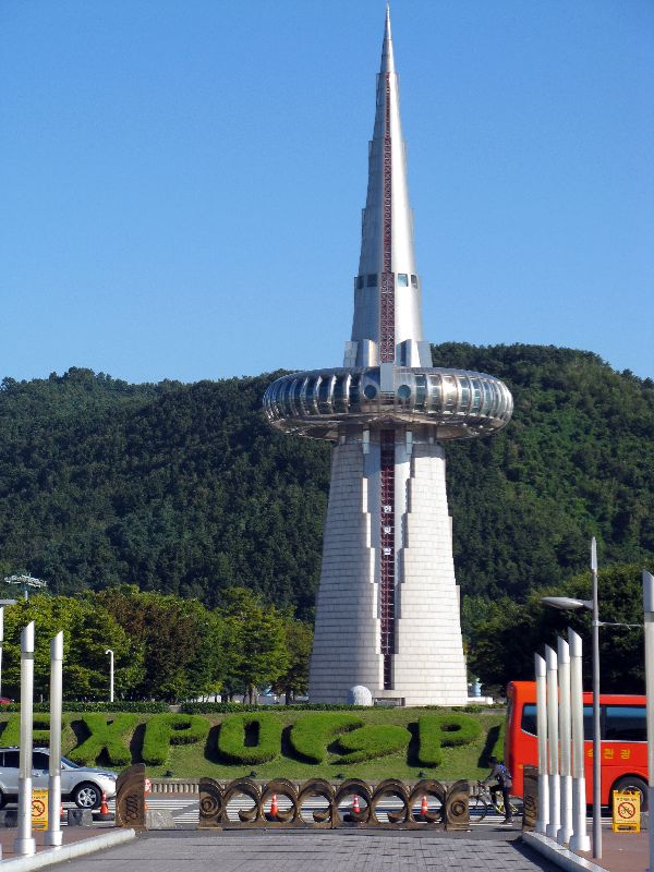
 Not
as iconic as the Hanbit-tap, but equally enduring and definitely more graceful
and functional is the Expo Bridge. It allowed participant to go from
activities on one side of the river to the other. It still serves that
purpose and is still primarily for non-motorized travelers. If you are in town
on December 31, the bridge is the center for the main fireworks display for the
New Year.
Not
as iconic as the Hanbit-tap, but equally enduring and definitely more graceful
and functional is the Expo Bridge. It allowed participant to go from
activities on one side of the river to the other. It still serves that
purpose and is still primarily for non-motorized travelers. If you are in town
on December 31, the bridge is the center for the main fireworks display for the
New Year.
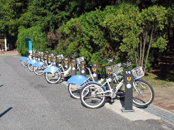
 Alas,
bicycles are not allowed on the Expo Park grounds, but there is a Daejeon Bike
Share station near by for visitors who might want to visit the plethora of other
points of interest in the area, or take a bike ride along the river.
Alas,
bicycles are not allowed on the Expo Park grounds, but there is a Daejeon Bike
Share station near by for visitors who might want to visit the plethora of other
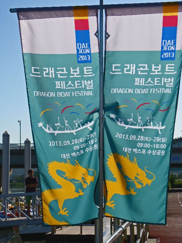
points of interest in the area, or take a bike ride along the river.Not that there was any shortage of on-going activities, Expo Square and the adjoining river bank were the staging area for the weekend's Dragon Boat Festival (right).
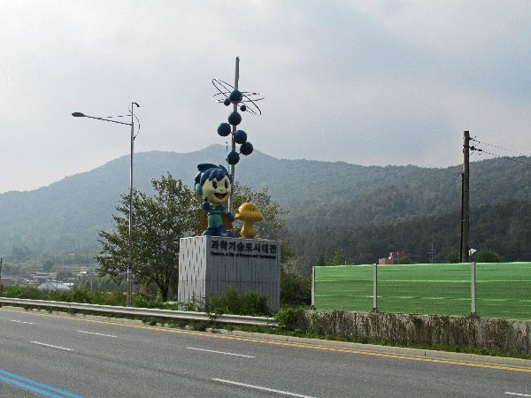 Korea Institute of Nuclear Safety, Korea Advanced Institute of Science, Geology
Museum (left), Daejeon Citizen Observatory, Korea Astronomy & Space Science
Instistitue and the Daejon Government Complex.
Korea Institute of Nuclear Safety, Korea Advanced Institute of Science, Geology
Museum (left), Daejeon Citizen Observatory, Korea Astronomy & Space Science
Instistitue and the Daejon Government Complex.From the list of museum and institutes it is not a real surprise that the city's mascot is a cartoon figure playing with atoms.
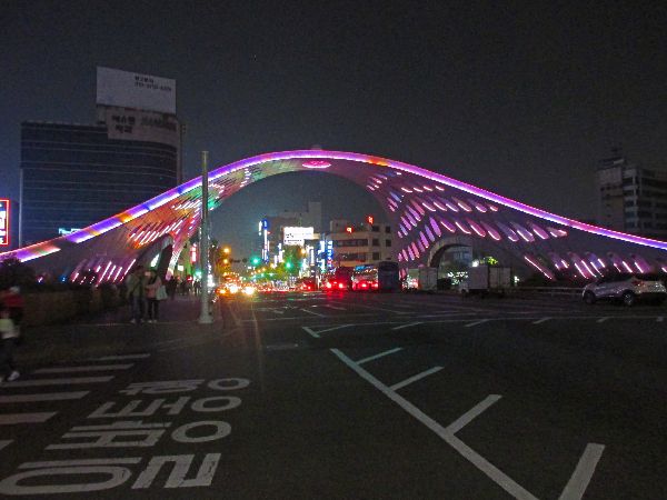
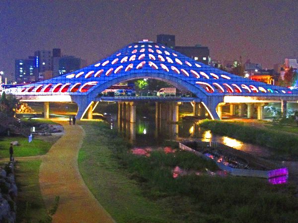
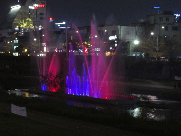 Some
of the most unique, creative and interesting sightseeing in Daejeon occurs at
night: Mokcheoggyo (bridge), over Yudeungcheon, could be mistaken for an
unidentified hovering object. Below it, in the park along Yudeungcheon, is a
fountain with a computerized light show at night.
Some
of the most unique, creative and interesting sightseeing in Daejeon occurs at
night: Mokcheoggyo (bridge), over Yudeungcheon, could be mistaken for an
unidentified hovering object. Below it, in the park along Yudeungcheon, is a
fountain with a computerized light show at night.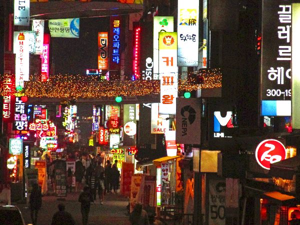
 On
both sides of Yudeungcheon there are shopping districts; Jungang Sijang, the
traditional market to the east, and Eunhaeng-dong, a more modern shopping
district to the west. They all have a different character at night. In Jungang
Sijang, many of the shops close, but the food tables stay open and they can be
surrounded with soju drinkers until late at night. Eunhaeng seems to become more
energized at night, maybe it is all the lights that come on to attract shoppers
(like moths).
On
both sides of Yudeungcheon there are shopping districts; Jungang Sijang, the
traditional market to the east, and Eunhaeng-dong, a more modern shopping
district to the west. They all have a different character at night. In Jungang
Sijang, many of the shops close, but the food tables stay open and they can be
surrounded with soju drinkers until late at night. Eunhaeng seems to become more
energized at night, maybe it is all the lights that come on to attract shoppers
(like moths).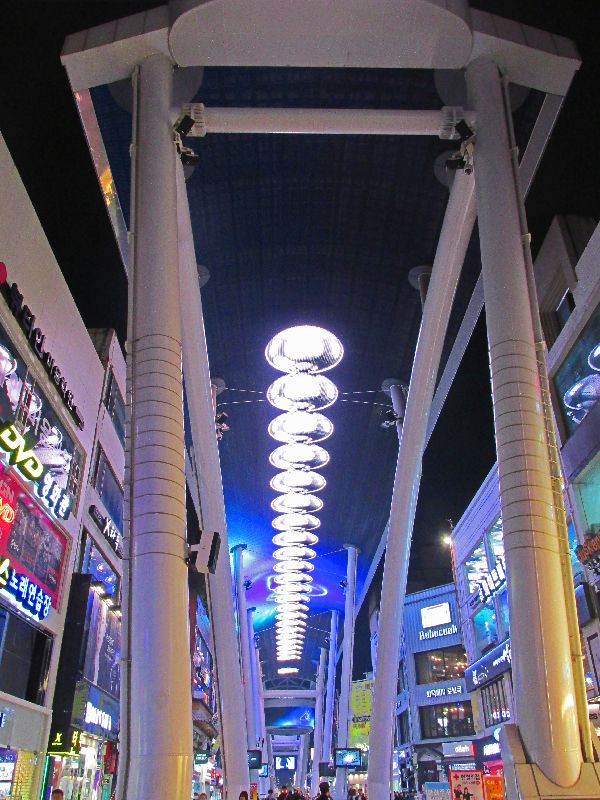
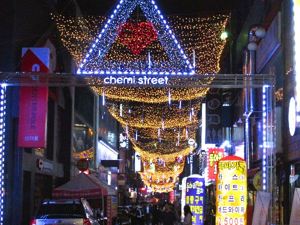
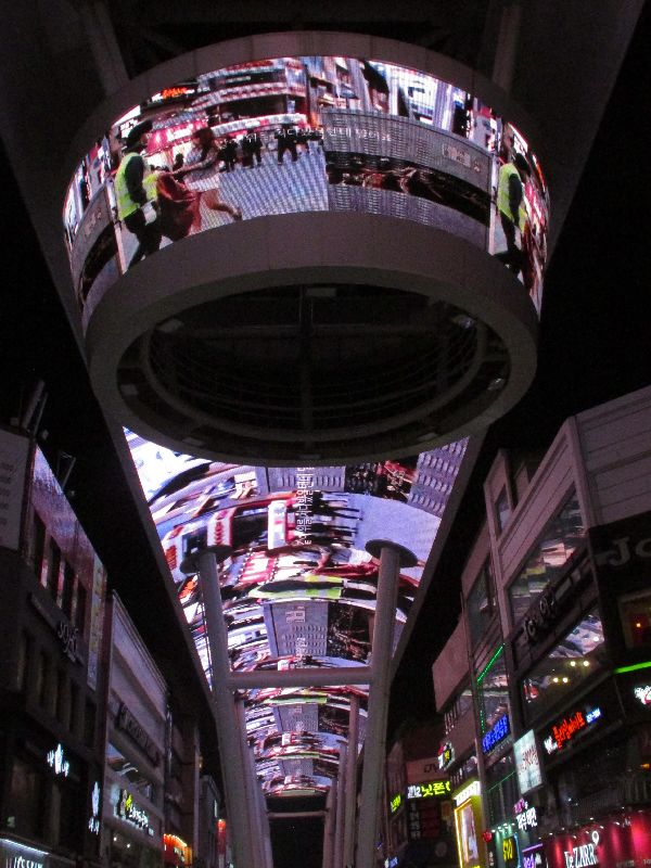 A
few blocks away, is Jungang-ro 164 beon-gil, Eunhaeng-dong. The Eunhaeng
neighborhood is generally known for it entertainment venues and nightlife. At
the street level, Jungang-ro 164 beon-gil it is a pretty normal fashion street,
with clothing and accessories boutiques, phone stores, coffee shops,
restaurants, and gift shops. But overhead is a dominate, 200 meters long, 10
A
few blocks away, is Jungang-ro 164 beon-gil, Eunhaeng-dong. The Eunhaeng
neighborhood is generally known for it entertainment venues and nightlife. At
the street level, Jungang-ro 164 beon-gil it is a pretty normal fashion street,
with clothing and accessories boutiques, phone stores, coffee shops,
restaurants, and gift shops. But overhead is a dominate, 200 meters long, 10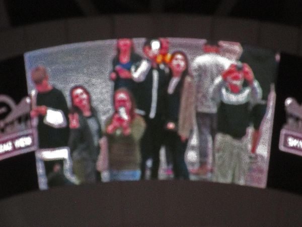 meters wide, digital display. The images cycle through several programs; there
is advertising, a number of animated digital graphic programs, and a "mall cam"
phase, which projects real-time images of shoppers in the mall on the screen. If
you are on the camera and look up to take a picture of yourself on the big
screen, you get a nice picture with your camera/phone in front of your face.
meters wide, digital display. The images cycle through several programs; there
is advertising, a number of animated digital graphic programs, and a "mall cam"
phase, which projects real-time images of shoppers in the mall on the screen. If
you are on the camera and look up to take a picture of yourself on the big
screen, you get a nice picture with your camera/phone in front of your face.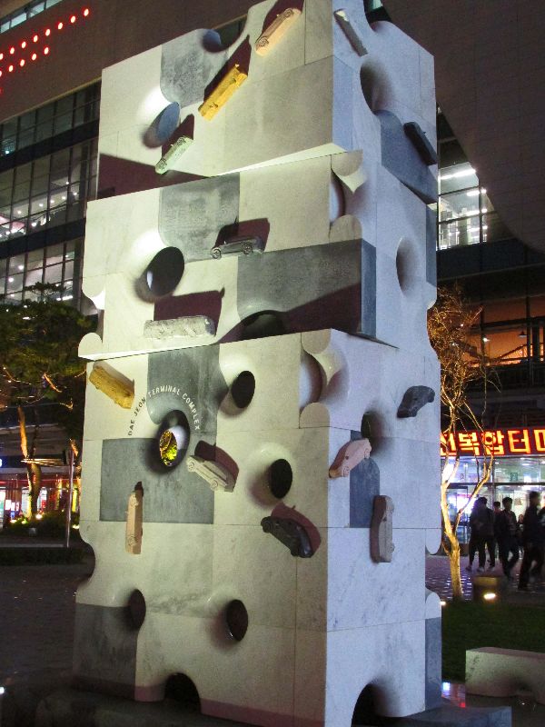
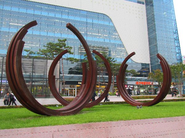
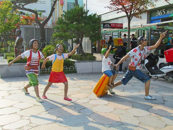 If
your travels to Daejeon take you through the Express Bus Terminal Complex don't
go so fast that you miss the art in the plaza outside.
If
your travels to Daejeon take you through the Express Bus Terminal Complex don't
go so fast that you miss the art in the plaza outside.
My favorite is the Korean family running for the bus (left). It is a bit dated because they have traditional cameras and aren't carrying smart phones.
Another interesting piece is the marble "Swiss cheese" block, with cars and bus encircling it like ants (left).


 Please
contact us if you would like to be added to
Ibike's mailing list or have questions, comments, corrections or criticism. (Also, please let us know how you learned about us and
found this site.) Privacy policy.
Please
contact us if you would like to be added to
Ibike's mailing list or have questions, comments, corrections or criticism. (Also, please let us know how you learned about us and
found this site.) Privacy policy.
![]() IBF Homepage
IBF Homepage ![]() Ibike Programs
Ibike Programs
![]() Ibike Schedule
Ibike Schedule
![]() Search
Search